Category:Nauru in the 19th century
Jump to navigation
Jump to search
Countries of Oceania: Australia · Fiji · Federated States of Micronesia · Kiribati · Marshall Islands · Nauru · New Zealand · Palau · Papua New Guinea · Samoa · Solomon Islands · Tonga · Tuvalu · Vanuatu
Other areas: American Samoa · Clipperton Island · Cook Islands · French Polynesia · Guam · Hawaii · New Caledonia · Norfolk Island · Northern Mariana Islands · Wallis and Futuna – Partly: Indonesia · French Southern and Antarctic Lands
Other areas: American Samoa · Clipperton Island · Cook Islands · French Polynesia · Guam · Hawaii · New Caledonia · Norfolk Island · Northern Mariana Islands · Wallis and Futuna – Partly: Indonesia · French Southern and Antarctic Lands
| Country map |
|---|
Wikimedia category | |||||
| Upload media | |||||
| Instance of | |||||
|---|---|---|---|---|---|
| Category combines topics | |||||
| Followed by | |||||
| 19th century | |||||
time period between January 1, 1801, and ended on December 31, 1900 | |||||
| Instance of | |||||
| Part of | |||||
| Has part(s) | |||||
| Point in time |
| ||||
| Start time |
| ||||
| End time |
| ||||
| Follows | |||||
| Followed by | |||||
 | |||||
Media in category "Nauru in the 19th century"
The following 9 files are in this category, out of 9 total.
-
Auweyida-Eigamoiya-nauruansubjects.jpg 453 × 248; 39 KB
-
Nauru Annexation Germany 1888.jpg 196 × 205; 9 KB
-
Nauruan people.jpg 2,661 × 1,811; 2.57 MB
-
Nauruan-warrior-1880ers.jpg 200 × 312; 24 KB
-
Old map South West Nauru.jpg 412 × 313; 84 KB
-
Scene at Arenibek.jpg 2,661 × 1,686; 520 KB
-
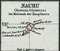
Schutzgebiet der Marshall-Inseln-Deutscher Kolonialatlas 1897-Nauru.jpg 634 × 532; 100 KB
-
Traditional house and canoe Nauru.jpg 1,706 × 1,243; 1.16 MB


