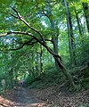
Category:Naturschutzgebiet Stinderbachtal
Jump to navigation
Jump to search
| Diese Kategorie repräsentiert ein Schutzgebiet nach Naturschutzrecht in Deutschland. |
|---|
| This category was created according to a clear scheme; it should not be moved, deleted or recategorized. It is stored in of this upload map, among other places. Description and background on the Wiki project page |
| [Upload //commons.wikimedia.org/w/index.php?title=Special:UploadWizard&campaign=wle-de&categories=Naturschutzgebiet+Stinderbachtal photo to Wiki Loves Earth!] - Wiki Loves Earth Germany page |
nature reserve in Germany | |||||
| Upload media | |||||
| Instance of | |||||
|---|---|---|---|---|---|
| Location | Erkrath, Mettmann, Düsseldorf Government Region, North Rhine-Westphalia, Germany | ||||
| IUCN protected areas category | |||||
| Inception |
| ||||
| Area |
| ||||
 | |||||
Media in category "Naturschutzgebiet Stinderbachtal"
The following 38 files are in this category, out of 38 total.
-
NSG Stinderbachtal (100).jpg 4,032 × 3,024; 5.18 MB
-
NSG Stinderbachtal (105).jpg 2,744 × 3,293; 3.8 MB
-
NSG Stinderbachtal (111).jpg 4,032 × 3,024; 4.48 MB
-
NSG Stinderbachtal (112).jpg 4,032 × 3,024; 4.71 MB
-
NSG Stinderbachtal (114).jpg 3,941 × 2,955; 4.03 MB
-
NSG Stinderbachtal (122).jpg 4,032 × 3,024; 4.25 MB
-
NSG Stinderbachtal (128).jpg 4,032 × 3,024; 4.42 MB
-
NSG Stinderbachtal (129).jpg 2,551 × 3,401; 3.43 MB
-
NSG Stinderbachtal (13) Stindertalweg.jpg 4,032 × 3,024; 4.09 MB
-
NSG Stinderbachtal (130).jpg 2,849 × 3,799; 3.68 MB
-
NSG Stinderbachtal (131) Seggenbestand.jpg 3,425 × 2,569; 3.65 MB
-
NSG Stinderbachtal (132) oberes Talende bei Nösenberg.jpg 4,032 × 3,024; 4.08 MB
-
NSG Stinderbachtal (16) Stindertalweg.jpg 4,032 × 3,024; 3.59 MB
-
NSG Stinderbachtal (18) Stindertalweg.jpg 3,794 × 2,844; 3.6 MB
-
NSG Stinderbachtal (21) Talaue.jpg 4,032 × 3,024; 4.79 MB
-
NSG Stinderbachtal (33) Buchenwald.jpg 4,032 × 3,024; 3.99 MB
-
NSG Stinderbachtal (34) Abzweig Maria im Tal.jpg 3,024 × 4,032; 3.82 MB
-
NSG Stinderbachtal (41) Dorper Bachtal.jpg 3,893 × 2,921; 4.43 MB
-
NSG Stinderbachtal (42) Dorper Bachtal.jpg 3,927 × 2,945; 4.69 MB
-
NSG Stinderbachtal (43) Abzweig Maria im Tal.jpg 4,032 × 3,024; 3.31 MB
-
NSG Stinderbachtal (45) Abzweig Maria im Tal.jpg 3,941 × 2,955; 4.29 MB
-
NSG Stinderbachtal (45) Dorper Bachtal.jpg 4,032 × 3,024; 4.69 MB
-
NSG Stinderbachtal (49) Dorper Bachtal.jpg 3,024 × 4,032; 4.71 MB
-
NSG Stinderbachtal (5) Stindermühle.jpg 3,834 × 2,946; 3.85 MB
-
NSG Stinderbachtal (56) Dorper Bachtal.jpg 4,032 × 3,024; 4.49 MB
-
NSG Stinderbachtal (59) Dorper Bachtal.jpg 3,941 × 2,955; 4.86 MB
-
NSG Stinderbachtal (73).jpg 4,032 × 3,024; 4.43 MB
-
NSG Stinderbachtal (75).jpg 4,032 × 3,024; 4.05 MB
-
NSG Stinderbachtal (83).jpg 3,895 × 2,921; 3.66 MB
-
NSG Stinderbachtal (9) Stindermühle.jpg 4,032 × 3,024; 2.81 MB
-
Stindertal01793146.jpg 6,240 × 4,160; 10.2 MB
-
Stindertal01863139.jpg 6,240 × 4,160; 9.69 MB
-
Stindertal01923133.jpg 6,240 × 4,160; 13.99 MB
-
Stindertal01963129.jpg 6,240 × 4,160; 5.24 MB
-
Stindertal02023123.jpg 6,240 × 4,160; 10.73 MB
-
Stindertal02063119.jpg 6,240 × 4,160; 9.41 MB
-
Stindertal02173108.jpg 6,240 × 4,160; 11.65 MB
-
Stindertal02713054.jpg 4,364 × 2,909; 2.02 MB


