Category:Nature of Austria in May 2024
Jump to navigation
Jump to search
States of Austria:
| Nature of Austria in May by year: | |
| Nature of Austria in 2024 by month: | |

Subcategories
This category has the following 2 subcategories, out of 2 total.
*
Media in category "Nature of Austria in May 2024"
The following 84 files are in this category, out of 84 total.
-
 3 Sommerlinden 01.jpg 2,333 × 3,500; 8.48 MB
-
 3 Sommerlinden 02.jpg 5,000 × 3,333; 8.08 MB
-
 3 Sommerlinden 03.jpg 4,209 × 3,333; 5 MB
-
 3 Sommerlinden 04.jpg 2,333 × 3,500; 8.27 MB
-
 3 Sommerlinden 05.jpg 2,333 × 3,500; 5.92 MB
-
 Achensee 5.jpg 4,000 × 1,800; 2.67 MB
-
 Aggsbach Aggsbach-Dorf 01.jpg 8,256 × 5,504; 23.81 MB
-
 Aggsbach Aggsbach-Dorf 02.jpg 8,256 × 5,504; 22.29 MB
-
 Aggsbach Donau Mündung.jpg 8,256 × 5,504; 19.19 MB
-
 Archkogl.jpg 4,032 × 3,024; 6.53 MB
-
 Baumstumpf mit Antriebe Auswuchs Nature of Bezirk Südoststeiermark 01.jpg 4,000 × 3,000; 4.27 MB
-
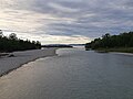
 Brandenberger Ache I.jpg 3,000 × 4,000; 6.47 MB
-
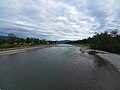
 Brandenberger Ache II.jpg 4,000 × 3,000; 6.67 MB
-
 Bregenz-Bregenzer Ache-Bodensee-River mouth-01ASD.jpg 3,264 × 2,448; 1.84 MB
-
 Bregenz-Bregenzer Ache-Bodensee-River mouth-02ESD.jpg 4,608 × 3,456; 5.96 MB
-
 Bregenz-Bregenzer Ache-view to Lauterach-Hochaelpele-01ASD.jpg 3,264 × 2,448; 1.89 MB
-
 Bregenz-Pfaender-former skiing piste (Dohle-Lift)-02ASD.jpg 4,624 × 3,468; 5.55 MB
-
 Deutsche Schwertlilie in Bad Pirawarth Anfang Mai 2024.jpg 2,992 × 2,992; 1.8 MB
-
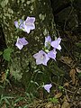 Die grazile lila Glockenblume Campanula 04.jpg 3,000 × 4,000; 1.83 MB
-
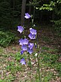 Die grazile lila Glockenblume Campanula 05.jpg 3,000 × 4,000; 1.98 MB
-
 Familieneiche Oak Nature of Bezirk Südoststeiermark 01.jpg 3,000 × 4,000; 4.7 MB
-
 Floridsdorfer Wasserpark - 20240516 AlteDonau 037.jpg 3,024 × 4,032; 3.4 MB
-
 Frauenstein Frauenstein Landschaft SO-Ansicht 05052024 5010.jpg 7,360 × 4,912; 30.38 MB
-
 Gallhofkogel 01.jpg 3,744 × 2,808; 6.52 MB
-
 Gallhofkogel 02.jpg 4,032 × 3,024; 7.61 MB
-
 Georgenbach 2024.jpg 5,895 × 3,930; 15.05 MB
-
 Glasklares Wasser am Plansee österreich.jpg 3,024 × 4,032; 2.31 MB
-
 Graz Schlosspark Eggenberg Pfau-3661.jpg 6,028 × 4,011; 21.73 MB
-
 Grundlsee von Zlaimkögel.jpg 4,032 × 3,024; 6.61 MB
-
 Hard-Alpine Rhine dam-end of the inner dykes-01ASD.jpg 3,903 × 2,452; 4.3 MB
-
 Hard-Alpine Rhine dyke-dead bird-01ASD.jpg 3,468 × 4,624; 6.98 MB
-
 Hard-Alpine Rhine dyke-dead fish-01ASD.jpg 3,468 × 4,624; 6.67 MB
-
 Hard-Alpine Rhine dyke-extension-01ASD.jpg 3,849 × 2,588; 3.8 MB
-
 Hard-Alpine Rhine-Driftwood-01ASD.jpg 4,624 × 3,468; 2.9 MB
-
 Hard-Alpine Rhine-Driftwood-02ASD.jpg 3,863 × 2,667; 4.51 MB
-
 Hard-Alpine Rhine-Driftwood-03ASD.jpg 4,592 × 3,056; 5.59 MB
-
 Hard-Alpine Rhine-lands end (dyke extension)-01ASD.jpg 4,624 × 3,468; 3.89 MB
-
 Hard-Alpine Rhine-lands end (dyke extension)-02ASD.jpg 4,624 × 3,468; 2.26 MB
-
 Hard-Fischteich-Lauterachbach-01ASD.jpg 4,624 × 3,468; 3.35 MB
-

-
 Hard-Lauteracher Ried-Storck-01ASD.jpg 3,468 × 4,624; 10.63 MB
-
 Hard-Lustenauer Kanal-plot Herrendielen-view to Dornbirner First-03ESD.jpg 3,456 × 4,608; 6.23 MB
-
 Himmelswiese (Kalksburg) Aufrechte Waldrebe Dirndlstrauch.jpg 3,264 × 2,448; 3.54 MB
-
 Himmelswiese (Kalksburg) Aufrechte Waldrebe.jpg 3,264 × 2,448; 3.12 MB
-
 Himmelswiese (Kalksburg) Aufrechter Ziest.jpg 2,448 × 3,264; 2.4 MB
-
 Himmelswiese (Kalksburg) Diptam2.jpg 3,264 × 2,448; 3.68 MB
-
 Himmelswiese (Kalksburg) Rauer Alant Blutroter Storchschnabel.jpg 2,448 × 3,264; 3.24 MB
-
 Hochplanberg Poppensand Totes Gebirge 20240505a.jpg 4,000 × 6,000; 17.9 MB
-
 Hölltalbach Liftstr.jpg 6,048 × 4,032; 15.83 MB
-
 I Wiener Hochquellenwasserleitung Am Rosenberg.jpg 4,032 × 3,024; 9.82 MB
-
 I Wiener Hochquellenwasserleitung Bertégasse 01.jpg 4,032 × 3,024; 10.31 MB
-
 ID 259268 Quercus 294A0082 Neudau.jpg 6,001 × 4,001; 6.14 MB
-
 ID 267565 Fagus 294A0039 Haberl.jpg 3,334 × 5,001; 5.43 MB
-
 ID 267570 Fagus 294A0034 Haberl.jpg 3,334 × 5,001; 6.06 MB
-
 Kelchsauer Ache.jpg 3,000 × 4,000; 6.92 MB
-
 Koppenwinkelbüller nahe der Koppenwinkellacke (2).jpg 4,032 × 3,024; 5.05 MB
-
 Koppenwinkelbüller nahe der Koppenwinkellacke.jpg 4,032 × 3,024; 5.54 MB
-
 Koppenwinkellacke am 12.5.2024.jpg 3,934 × 2,951; 3.78 MB
-

-
 Lauterach-Lauteracher Ried-Dornbirner First-Staufen-Breitenberg-01ASD 01.jpg 4,624 × 3,468; 4.79 MB
-
 Lauterach-Stream gauge Dornbirner Ache-Hausle Recycling-05ASD.jpg 3,468 × 4,624; 9 MB
-
 NDM 321 Obereibensteiner-Linden Kaltenberg (1).jpg 2,048 × 1,536; 614 KB
-
 NDM 321 Obereibensteiner-Linden Kaltenberg 1.jpg 1,447 × 1,929; 625 KB
-
 NDM 321 Obereibensteiner-Linden Kaltenberg.jpg 1,728 × 2,303; 820 KB
-
 Oberbodenkopf.jpg 1,600 × 1,200; 414 KB
-
 Plansee hiking.jpg 3,024 × 4,032; 3.35 MB
-
 Plansee wunderschöne Aussicht.jpg 4,284 × 5,712; 6.8 MB
-
 Pörtschach Johannes-Brahms-Promenade Blumenstrand Kletterrosen 28052024 5088.jpg 6,724 × 4,674; 15.41 MB
-
 Pörtschach Johannes-Brahms-Promenade Blumenstrand Kletterrosen 28052024 5089.jpg 7,360 × 4,912; 16.94 MB
-
 Pörtschach Johannes-Brahms-Promenade Blumenstrand Kletterrosen 28052024 5090.jpg 7,360 × 4,912; 16.08 MB
-
 Regenbogen in Leonstein 1.jpg 5,275 × 2,536; 6.95 MB
-
 Sababach.jpg 1,600 × 1,200; 724 KB
-
 Sattelbach Grundlsee 01.jpg 4,032 × 3,024; 13.01 MB
-
 Sattelbach Grundlsee 02.jpg 3,954 × 2,966; 13.62 MB
-
 Sattelbach Grundlsee 03.jpg 4,032 × 3,024; 12.57 MB
-
 Sattelbach Grundlsee 04.jpg 4,032 × 3,024; 13.01 MB
-
 Tiefenbachklamm I.jpg 3,000 × 4,000; 7.52 MB
-
 Tiefenbachklamm II.jpg 3,000 × 4,000; 6.4 MB
-
 Tiefenbachklamm III.jpg 3,000 × 4,000; 7.08 MB
-
 Tümpel Natrun Steinernes Meer 20240519a.jpg 6,000 × 4,000; 20.55 MB
-
 Zlaim 01.jpg 4,032 × 3,024; 8.41 MB
-
 Zlaim 04.jpg 4,032 × 3,024; 9.68 MB
-
 Zlaim 07.jpg 4,032 × 3,024; 11.3 MB
-
 Zlaimkögel.jpg 3,564 × 2,673; 6.27 MB


-02ASD.jpg)


-01ASD.jpg)
-02ASD.jpg)


_Aufrechte_Waldrebe_Dirndlstrauch.jpg)
_Aufrechte_Waldrebe.jpg)
_Aufrechter_Ziest.jpg)
_Diptam2.jpg)
_Rauer_Alant_Blutroter_Storchschnabel.jpg)


.jpg)


.jpg)


