Category:Natural Earth
Jump to navigation
Jump to search
public domain geographic data collection | |||||
| Upload media | |||||
| Instance of |
| ||||
|---|---|---|---|---|---|
| Developer |
| ||||
| Software version identifier |
| ||||
| Inception |
| ||||
| Sponsor | |||||
| official website | |||||
| |||||
Maps created with Natural Earth Data.
Subcategories
This category has only the following subcategory.
N
Media in category "Natural Earth"
The following 154 files are in this category, out of 154 total.
-
Apis andreniformis distribution map.svg 863 × 443; 1.85 MB
-
Apis cerana distribution map.svg 863 × 443; 1.85 MB
-
Apis distribution map.svg 863 × 443; 1.85 MB
-
Apis dorsata distribution map.svg 863 × 443; 1.85 MB
-
Apis florea distribution map.svg 863 × 443; 1.85 MB
-
Apis koschevnikovi distribution map.svg 863 × 443; 1.85 MB
-
Apis nigrocincta distribution map.svg 863 × 443; 1.85 MB
-
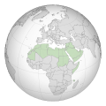
Arab league orthographic NED 50m.svg 550 × 550; 350 KB
-
Aztec Empire - es.svg 1,158 × 842; 1.04 MB
-
Aztec Empire - ru.svg 1,158 × 842; 958 KB
-
Baltic states in the first half of the 16th century - es.svg 1,256 × 1,745; 893 KB
-
Baltic states in the first half of the 16th century - ru.svg 1,256 × 1,745; 948 KB
-
Barge T-36 drift and rescue - en.svg 1,770 × 925; 230 KB
-
Barge T-36 drift and rescue - ru.svg 1,770 × 925; 232 KB
-
Barge T-36 drift and rescue 2 - ru.svg 1,207 × 1,235; 444 KB
-
Bari location map.svg 425 × 425; 19 KB
-
Benjamin of Tudela route - es.svg 1,510 × 917; 181 KB
-
Benjamin of Tudela route - he.svg 1,510 × 917; 181 KB
-
Benjamin of Tudela route - oc.svg 1,510 × 917; 181 KB
-
Benjamin of Tudela route - ru.svg 1,510 × 917; 518 KB
-
Benjamin of Tudela route - uk.svg 1,510 × 917; 194 KB
-
Blank world map (de facto country borders in 2022).svg 2,048 × 1,097; 199 KB
-
Blank world map (de facto country borders).png 2,048 × 1,097; 48 KB
-
Blank world map AuthaGraph projection.svg 2,048 × 887; 206 KB
-
Blank world map Cahill-Concialdi projection.svg 2,048 × 1,196; 197 KB
-
Blank world map Cahill-Keyes projection.svg 2,048 × 939; 203 KB
-
Blank world map Dymaxion projection.svg 1,769 × 967; 207 KB
-
Blank world map Elastic I projection.svg 2,048 × 1,097; 201 KB
-
Blank world map Elastic III projection.svg 2,048 × 1,195; 203 KB
-
Blank world map Equal Earth projection.svg 2,048 × 997; 203 KB
-
Blank world map Robinson projection.svg 2,048 × 1,039; 202 KB
-
Blank world map with provinces AuthaGraph projection.svg 2,048 × 887; 2.87 MB
-
Blank world map with provinces Cahill-Concialdi projection.svg 2,048 × 1,196; 2.68 MB
-
Blank world map with provinces Cahill-Keyes projection.svg 2,048 × 939; 2.74 MB
-
Blank world map with provinces Dymaxion projection.svg 1,769 × 967; 2.86 MB
-
Blank world map with provinces Elastic I projection.svg 2,048 × 1,097; 2.73 MB
-
Blank world map with provinces Elastic III projection.svg 2,048 × 1,195; 2.83 MB
-
Blank world map with provinces Equal Earth projection.svg 2,048 × 997; 2.83 MB
-
Blank world map with provinces Robinson projection.svg 2,048 × 1,039; 2.83 MB
-
Blank world map with rivers AuthaGraph projection.svg 2,048 × 887; 110 KB
-
Blank world map with rivers Cahill-Concialdi projection.svg 2,048 × 1,196; 108 KB
-
Blank world map with rivers Cahill-Keyes projection.svg 2,048 × 939; 113 KB
-
Blank world map with rivers Dymaxion projection.svg 1,769 × 967; 110 KB
-
Blank world map with rivers Elastic I projection.svg 2,048 × 1,097; 111 KB
-
Blank world map with rivers Elastic II projection.svg 2,048 × 1,192; 139 KB
-
Blank world map with rivers Elastic III projection.svg 2,048 × 1,195; 111 KB
-
Blank world map with rivers Equal Earth projection.svg 2,048 × 997; 112 KB
-
Blank world map with rivers Robinson projection.svg 2,048 × 1,039; 111 KB
-
Bounty Islands (orthographic projection).svg 553 × 553; 2.58 MB
-
Braddock Expedition - ru.svg 1,367 × 1,011; 2.13 MB
-
Bulgarian ulus - ru.svg 1,201 × 859; 55 KB
-
Cahill–Concialdi projection (Natural Earth Hypso).png 3,336 × 1,966; 6.03 MB
-
Cempaka hourly precipitation 2017.gif 895 × 567; 12.74 MB
-
Ciconia boyciana distribution map.svg 2,100 × 1,950; 1.57 MB
-
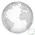
CPV orthographic NaturalEarth.svg 550 × 550; 235 KB
-
Cross-blended Hypsometric Tints World map.png 2,048 × 1,025; 3.09 MB
-
Dhangethi administrative map - ru.svg 984 × 1,500; 414 KB
-
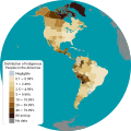
Distribution of Indigenous Peoples in the Americas.svg 3,200 × 3,200; 2.13 MB
-
Earthquakes in Indonesia.svg 1,052 × 744; 2.12 MB
-
Elephas Maximus distribution evolution map.svg 1,840 × 1,246; 1.78 MB
-
Fiji (orthographic projection).svg 550 × 550; 318 KB
-
First Russian Antarctic Expedition route - fr.svg 1,451 × 2,098; 1.65 MB
-
First Russian Antarctic Expedition route - ru.svg 1,451 × 2,098; 1.67 MB
-
First Russian circumnavigation route - ru.svg 1,851 × 1,031; 906 KB
-
Flinn-Engdahl regionalization.svg 1,527 × 1,145; 5.79 MB
-
French Polynesia (orthographic projection).svg 550 × 550; 744 KB
-
French Polynesia (orthographic projection, yellowblue).svg 501 × 501; 291 KB
-
Gepid kingdom 6th century - es.svg 1,102 × 1,154; 218 KB
-
Gepid kingdom 6th century - ru.svg 1,033 × 1,082; 161 KB
-
Gepid kingdom 6th century - zh.svg 1,102 × 1,154; 82 KB
-
Hoelzel10ost.jpg 10,800 × 6,123; 5.84 MB
-
Hoelzelnaturalearth.png 3,038 × 1,944; 6.66 MB
-
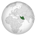
Iran Ecuador (orthographic projection).svg 550 × 550; 137 KB
-
Iran Lebanon (orthographic projection).svg 550 × 550; 139 KB
-
Korea (orthographic projection).svg 550 × 550; 97 KB
-
Koreya respublikasini joylashuvi 2000.jpg 1,080 × 865; 127 KB
-
Koreya va O'zbekiston.2000jpg.jpg 1,080 × 555; 61 KB
-
Lower Shebelle location map.svg 608 × 608; 64 KB
-
Made with Natural Earth.png 800 × 267; 71 KB
-
Map of Attested and Hypothetical Old Indo-Iranian Dialects Without Key.png 2,243 × 1,549; 3.97 MB
-
Map of Attested and Hypothetical Old Indo-Iranian Dialects.png 2,243 × 1,549; 3.97 MB
-
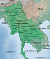
Map of Taungoo Empire (1580).png 950 × 1,121; 1.5 MB
-
Mexican–American War (without Scott's Campaign)-en.svg 1,433 × 1,230; 610 KB
-
Mexican–American War(without Scott's Campaign)-ru.svg 1,430 × 1,230; 608 KB
-
Mexican–American War-de.svg 1,571 × 1,230; 1.95 MB
-
Mexican–American War-en.svg 1,571 × 1,230; 675 KB
-
Mexican–American War-es.svg 1,571 × 1,230; 1.97 MB
-
Mexican–American War-hu.svg 1,571 × 1,230; 673 KB
-
Mexican–American War-ru.svg 1,571 × 1,230; 674 KB
-
MGRSgridOriginSchemeAA.png 1,895 × 1,309; 461 KB
-
Mollweide.jpg 10,800 × 5,400; 4.52 MB
-
Mollweide10ost.jpg 10,800 × 5,401; 4.52 MB
-
Mudug location map.svg 680 × 493; 36 KB
-
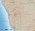
Namibia Natural Earth 1.jpg 1,015 × 914; 279 KB
-
Natural Earth hypso water.gif 150 × 126; 16 KB
-
NED worldmap 110m.svg 800 × 400; 1.96 MB
-
New Silk Road - ru.svg 1,174 × 647; 237 KB
-
Nicaragua canal proposals - de.svg 2,149 × 1,684; 513 KB
-
Nicaragua canal proposals - es.svg 2,149 × 1,684; 817 KB
-
Nicaragua canal proposals - ru.svg 2,149 × 1,684; 713 KB
-
North Kalimantan (Indonesia) topographic map - ru.svg 1,557 × 1,473; 2.28 MB
-
Norway Spruce Picea abies distribution in Poland map 2.png 721 × 800; 735 KB
-
Norway Spruce Picea abies distribution in Scandinavia map.png 634 × 800; 817 KB
-
Norway Spruce Picea abies distribution in Southern Europe map.png 742 × 800; 1.19 MB
-
Norway Spruce Picea abies distribution in Western Europe map.png 619 × 800; 1,011 KB
-
Norway Spruce Picea abies distribution map 2.png 683 × 800; 1.08 MB
-
Norwegian Arctic Expedition (1898—1902) map-ru.svg 1,731 × 1,521; 787 KB
-
Novozelandske kralovstvi.jpg 1,000 × 1,000; 84 KB
-
Nugaal location map.svg 636 × 424; 47 KB
-
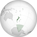
NZL orthographic NaturalEarth.svg 512 × 512; 574 KB
-
Oceans base map.svg 2,362 × 752; 4.06 MB
-
Pacific Clipper Map.svg 512 × 214; 4.82 MB
-
Palestinian cities during the Byzantine period - es.svg 847 × 1,426; 852 KB
-
Palestinian cities during the Byzantine period - ru.svg 794 × 1,337; 512 KB
-
Paradisaeidae distribution map.svg 902 × 1,126; 49 KB
-
Partition of the Livonian Order - es.svg 930 × 1,245; 335 KB
-
Partition of the Livonian Order - ru.svg 930 × 1,245; 390 KB
-
Perlshaper orthographic example1.svg 550 × 550; 247 KB
-
Perlshaper Winkel-Tripel example1.svg 1,100 × 700; 410 KB
-
Progress of the Reconquista (718–1492) - es.svg 1,208 × 1,100; 1.29 MB
-
Progress of the Reconquista (718–1492) - ru.svg 1,207 × 1,100; 906 KB
-
PUBLIC DOMAIN NaturalEarth z4 GreatLakes Insert SVG export.svg 1,052 × 744; 140 KB
-
PUBLIC DOMAIN NaturalEarth z4 World pseudo mercator.svg 1,055 × 700; 2 MB
-
RobinsonWeltkarte (without background).png 10,800 × 5,478; 26.14 MB
-
RobinsonWeltkarte.jpg 10,800 × 5,478; 4.83 MB
-
Roeseliana roeselii distribution.svg 1,800 × 898; 278 KB
-
Ross Island (orthographic projection).svg 512 × 512; 590 KB
-
Siberian Military District in 2003 - ru.svg 1,361 × 960; 2.84 MB
-
Silk Road in the I century AD - ca.svg 1,544 × 907; 859 KB
-
Silk Road in the I century AD - de.svg 1,159 × 681; 696 KB
-
Silk Road in the I century AD - en.svg 1,544 × 907; 869 KB
-
Silk Road in the I century AD - es.svg 1,544 × 907; 1.11 MB
-
Silk Road in the I century AD - hu.svg 1,544 × 907; 867 KB
-
Silk Road in the I century AD - ru.svg 1,544 × 907; 1.08 MB
-
Smyrnium olusatrum distribution map.svg 800 × 1,100; 122 KB
-
States and territories of Africa 27 December 2024.svg 2,585 × 2,178; 193 KB
-
States and territories of Africa 27 September 2024.svg 2,585 × 2,178; 192 KB
-
States and territories of Africa 270924.svg 2,585 × 2,178; 192 KB
-
States and territories of Africa.svg 1,564 × 1,633; 265 KB
-
States and territories of Americas 2024.svg 3,189 × 4,043; 667 KB
-
States and territories of Americas.svg 2,392 × 3,032; 917 KB
-
States and territories of Europe (Feb. 2019).svg 2,532 × 2,391; 842 KB
-
States and territories of Europe.svg 2,532 × 2,391; 825 KB
-
São Francisco basin map.png 1,700 × 1,678; 2.86 MB
-
Territory of Orleans in 1804 - ru.svg 1,125 × 1,031; 211 KB
-
The first Antarctic voyage (1839) of the Wilkes expedition-ru.svg 4,552 × 3,458; 1.04 MB
-
Voyages of Ilya Voznesensky (1840-1848) - ru.svg 1,482 × 1,086; 913 KB
-
Winkeltripel.jpg 10,800 × 6,599; 5.42 MB
-
Winkeltripel10ost.jpg 10,800 × 6,600; 5.41 MB
-
World Climate Extremes.png 1,600 × 800; 1.99 MB
-
Worldmap location NED 50m 20000-10027.png 20,000 × 10,027; 6.25 MB
-
Worldmap location NED 50m.svg 1,100 × 550; 561 KB
-
ZMB orthographic NaturalEarth.svg 553 × 553; 195 KB


