Category:Native American history of Tennessee
Jump to navigation
Jump to search
States of the United States: Alabama · Alaska · Arizona · Arkansas · California · Colorado · Connecticut · Delaware · Florida · Georgia · Idaho · Illinois · Indiana · Iowa · Kansas · Kentucky · Louisiana · Maine · Maryland · Massachusetts · Michigan · Minnesota · Mississippi · Missouri · Montana · Nebraska · Nevada · New Hampshire · New Jersey · New Mexico · New York · North Carolina · North Dakota · Ohio · Oklahoma · Oregon · Pennsylvania · Rhode Island · South Carolina · South Dakota · Tennessee · Texas · Utah · Vermont · Virginia · Washington · West Virginia · Wisconsin · Wyoming – Washington, D.C.
| NO WIKIDATA ID FOUND! Search for Native American history of Tennessee on Wikidata | |
| Upload media |
Subcategories
This category has the following 33 subcategories, out of 33 total.
B
- Brainerd Mission (16 F)
- Bussell Island (19 F)
C
- Citico (Cherokee town) (5 F)
D
E
- Eva Site (7 F)
F
- Fort Nashborough (4 F)
G
- Great Tellico (7 F)
I
- Icehouse Bottom (3 F)
J
L
- Lochaber Treaty (1771) (5 F)
N
- Neddy Jacobs Cabin (6 F)
P
- Path Grant Deed (7 F)
S
- Swaggerty Blockhouse (3 F)
T
- Tellico Blockhouse (18 F)
- Treaty of Holston (3 F)
- Treaty of Hopewell (2 F)
W
Media in category "Native American history of Tennessee"
The following 39 files are in this category, out of 39 total.
-
1815m4.jpg 1,689 × 1,442; 147 KB
-
A map of the Tennassee state formerly part of North Carolina (3045318235).jpg 2,000 × 1,527; 2.5 MB
-
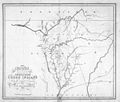
A new map of the Cherokee Nation (NBY 15538).jpg 3,540 × 2,781; 1.59 MB
-
Buchanan's Station Historical Marker.jpg 720 × 960; 336 KB
-
Casey Jones Village Jackson TN 017.jpg 768 × 1,024; 697 KB
-
Cessions Southeastern Tribes- Andrew Jackson.jpg 2,030 × 1,512; 633 KB
-
Cherokee Marks A.djvu 2,550 × 3,300; 94 KB
-
Cherokee and earlier remains on upper Tennessee river (IA cherokeeandearli00harriala).pdf 602 × 977, 420 pages; 12.94 MB
-
Chickamauga Towns.jpg 3,000 × 2,400; 1.46 MB
-
Cottonport - Williamson County Historical Society sign.JPG 2,892 × 1,976; 1.68 MB
-
Crockett.jpg 2,281 × 1,870; 1.25 MB
-
Demere-stuart-cherokees-peixotto.jpg 384 × 631; 46 KB
-
DeSoto Map Leg 2 HRoe 2008.jpg 600 × 470; 290 KB
-
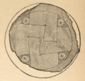
Fain's Island shell gorget.png 600 × 577; 792 KB
-
Fainsislandpage35spider.png 364 × 343; 48 KB
-
Fort Vincennes.jpg 800 × 530; 133 KB
-
Great-hiwassee-site-411.jpg 1,809 × 1,089; 496 KB
-
History of Tennessee, its people and its institutions (1900) (14779613264).jpg 1,886 × 1,374; 332 KB
-
Natchez Trace Parkway - Gordon House Plaque - NARA - 7720590.jpg 640 × 480; 151 KB
-
Newport-tennessee-war-ford.jpg 1,199 × 899; 332 KB
-
Overhill-cherokee-map-full.jpg 525 × 319; 61 KB
-
Paramountcy of Coosa.jpg 1,048 × 763; 162 KB
-
Path Grant 8.15.13.jpg 1,565 × 961; 117 KB
-
Reelfoot Lake Obion County TN 2013-04-06 002.jpg 1,024 × 768; 637 KB
-
Sequoyah-mound-vonore-tn1.jpg 1,956 × 1,134; 775 KB
-
Southwest Territory Counties (1790).svg 792 × 200; 329 KB
-
Tellico-lake-tennessee.jpg 1,199 × 895; 198 KB
-
TENNESSEE and ALABAMA portions - Indian land cessions in the United States.jpg 1,064 × 824; 195 KB
-
TENNESSEE detail - Indian land cessions in the United States.jpg 824 × 1,064; 160 KB
-
TENNESSEE map - Indian land cessions in the United States.jpg 820 × 535; 122 KB
-
The-cherokees-are-coming-tn1.jpg 427 × 605; 64 KB
-
Tipton Phase sites HRoe 2010 Randolph TN.jpg 606 × 750; 88 KB
-
Travellers Rest Nashville TN 2013-07-20 044.jpg 1,365 × 1,024; 258 KB
-
Unicoi Turnpike Great Indian Warpath.jpg 720 × 540; 161 KB
-
Watauga Association Marker.jpg 376 × 282; 40 KB
-
Wauhatchie at Rock Mont, Old Wauhatchie Pike, Chattanooga TN.jpg 587 × 737; 340 KB


