Category:National nature reserve signs in the Czech Republic
Jump to navigation
Jump to search
Čeština: Značky národních přírodních rezervací v České republice.
Subcategories
This category has the following 2 subcategories, out of 2 total.
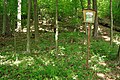
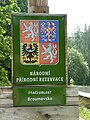
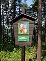
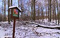
Media in category "National nature reserve signs in the Czech Republic"
The following 111 files are in this category, out of 111 total.
-
 161 Konec lesa na SZ po modré ke Kodě.jpg 3,456 × 5,184; 7.91 MB
-
 167 U konce lesa od Kody informace.jpg 5,184 × 3,456; 8.27 MB
-
 2016 Śnieżnik 04.jpg 3,034 × 3,722; 6.12 MB
-
 228 Rozcestí Kodské polesí.jpg 3,456 × 5,184; 6.33 MB
-
 231 Cesta lesem Z k lomu Malá Amerika.jpg 5,184 × 3,456; 10.11 MB
-
 315 Cesta po žluté na SV ke Kodě do lesa.jpg 5,184 × 3,456; 9.63 MB
-
 316 Cesta po žluté ke Kodě, informace.jpg 5,184 × 3,456; 6.2 MB
-
 352 U konce lesa od Kody informace.jpg 5,184 × 3,456; 6.56 MB
-
 396 Kodské polesí, vstup do lesa modrá V.jpg 3,456 × 5,184; 5.91 MB
-
 Bezděz NPR.jpg 3,648 × 2,432; 3.51 MB
-
 Bezděz, národní přírodní památka 001.JPG 3,888 × 2,592; 6.32 MB
-
 Bezděz, národní přírodní památka 002.JPG 2,438 × 3,613; 745 KB
-
 Boubín - varovná cedule.JPG 2,736 × 3,648; 4.36 MB
-
 Bozidarski2.jpg 3,888 × 2,592; 4.68 MB
-
 Broumovsko, 2012, 030.JPG 3,000 × 4,000; 6.57 MB
-
 Býčí-skála-cedule2016.jpg 4,000 × 6,000; 9.37 MB
-
 Cedule chráněné uzemí.jpg 5,120 × 3,840; 7.22 MB
-
 Cedule PR Kaňon Labe u Belvedéru.jpg 2,736 × 3,648; 8.71 MB
-
 Cedule se státním znakem.jpg 320 × 204; 77 KB
-
 Cedule.jpg 320 × 204; 76 KB
-
 Cervene-blato-2.jpg 800 × 517; 101 KB
-
 Chlumská stráń, tabule NPR.jpg 3,888 × 5,184; 7.38 MB
-
 Chlumská stráň - tabule.JPG 2,112 × 2,816; 2.11 MB
-
 Hostim, V Kozle, tabule u Kačáku.jpg 3,128 × 2,286; 1.34 MB
-
 Hranice NPR.JPG 2,592 × 4,608; 6.97 MB
-
 Hůrka u Hranic (02).jpg 2,448 × 3,264; 731 KB
-
 Hůrka u Hranic (12).jpg 2,448 × 3,264; 1.32 MB
-
 Jeseníky, NPR Praděd (2).JPG 3,000 × 4,000; 5.93 MB
-
 Jeseníky, NPR Praděd (4).JPG 2,636 × 3,598; 5.94 MB
-
 Karlovské bučiny - NPR.JPG 3,968 × 2,976; 2.8 MB
-
 Kaňkovy hory - okruh od kaple Sv. Jana po hřebeni 01.jpg 5,472 × 3,648; 2.11 MB
-
 Koda - pristup ze Srbska.jpg 2,400 × 1,800; 1,018 KB
-
 KodaCedule.jpg 3,433 × 2,289; 2.07 MB
-
 Libicky luh cedule 01b.jpg 2,657 × 1,772; 4.26 MB
-
 Malá voda02.jpg 2,304 × 1,536; 1.78 MB
-
 National nature reserve Karlstejn (2).jpg 3,401 × 2,048; 5.74 MB
-
 National nature reserve Karlstejn (3).jpg 3,589 × 2,302; 6.43 MB
-
 National nature reserve Kladské rašeliny in summer 2012 (13).JPG 4,752 × 3,168; 9.73 MB
-
 Novozámecký rybník 1.jpg 3,648 × 2,432; 3.57 MB
-
 Novozámecký rybník 3.jpg 3,648 × 2,432; 3.55 MB
-
 Novozámecký rybník Zahrádky 2017 (8).jpg 2,847 × 2,135; 2.02 MB
-
 NPP Březinské tisy (10).jpg 2,832 × 4,240; 6.81 MB
-
 NPP Březinské tisy (3) - cedule na severní hranici chráněného území (na okraji Březin).jpg 4,240 × 2,832; 5.94 MB
-
 NPP Březinské tisy (4) - cedule na severní hranici chráněného území (na okraji Březin).jpg 2,832 × 4,240; 3.91 MB
-
 NPP Březinské tisy (9).jpg 4,240 × 2,832; 4.59 MB
-
 NPR Bohdanečský rybník (2).JPG 3,264 × 2,448; 3.72 MB
-
 NPR Břehyně 1.jpg 3,648 × 2,432; 3.52 MB
-
 NPR Břehyně.JPG 1,536 × 2,048; 1.42 MB
-
 NPR Chejlava.jpg 1,536 × 2,048; 1.64 MB
-
 NPR Hůrka u Hranic.JPG 2,592 × 4,608; 7.37 MB
-
 NPR Kanon Labe.jpg 1,952 × 2,592; 1.42 MB
-
 NPR Lednické rybníky.jpg 2,448 × 3,264; 1.2 MB
-
 NPR Novozámecký 2.JPG 1,944 × 2,592; 2.3 MB
-
 NPR Pluhův bor (1).jpg 1,600 × 1,060; 2.22 MB
-
 NPR Pluhův bor infotabule č.6.jpg 4,742 × 3,141; 8.05 MB
-
 NPR Praděd.JPG 2,816 × 2,112; 1.35 MB
-
 NPR Radostínské rašeliniště 18.jpg 5,472 × 3,648; 2.09 MB
-
 NPR Rešovské vodopády, tabule.jpg 2,976 × 3,968; 2.37 MB
-
 NPR Salajka.JPG 4,000 × 3,000; 4.07 MB
-
 Npr tisy 01.jpg 5,194 × 3,457; 17.21 MB
-
 NPR Ve Studeném (01).jpg 3,648 × 2,736; 4.95 MB
-
 NPR Ve Studeném, informační tabule (01).jpg 3,648 × 2,736; 4.43 MB
-
 NPR Ve Studeném, informační tabule (02).jpg 2,736 × 3,648; 4.5 MB
-
 NPR Ve Studeném, informační tabule (03).jpg 2,736 × 3,648; 4.68 MB
-
 NPR Ve Studeném.jpg 2,736 × 3,648; 5.26 MB
-
 NPR Větrušické rokle, označení.JPG 1,704 × 2,272; 1.9 MB
-
 NPR Zhejral - kamenné terásky.jpg 2,592 × 1,944; 1.98 MB
-
 NPR Zhejral - označení ZCHÚ.jpg 2,592 × 1,944; 2.13 MB
-
 NPR Zhejral v zimě 2010.jpg 4,288 × 2,848; 5.9 MB
-
 NPR Žebračka, směrovník.jpg 3,000 × 4,000; 3.15 MB
-
 NPR-Chlumska-Stran-informacni-tabule1.JPG 5,472 × 3,080; 7.56 MB
-
 NPR-Chlumska-Stran-tabule2.JPG 5,472 × 3,080; 6.2 MB
-
 Národní přírodní rezervace Koda, cedule.jpg 1,704 × 2,272; 799 KB
-

-

-
 Overview of sign of National nature reserves Divoká Oslava near Sedlec, Třebíč District.jpg 4,000 × 6,000; 7.04 MB
-
 Označení NPR.jpg 3,456 × 4,608; 3.15 MB
-
 Pluhův Bor.jpg 1,500 × 994; 2.11 MB
-
 Pulčín - Hradisko, Pulčínské skály (06).jpg 2,448 × 3,264; 1.2 MB
-
 Pustý žleb 3 - rozcestí na Suchdol.jpg 600 × 800; 129 KB
-
 Přírodní rezervace Hruboskalsko, cedule.jpg 1,944 × 2,592; 1.6 MB
-
 Radhošť, rezervace, tabule.jpg 4,000 × 3,000; 4.98 MB
-
 Radhošť-rezervace2013b.jpg 2,848 × 4,288; 6.32 MB
-
 Ransko02.jpg 3,008 × 2,000; 2.48 MB
-
 Razula (10).jpg 3,264 × 2,448; 1.51 MB
-
 Razula (11).jpg 2,448 × 3,264; 1.24 MB
-
 Razula (12).jpg 2,448 × 3,264; 751 KB
-
 Razula (61).jpg 3,264 × 2,448; 1.48 MB
-
 Razula (62).jpg 2,448 × 3,264; 1.51 MB
-
 Razula (63).jpg 2,448 × 3,264; 1.03 MB
-
 Ruzovsky vrch cedule.jpg 1,500 × 1,000; 953 KB
-
 Sign of National natural reserve Mohelenská hadcová step near Mohelno, Třebíč District.jpg 2,592 × 3,888; 5.37 MB
-
 Sneznik oblodzenie.JPG 2,048 × 1,360; 705 KB
-
 SOOS 1.jpg 3,872 × 2,592; 2.37 MB
-
 Svatý Jan pod Skalou, pumpa u čp. 19.jpg 3,264 × 2,448; 3.24 MB
-
 Swamp nová tabule.JPG 3,456 × 4,608; 5.11 MB
-
 Tabule krusne hory.jpg 2,878 × 3,838; 3.48 MB
-
 Trčkov 1.JPG 4,000 × 3,000; 7.08 MB
-
 Trčkov national nature reserve.jpg 3,456 × 2,304; 2.62 MB
-
 Týřov (národní přírodní rezervace) (17).jpg 2,592 × 3,872; 2.4 MB
-
 Týřov, cedule na stromě.jpg 3,888 × 5,184; 7.38 MB
-
 Týřov, Praga V3S.jpg 5,184 × 3,888; 8.43 MB
-
 Větrušice, Národní přírodní rezervace Větrušické rokle.jpg 1,024 × 768; 193 KB
-
 Vůznice a Jenčov, informační tabule.jpg 3,264 × 2,448; 1.49 MB
-
 Značka chraněnné uzemí.jpg 5,120 × 3,840; 7.74 MB
-
 Úhošť 16.jpg 2,736 × 3,648; 4.99 MB
-
 Čertovo jezero (4).jpg 3,553 × 2,494; 7.65 MB
-
 Řež, cesta podél Vltavy do Kralup III.JPG 2,848 × 2,136; 1.47 MB
-
 Šerák-Keprník - vrchol Keprníku, Jeseníky (44).JPG 2,608 × 3,404; 2.72 MB
-
 Šerák-Keprník, Jeseníky (13).JPG 4,000 × 3,000; 7.13 MB
-
 Žofínský-prales-1.jpg 850 × 1,156; 202 KB


.jpg)
.jpg)
.JPG)
.JPG)


.jpg)
.jpg)
.JPG)


.jpg)
.jpg)
_-_cedule_na_severn%C3%AD_hranici_chr%C3%A1n%C4%9Bn%C3%A9ho_%C3%BAzem%C3%AD_(na_okraji_B%C5%99ezin).jpg)
_-_cedule_na_severn%C3%AD_hranici_chr%C3%A1n%C4%9Bn%C3%A9ho_%C3%BAzem%C3%AD_(na_okraji_B%C5%99ezin).jpg)
.jpg)
.JPG)


.jpg)


.jpg)
.jpg)
.jpg)
.jpg)


.jpg)


.jpg)
.jpg)
.jpg)
.jpg)
.jpg)
.jpg)


_(17).jpg)


.jpg)

.JPG)
.JPG)
