Category:National Geophysical Data Center
Jump to navigation
Jump to search
Media in category "National Geophysical Data Center"
The following 26 files are in this category, out of 26 total.
-
2010 Central Canada earthquake - USGS poster.pdf 5,400 × 3,600; 11.78 MB
-
3dPerspective wSeamounts NoRefs.jpg 864 × 541; 368 KB
-
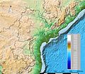
Andhra Pradesh and Telangana Physical.jpeg 2,598 × 2,244; 796 KB
-
AYool topography 15min PT.png 1,617 × 1,133; 1.15 MB
-
AYool topography 15min.jpg 800 × 561; 76 KB
-
Great Lakes bathymetry map 2.png 1,024 × 731; 943 KB
-
Great Lakes bathymetry map.png 1,024 × 731; 1.34 MB
-
Japan Trench.jpg 1,185 × 1,186; 1.8 MB
-
Lake Erie and Lake Saint Clair bathymetry map.png 1,024 × 684; 766 KB
-
Lake Huron bathymetry map 2.png 936 × 1,024; 878 KB
-
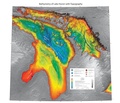
Lake Huron bathymetry.pdf 6,300 × 5,400; 16.87 MB
-
Lake Michigan bathymetry map 2.png 597 × 1,024; 600 KB
-
Lake Michigan bathymetry map.png 597 × 1,024; 948 KB
-
Lake Ontario bathymetry map.png 1,024 × 656; 750 KB
-
Lake Superior bathymetry map 2.png 1,024 × 636; 699 KB
-
Lake Superior bathymetry map, deepest point, trenches.png 1,024 × 1,348; 1.36 MB
-
Lake Superior bathymetry map.png 1,024 × 636; 1,014 KB
-
Map-Northern Patagonia-Argentina-political.png 1,731 × 1,218; 663 KB
-
Map-Northern Patagonia-Argentina-topologycal.png 1,754 × 1,240; 1.27 MB
-
Map-ValleMedio-Argentina.png 3,414 × 2,147; 515 KB
-
NYH gna41074 5.jpg 713 × 937; 226 KB
-
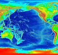
Pacific elevation.jpg 2,500 × 2,370; 899 KB
-
Sonar data scan of the water column.ogv 7.5 s, 720 × 480; 749 KB
-
Spain topo.png 992 × 854; 394 KB
-
Spain topography.png 1,240 × 1,068; 452 KB
-
Static image of sonar data scan.jpg 1,280 × 536; 434 KB


