Category:National Cycle Network route 14
Jump to navigation
Jump to search
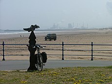
Three Rivers cycle route from Darlington to South Shields via Stockton, Hartlepool, Durham, Consett and Gateshead. | |||||
| Upload media | |||||
| Instance of | |||||
|---|---|---|---|---|---|
| Part of | |||||
| Location | |||||
| Connects with | |||||
| Length |
| ||||
| Partially coincident with | |||||
| official website | |||||
 | |||||
Subcategories
This category has the following 2 subcategories, out of 2 total.
M
P
- Pontburn Viaduct (7 F)
Media in category "National Cycle Network route 14"
The following 15 files are in this category, out of 15 total.
-
A1027 - geograph.org.uk - 215187.jpg 640 × 479; 44 KB
-
Cycle path alongside the B1283 - geograph.org.uk - 150743.jpg 480 × 640; 84 KB
-
Lanchester Valley Path at Baxter Wood - geograph.org.uk - 340507.jpg 640 × 480; 82 KB
-
Lanchester Valley Walk - geograph.org.uk - 30058.jpg 640 × 480; 90 KB
-
National Cycleway No. 14 - geograph.org.uk - 30064.jpg 640 × 480; 73 KB
-
National Cycleway Route 14 - geograph.org.uk - 568545.jpg 640 × 427; 64 KB
-
NCN signpost at Seaton Carew - geograph.org.uk - 1747407.jpg 640 × 480; 65 KB
-
Path off A689 - geograph.org.uk - 215233.jpg 640 × 479; 89 KB
-
Public Bridleway, Hurbuck Cottages - geograph.org.uk - 30001.jpg 640 × 480; 70 KB
-
Renny's Lane, Durham - geograph.org.uk - 150382.jpg 640 × 480; 135 KB
-
Sea wall - Seaton Carew - geograph.org.uk - 215266.jpg 640 × 479; 42 KB
-
The road to Old Durham - geograph.org.uk - 150375.jpg 640 × 480; 51 KB
-
NCN 14, near Haswell Moor Farm - geograph.org.uk - 150739.jpg 640 × 480; 109 KB


