Category:Narrow gauge railways in England
Jump to navigation
Jump to search
Wikimedia category | |||||
| Upload media | |||||
| Instance of | |||||
|---|---|---|---|---|---|
| Category combines topics | |||||
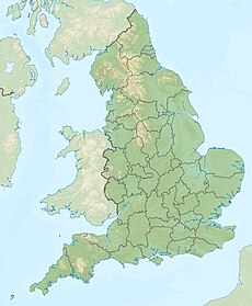
| England | |||||
country in north-west Europe, part of the United Kingdom | |||||
| Spoken text audio | |||||
| Pronunciation audio | |||||
| Instance of | |||||
| Name in native language |
| ||||
| Named after | |||||
| Patron saint | |||||
| Location |
| ||||
| Capital | |||||
| Basic form of government |
| ||||
| Official language | |||||
| Anthem |
| ||||
| Currency | |||||
| Head of state |
| ||||
| Head of government |
| ||||
| Highest point | |||||
| Population |
| ||||
| Area |
| ||||
| Replaces |
| ||||
| Different from | |||||
| official website | |||||
 | |||||
Subcategories
This category has the following 73 subcategories, out of 73 total.
1
A
- Apedale Valley Light Railway (97 F)
B
- Beeches Light Railway (49 F)
- Bicton Woodland Railway (8 F)
- Blake Dean Railway (9 F)
- Blakesley Miniature Railway (13 F)
C
- Cadeby Light Railway (6 F)
D
- Davington Light Railway (2 F)
E
F
- Fayle's tramway (6 F)
G
- Gartell Light Railway (39 F)
- Golden Valley Light Railway (33 F)
- Great Bush Railway (28 F)
H
- Hayling Seaside Railway (81 F)
- Holy Island Waggonway (21 F)
L
M
- Moors Valley Railway (16 F)
O
P
- Penlee Quarry railway (1 F)
- Perrygrove Railway (23 F)
- Poole Park Railway (13 F)
R
- Rye and Camber Tramway (9 F)
S
- Setchey Oil Railway (10 F)
- Steeple Grange Light Railway (15 F)
T
V
- Viables Craft Centre (18 F)
W
- Warwickslade Cutting railway (67 F)
Y
- Yaxham Light Railway (6 F)
Media in category "Narrow gauge railways in England"
The following 51 files are in this category, out of 51 total.
-
A tangle of lines 2.jpg 2,700 × 1,800; 988 KB
-
A tangle of lines.jpg 2,700 × 1,800; 1.09 MB
-
Amos on the larger loop.jpg 2,700 × 1,800; 1.16 MB
-
Amos on the loop.jpg 2,700 × 1,800; 1.21 MB
-
Avoncliff - Westwood Tramway - Westwood Ground Stone Quarry.jpg 428 × 358; 103 KB
-
Avoncliff - Westwood Tramway 01.jpg 719 × 463; 78 KB
-
Avoncliff - Westwood Tramway and Red Cross Hospital (cropped).jpg 460 × 698; 37 KB
-
Avoncliff - Westwood Tramway and Red Cross Hospital.jpg 710 × 440; 47 KB
-
BillingAquadrome.jpg 600 × 450; 51 KB
-
Buffer stop showing the two different gauges.jpg 2,700 × 1,800; 1.05 MB
-
CliffeHillMineralRailwayMap.png 615 × 467; 25 KB
-
Crickheath Tramway and bridge, Llynclys, Shropshire.jpg 4,896 × 2,752; 7.71 MB
-
Disused narrow gauge track at Gorebridge Green Farm (geograph 2032278).jpg 2,592 × 1,944; 2.28 MB
-
Entrance to Watermill Court, Goose Eye - geograph.org.uk - 807750.jpg 1,024 × 683; 186 KB
-
Farm at Loxhill. - geograph.org.uk - 167863.jpg 640 × 435; 154 KB
-
Feldbahnlokomotive eines Bauunternehmers.jpg 400 × 258; 37 KB
-
Fragment of narrow gauge railway line - geograph.org.uk - 1220520.jpg 469 × 640; 445 KB
-
Goose Eye, Watermill Court - geograph.org.uk - 4137826.jpg 640 × 427; 88 KB
-
Goose Eye, Watermill Court - geograph.org.uk - 4137837.jpg 3,456 × 2,304; 4.15 MB
-
Hurst Castle, entering the west wing - geograph.org.uk - 3648187.jpg 480 × 640; 77 KB
-
Hurst Castle, Narrow Gauge Railway for transporting artillery shells. - panoramio.jpg 2,736 × 3,648; 4.2 MB
-
Ironside advert for New Century Motor Locomotive (at Nenthead Mines).jpg 1,106 × 1,662; 300 KB
-
Light railway track remains, Freiston Shore.JPG 1,600 × 1,200; 625 KB
-
Light-rail1.JPG 1,280 × 960; 692 KB
-
Marwell07-train.jpg 2,816 × 2,112; 1.2 MB
-
Narrow gauge diesel loco - geograph.org.uk - 633901.jpg 640 × 428; 98 KB
-
Oval track (lower), upper track with train.jpg 2,700 × 1,800; 919 KB
-
PentewanLocomotiveShed.jpg 640 × 480; 115 KB
-
Purfleet Tramway on an old topgraphic map.jpg 758 × 478; 155 KB
-
Railway in Lydd Ranges (geograph 2464621).jpg 3,072 × 2,304; 2.71 MB
-
Railway line in Lydd Ranges (geograph 3064189).jpg 640 × 480; 86 KB
-
Railway Track, Dungeness - geograph.org.uk - 449507.jpg 640 × 467; 176 KB
-
Ramsgate1.png 2,456 × 1,582; 8.56 MB
-
Restoring the Deepcut flight Basingstoke Canal.jpg 640 × 549; 178 KB
-
Shepherdswell, East Kent Railway (geograph 2592899).jpg 3,648 × 2,736; 2.19 MB
-
Shepshed quarry, 1885.jpg 999 × 796; 165 KB
-
Strensall Firing Range Railway.jpg 2,700 × 1,800; 950 KB
-
The Royal Navy during the Second World War A24931.jpg 800 × 594; 77 KB
-
Turntable of The Peat Railway at Washford - geograph.org.uk - 943912.jpg 480 × 640; 113 KB
-
Watermill Court, Goose Eye - geograph.org.uk - 807738.jpg 1,024 × 683; 187 KB


