Category:Narembeen, Western Australia
Jump to navigation
Jump to search
town in the wheatbelt region of Western Australia, Australia | |||||
| Upload media | |||||
| Instance of | |||||
|---|---|---|---|---|---|
| Location |
| ||||
| Population |
| ||||
| Area |
| ||||
| Elevation above sea level |
| ||||
 | |||||
English: Narembeen, Western Australia
Subcategories
This category has the following 4 subcategories, out of 4 total.
C
S
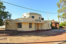
- Narembeen shire offices (2 F)
Media in category "Narembeen, Western Australia"
The following 8 files are in this category, out of 8 total.
-
Ag Implements, Narembeen, 2014.JPG 3,776 × 2,520; 3.65 MB
-
Narembeen grain receival point, 2014.JPG 3,862 × 2,169; 4.15 MB
-
Narembeen Public Hall, 2014.JPG 3,776 × 2,520; 3.77 MB
-
Narembeen railway station, 2014.JPG 3,962 × 2,222; 4.29 MB
-
Narembeen Road Board building, 2014.JPG 3,776 × 2,520; 3.83 MB
-
Narembeen Roadhouse, 2014.JPG 3,739 × 2,103; 3.48 MB
-
Town clock, Narembeen, 2014(1).JPG 2,736 × 2,736; 3.59 MB
-
Town clock, Narembeen, 2014(2).JPG 2,736 × 2,736; 5.49 MB


