Category:Nantmor
Jump to navigation
Jump to search
village in Wales  | |||||
| Upload media | |||||
| Instance of | |||||
|---|---|---|---|---|---|
| Location | Beddgelert, Gwynedd, Wales | ||||
 | |||||
Cymraeg: Pentref yng Ngwynedd yw Nantmor, hefyd Nanmor, efallai yn wreiddiol Nanmor Deudraeth. Saif ynghanol Eryri, ychydig i'r de o bentref Beddgelert, ar ffordd gefn fymryn i'r dwyrain o'r briffordd A4085, rhwng Aberglaslyn a Garreg, Llanfrothen. I'r gogledd-ddwyrain o'r pentref mae Blaen Nanmor.
English: Nantmor is a hamlet which lies about 1½ miles to the south of the village of Beddgelert in Gwynedd, North Wales.
Subcategories
This category has the following 5 subcategories, out of 5 total.
A
- Aberglaslyn Long Tunnel (9 F)
- Aberglaslyn Short Tunnel (5 F)
C
- Capel Peniel, Nantmor (4 F)
N
- Nantmor railway station (11 F)
- Nantmor telephone box (4 F)
Media in category "Nantmor"
The following 66 files are in this category, out of 66 total.
-
 A view from below the Pont Aberglaslyn.jpeg 900 × 710; 395 KB
-
-
 A4085 at Nantmor - geograph.org.uk - 3698291.jpg 640 × 479; 116 KB
-
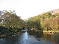
 Afon Glaslyn River, Gwynedd - geograph.org.uk - 782974.jpg 640 × 426; 82 KB
-
 Carnedd - geograph.org.uk - 828739.jpg 640 × 480; 105 KB
-
 Chapel at Nantmor, Gwynedd - geograph.org.uk - 1839751.jpg 3,872 × 2,592; 4 MB
-
 Golden moon (5439556142).jpg 640 × 480; 105 KB
-
 Hafod Garregog - geograph.org.uk - 567791.jpg 640 × 480; 91 KB
-
 Picnic area at Nantmor - geograph.org.uk - 4081560.jpg 4,184 × 2,789; 3.75 MB
-
 Picnic clearing beside Welsh Highland Railway at Nantmor - geograph.org.uk - 4104377.jpg 3,912 × 2,076; 6.69 MB
-
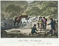
 Pont Abberglasslyn, n. Wales (1130210).jpg 1,000 × 816; 277 KB
-
 Pont Abberglasslyn, n. Wales.jpeg 900 × 720; 375 KB
-
 Pont Abberglasslyn, n.Wales.jpeg 900 × 729; 378 KB
-
 Pont Aber Glaslyn.jpeg 900 × 669; 396 KB
-
 Pont Aber Glass-Llyn.jpeg 900 × 746; 444 KB
-
 Pont Aber-Glaslyn, north Wales.jpeg 900 × 730; 411 KB
-
 Pont Aberglaslyn (1129646).jpg 1,000 × 697; 195 KB
-
 Pont Aberglaslyn (1130093).jpg 1,000 × 767; 159 KB
-
 Pont Aberglaslyn (1130118).jpg 1,000 × 750; 205 KB
-
 Pont Aberglaslyn (1130264).jpg 1,000 × 755; 234 KB
-
 Pont Aberglaslyn (1131323).jpg 1,000 × 1,696; 254 KB
-
 Pont Aberglaslyn (1131628).jpg 1,000 × 1,091; 316 KB
-
 Pont Aberglaslyn (1131656).jpg 1,000 × 743; 176 KB
-
 Pont Aberglaslyn (1132046).jpg 1,000 × 743; 188 KB
-
 Pont Aberglaslyn (1132754).jpg 1,000 × 1,410; 478 KB
-

-
 Pont Aberglaslyn - principal entrance to Caernarvonshire.jpeg 537 × 900; 323 KB
-
 Pont Aberglaslyn and salmon leap.jpeg 900 × 664; 422 KB
-
 Pont Aberglaslyn, Caernarvonshire (1131553).jpg 1,000 × 771; 183 KB
-
 Pont Aberglaslyn, Caernarvonshire (1132998).jpg 1,000 × 962; 284 KB
-
 Pont Aberglaslyn, Caernarvonshire.jpeg 900 × 684; 378 KB
-
 Pont Aberglaslyn, Carnarvonshire (1131260).jpg 1,000 × 767; 279 KB
-
 Pont Aberglaslyn, Carnarvonshire (1131312).jpg 1,000 × 747; 267 KB
-
 Pont Aberglaslyn, Carnarvonshire (1133723).jpg 1,000 × 760; 272 KB
-
 Pont Aberglaslyn, Carnarvonshire.jpeg 900 × 687; 386 KB
-
 Pont Aberglaslyn, near Beddgelert (1130183).jpg 1,000 × 783; 250 KB
-
 Pont Aberglaslyn, near Beddgelert.jpeg 900 × 642; 277 KB
-
 Pont Aberglaslyn, North Wales.jpeg 900 × 640; 403 KB
-
 Pont Aberglaslyn, north Wales.jpeg 900 × 641; 420 KB
-
 Pont Aberglaslyn.jpeg 627 × 900; 376 KB
-
 Pont Aberglasslyn (1131120).jpg 1,000 × 644; 212 KB
-
 Pont Aberglasslyn (1131288).jpg 1,000 × 769; 115 KB
-
 Pont Aberglasslyn (1131622).jpg 1,000 × 632; 146 KB
-
 Pont Aberglasslyn (1132552).jpg 1,000 × 761; 127 KB
-
 Pont Aberglasslyn.jpeg 900 × 700; 454 KB
-
 Pont-aberglaslyn.jpeg 900 × 704; 352 KB
-
 Pre-Worboys Road Sign - geograph.org.uk - 2151431.jpg 1,600 × 1,200; 437 KB
-
 Retrospect of Pont Aberglaslyn,.jpeg 900 × 669; 392 KB
-
 Salmon Fishery. Pont Aberglaslyn (1133074).jpg 1,000 × 795; 206 KB
-
 Salmon Fishery. Pont Aberglaslyn.jpeg 900 × 670; 389 KB
-
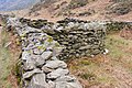 Sheepfolds in Cwm Bychan - geograph.org.uk - 1384110.jpg 640 × 427; 134 KB
-
 Tremadog 5 - geograph.org.uk - 4775971.jpg 1,024 × 683; 254 KB
-
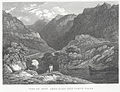 View of Pont Aber Glass Lyn, north Wales.jpeg 900 × 690; 428 KB
-
 Welsh Highland Railway, Nantmor - geograph.org.uk - 1423860.jpg 640 × 480; 132 KB
-

-
 Abandoned Cableway - geograph.org.uk - 336035.jpg 640 × 426; 115 KB
-
 Afon Glaslyn from the Sygun Mine Bridge - geograph.org.uk - 275096.jpg 640 × 480; 101 KB
-
 Afon Glaslyn River, Gwynedd - geograph.org.uk - 782983.jpg 640 × 428; 76 KB
-
 Crusader Centre, Cae Canol - geograph.org.uk - 275003.jpg 559 × 640; 197 KB
-
 Nant-dwr-oer - geograph.org.uk - 414103.jpg 640 × 480; 116 KB
-
 Open workings - geograph.org.uk - 366601.jpg 480 × 640; 104 KB
-
 The Sygun Mine Bridge - geograph.org.uk - 275093.jpg 640 × 480; 113 KB
-
 Ty-Hen - geograph.org.uk - 275085.jpg 640 × 480; 101 KB
-
 Tyrpeg Traeth - geograph.org.uk - 414089.jpg 640 × 480; 117 KB
-
 Woodland at Cae Canol - geograph.org.uk - 275061.jpg 640 × 480; 184 KB
-
 Ynys Fer-las and Afon Dylif - geograph.org.uk - 261687.jpg 640 × 448; 83 KB


.jpg)


.jpg)


.jpg)
.jpg)
.jpg)
.jpg)
.jpg)
.jpg)
.jpg)
.jpg)
.jpg)


.jpg)
.jpg)

.jpg)
.jpg)
.jpg)

.jpg)


.jpg)
.jpg)
.jpg)
.jpg)


.jpg)


