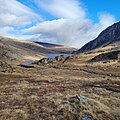
Category:Nant Ffrancon
Jump to navigation
Jump to search
glacial valley between Bethesda and Llyn Ogwen, gwynedd, in Eryri National Park | |||||
| Upload media | |||||
| Instance of | |||||
|---|---|---|---|---|---|
| Location | Gwynedd, Wales | ||||
| Carries | |||||
| Heritage designation |
| ||||
| Mountain range | |||||
| Elevation above sea level |
| ||||
 | |||||
Subcategories
This category has the following 2 subcategories, out of 2 total.
A
O
- Ogwen Falls (7 F)
Media in category "Nant Ffrancon"
The following 118 files are in this category, out of 118 total.
-
Bochlwyd Buttress - geograph.org.uk - 2678389.jpg 3,264 × 2,448; 2.22 MB
-
Cwm Ceunant - geograph.org.uk - 110414.jpg 640 × 480; 126 KB
-
Fall of the Ogwen, in Nant Frangon, Caernarvonshire (1133422).jpg 1,000 × 731; 226 KB
-
Fall of the Ogwen, Nant Francon.jpeg 900 × 866; 517 KB
-
Fall of the River Ogwen, north Wales.jpeg 900 × 664; 440 KB
-
Falls of the Ogwen, into Nant Frangon.jpeg 900 × 681; 407 KB
-
Falls Of The Ogwen, Nant Frangon.jpeg 641 × 900; 362 KB
-
General view, Nant Francon (i.e. Nant Ffrancon) Pass, Wales-LCCN2001703526.jpg 3,646 × 2,708; 3.63 MB
-
Landslide on the A5 at Nant Ffrancon (1493591).jpg 1,623 × 1,250; 911 KB
-
Landslide on the A5 at Nant Ffrancon (1493592).jpg 1,250 × 1,601; 836 KB
-
Landslide on the A5 at Nant Ffrancon (4478262339).jpg 470 × 602; 69 KB
-
Layby along the A5 - geograph.org.uk - 2678350.jpg 3,264 × 2,448; 2.92 MB
-
Looking north along Nant Ffrancon - geograph.org.uk - 2678330.jpg 3,264 × 2,448; 3.88 MB
-
Mynydd Perfedd across Nant Ffrancon - geograph.org.uk - 1311226.jpg 640 × 480; 76 KB
-
Nant Ffrancon - geograph.org.uk - 771711.jpg 640 × 480; 63 KB
-
Nant Ffrancon and Ogwen Valley, Snowdonia National Park (50698598102).jpg 25,227 × 5,368; 197.77 MB
-
Nant Ffrancon and the Menai Straits - geograph.org.uk - 1264932.jpg 640 × 480; 88 KB
-
Nant Ffrancon from Bwlch Tryfan - geograph.org.uk - 73036.jpg 640 × 480; 68 KB
-
Nant Ffrancon from the Glyders - geograph.org.uk - 122078.jpg 480 × 640; 97 KB
-
Nant Ffrancon, from Cwm Idwal, Eryri National Park.jpg 2,560 × 2,560; 1.31 MB
-
Nant Ffrancon,looking north - geograph.org.uk - 771713.jpg 640 × 480; 81 KB
-
Nant Francon (1128952).jpg 1,000 × 616; 183 KB
-
Nant Francon (1129183).jpg 1,000 × 717; 157 KB
-
Nant Francon (1133993).jpg 1,000 × 677; 198 KB
-
Nant Francon, Caernarvonshire (1133602).jpg 1,000 × 809; 250 KB
-
Nant Francon, Caernarvonshire.jpeg 900 × 696; 416 KB
-
Nant Francon.jpeg 900 × 682; 415 KB
-
Nant Frangon (1130415).jpg 1,000 × 761; 174 KB
-
Nant Frangon (1133508).jpg 1,000 × 728; 198 KB
-
Nant Frangon.jpeg 900 × 861; 539 KB
-
Pass of Nant Francon & Falls of the Ogwen (1132661).jpg 1,000 × 784; 175 KB
-
Pass of Nant Francon & Falls of the Ogwen.jpeg 900 × 706; 370 KB
-
Pass of Nant Francon.jpeg 900 × 685; 342 KB
-
Pontybenglog near Ogwen Lake.jpeg 900 × 749; 406 KB
-
Scree slope alongside the A5 - geograph.org.uk - 2678346.jpg 3,259 × 2,265; 3.02 MB
-
The A5 in Nant Ffrancon - geograph.org.uk - 2678340.jpg 3,264 × 2,448; 3.01 MB
-
The flat valley floor of Nant Ffrancon - geograph.org.uk - 2678360.jpg 3,264 × 2,448; 4.07 MB
-
View from the Glyder Vawr.jpeg 3,222 × 999; 1.49 MB
-
View towards Pentre Farm - geograph.org.uk - 2678355.jpg 3,264 × 2,448; 4.07 MB


