Category:Nagatoro (gorge)
Jump to navigation
Jump to search
  | |||||
| Upload media | |||||
| Instance of | |||||
|---|---|---|---|---|---|
| Part of |
| ||||
| Located in protected area |
| ||||
| Location | |||||
| Located in or next to body of water | |||||
| Heritage designation | |||||
 | |||||
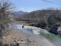
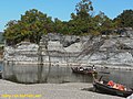
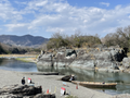
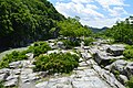
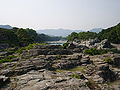
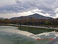
English: Nagatoro is a 4 kilometre long gorge on the Arakawa River in northwestern Saitama prefecture, spanning the boundaries of the towns of Minano and Nagatoro.
- ↑ a b 『日本地名大百科』、小学館、1996年、ISBN 4-09-523101-7 p.836
Media in category "Nagatoro (gorge)"
The following 45 files are in this category, out of 45 total.
-
 20191127 埼玉県秩父市長瀞渓谷.jpg 1,440 × 1,080; 1.03 MB
-
 20191127 埼玉県秩父市長瀞渓谷3.jpg 1,440 × 1,080; 376 KB
-
 Arakawa River (15671906440).jpg 6,000 × 4,000; 14.3 MB
-
 Arakawa River (15859259865).jpg 4,000 × 6,000; 14.87 MB
-
 Arakawa River from Takasago Bridge in Nagatoro, Saitama 1.png 4,032 × 3,024; 19.77 MB
-
 Arakawa River from Takasago Bridge in Nagatoro, Saitama 2.png 4,032 × 3,024; 10.28 MB
-
 Arakawa River from Takasago Bridge in Nagatoro, Saitama 3.png 4,032 × 3,024; 19.74 MB
-
 Chichibu 504 Oyahana Viaduct 20110425.jpg 4,145 × 2,763; 8.63 MB
-
 Kanaishi-suikan Bridge in Nagatoro, Saitama 1.png 3,024 × 4,032; 21.3 MB
-
 Nagatoro - panoramio.jpg 500 × 374; 106 KB
-
 Nagatoro gorge 2019 01.jpg 4,320 × 3,240; 3.92 MB
-
 Nagatoro gorge 2019 02 (cropped).jpg 3,823 × 787; 953 KB
-
 Nagatoro gorge 2019 02.jpg 3,823 × 2,867; 3.44 MB
-
 Nagatoro Iwadatami (1955556739).jpg 1,280 × 853; 496 KB
-
 Nagatoro Iwadatami in April 2024 1.png 4,032 × 3,024; 14.26 MB
-
 Nagatoro Iwadatami in April 2024 10.png 3,024 × 4,032; 19.49 MB
-
 Nagatoro Iwadatami in April 2024 11.png 4,032 × 3,024; 22.53 MB
-
 Nagatoro Iwadatami in April 2024 12.png 4,032 × 3,024; 22.01 MB
-
 Nagatoro Iwadatami in April 2024 13.png 3,024 × 4,032; 15.42 MB
-
 Nagatoro Iwadatami in April 2024 14.png 3,024 × 4,032; 14 MB
-
 Nagatoro Iwadatami in April 2024 2.png 4,032 × 3,024; 13.5 MB
-
 Nagatoro Iwadatami in April 2024 3.png 4,032 × 3,024; 21.4 MB
-
 Nagatoro Iwadatami in April 2024 4.png 4,032 × 3,024; 16.23 MB
-
 Nagatoro Iwadatami in April 2024 5.png 4,032 × 3,024; 15.64 MB
-
 Nagatoro Iwadatami in April 2024 6.png 3,024 × 4,032; 23.98 MB
-
 Nagatoro Iwadatami in April 2024 7.png 4,032 × 3,024; 11.73 MB
-
 Nagatoro Iwadatami in April 2024 8.png 4,032 × 3,024; 10.37 MB
-
 Nagatoro Iwadatami in April 2024 9.png 4,032 × 3,024; 12.07 MB
-
 Nagatoro Iwadatami.JPG 1,024 × 768; 221 KB
-
 Nagatoro Keikoku, iwa-datami.jpg 6,016 × 4,000; 9.95 MB
-
 Nagatoro monument.jpg 2,136 × 3,216; 4.87 MB
-
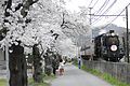 Nagatoro Sakura SL.JPG 4,185 × 2,790; 3.55 MB
-
 Nagatoro, Chichibu District, Saitama Prefecture 369-1305, Japan - panoramio (3).jpg 4,272 × 2,848; 2.33 MB
-
 Nagatoro, Chichibu District, Saitama Prefecture 369-1305, Japan - panoramio (7).jpg 4,272 × 2,848; 2.21 MB
-
 Nagatoro, Chichibu District, Saitama Prefecture 369-1305, Japan - panoramio (9).jpg 2,848 × 4,272; 2.25 MB
-
 Nagatoro2a.jpg 2,048 × 1,536; 678 KB
-
 Nagatorokeikoku1.jpg 3,648 × 2,736; 3.56 MB
-
 Nagatorokeikoku2.jpg 3,648 × 2,736; 3.56 MB
-
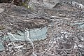
 Pot hole near the Oyahana bridge in Minano Town Saitama.jpg 6,000 × 4,000; 11.37 MB
-
 Railway Bridge (15857264551).jpg 5,722 × 3,815; 18.3 MB
-
 Railway Bridge (15857267121).jpg 6,000 × 4,000; 20.62 MB
-
 Toraiwa in Nagatoro Town Saitama Close up.jpg 6,000 × 4,000; 14.14 MB
-
 長瀞、岩畳対岸から - panoramio.jpg 2,288 × 1,712; 846 KB
-
 長瀞ウォーターパークより美の山を望む - panoramio.jpg 4,000 × 3,000; 4.74 MB
-
 長瀞ラフティング - panoramio.jpg 2,816 × 2,112; 3.98 MB

.jpg)
.jpg)


.jpg)


.jpg)
.jpg)
.jpg)


.jpg)
.jpg)


.jpg)