Category:NASA MODIS images of Central America
Jump to navigation
Jump to search
Media in category "NASA MODIS images of Central America"
The following 22 files are in this category, out of 22 total.
-
 Eastern Lesser Antilles (Barbuda to Grenada) satellite image.jpg 2,400 × 3,200; 1.1 MB
-
 Lesser Antilles 250m (cropped to Dominica Passage).jpg 600 × 600; 165 KB
-
 Lesser Antilles 250m (cropped to Martinique Passage).jpg 600 × 600; 168 KB
-
 Lesser Antilles 250m.jpg 838 × 1,120; 424 KB
-
 Nicaragua 2015-05-12 1615Z.jpg 2,792 × 2,928; 1.37 MB
-
 Panama.A2003087.1850.250m.jpg 720 × 721; 67 KB
-
 Satellite image of Antigua And Barbuda in September 2002.jpg 311 × 372; 16 KB
-
 Satellite image of Barbados September 2002.jpg 128 × 144; 4 KB
-
 Satellite image of Belize in March 31, 2002.jpg 780 × 1,190; 330 KB
-
 Satellite image of Belize in May 2001.jpg 759 × 1,176; 205 KB
-
 Satellite image of Cuba in November 2001.jpg 4,558 × 1,619; 1.28 MB
-
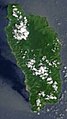 Satellite image of Dominica in September 2002.jpg 118 × 210; 6 KB
-
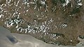 Satellite image of El Salvador in April 2002.jpg 1,058 × 599; 131 KB
-
 Satellite image of Grenada in September 2002.jpg 202 × 268; 13 KB
-
 Satellite image of Guatemala in April 2002.jpg 1,766 × 1,863; 789 KB
-
 Satellite image of Gulf of Chiriquí in March 2003.jpg 730 × 477; 66 KB
-
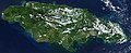 Satellite image of Jamaica in November 2001.jpg 949 × 387; 65 KB
-
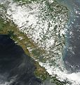
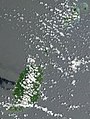
 Satellite image of Nicaragua in March 2003.jpg 1,995 × 1,969; 919 KB
-
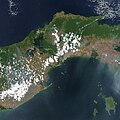
 Satellite image of Panama in March 2003.jpg 2,629 × 1,116; 535 KB
-
 Sediment off the Yucatan Peninsula.jpg 2,400 × 2,000; 1.59 MB
-

-
 Yucatan Peninsula on January 25, 2017.jpg 5,600 × 4,400; 3.5 MB
_satellite_image.jpg)
.jpg)
.jpg)


.jpg)
