Category:NASA Earth Observing-1 images
Jump to navigation
Jump to search
These satellite images are created using NASA's Earth Observing-1.
Subcategories
This category has only the following subcategory.
Media in category "NASA Earth Observing-1 images"
The following 200 files are in this category, out of 310 total.
(previous page) (next page)-
100 Years at Kilauea - NASA Earth Observatory.jpg 720 × 964; 293 KB
-
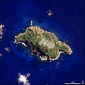
Pitcairnsatellite.jpg 540 × 540; 50 KB
-
Pitcairnsatellite.png 540 × 540; 326 KB
-
2010 Activity at Shiveluch Volcano.jpg 2,906 × 3,930; 2.19 MB
-
2010 Oil Slick Around Mississippi Barrier Islands.jpg 3,400 × 2,800; 3.35 MB
-
2011 Earthquake and Tsunami near Sendai, Japan.jpg 2,614 × 6,832; 5.21 MB
-
2011 flooding in Ayutthaya Province-EO-1 merged.jpg 5,860 × 4,000; 8.4 MB
-
2011 flooding in Ayutthaya Province-EO-1-ALI, image 1.jpg 3,000 × 4,000; 4.7 MB
-
2011 flooding in Ayutthaya Province-EO-1-ALI, image 2.jpg 3,000 × 4,000; 3.67 MB
-
PIA11239 - NASA Spacecraft Watches as Eruption Reshapes African Volcano.jpg 1,044 × 801; 66 KB
-
Activity at Sakurajima Volcano 2010-02-15.jpg 720 × 480; 128 KB
-
Ambrym ali 2012348 lrg.jpg 5,097 × 2,550; 2.25 MB
-
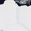
Amery Ice Shelf.jpg 720 × 720; 160 KB
-
April 17, 2010, Ash plume from Eyjafjallajokull Volcano .jpg 255 × 501; 30 KB
-
April 2011 Heavy Rain Triggers Landslides in Thailand 2.jpeg 720 × 480; 237 KB
-
April 2011 Heavy Rain Triggers Landslides in Thailand.jpg 3,000 × 4,000; 4.7 MB
-
Apua Point satellite.jpg 602 × 452; 138 KB
-
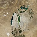
Aral Sea August 2017.jpg 2,000 × 2,000; 1.94 MB
-
Ash and Lava Flows at Nabro Volcano September 28, 2011.png 719 × 478; 594 KB
-
Ash and Lava Flows at Nabro Volcano, September 28, 2011.png 720 × 480; 788 KB
-
Ash Plume from Tavurvur, Papua New Guinea.jpg 1,183 × 1,327; 241 KB
-
Astrolabe Glacier.jpg 2,454 × 3,030; 861 KB
-
Athabasca oil sands.jpg 720 × 480; 175 KB
-
Athens ALI 2004184 lrg.jpg 2,490 × 2,490; 4.69 MB
-
Attabad Lake 2011-09-04.jpg 720 × 360; 188 KB
-
B17b ali 2009364 lrg.jpg 3,497 × 3,497; 3.4 MB
-
Barnes Ice Cap, Baffin Island, Canada.jpg 2,243 × 4,000; 4.55 MB
-
Barrier Island along Arctic Shores.jpg 2,792 × 3,000; 4.11 MB
-
Bastrop County Complex Fire Burn Scar (6147392845).jpg 924 × 1,134; 1.49 MB
-
Bezymianny Volcano Natural Color.jpg 2,812 × 3,903; 4.03 MB
-
Big Thompson Canyon, Colorado.jpg 3,000 × 3,000; 3.54 MB
-
Blackwater National Wildlife Refuge.jpg 2,536 × 3,000; 3.72 MB
-
Boteti River, Botswana.jpg 2,043 × 1,407; 477 KB
-
Brazilian Dune Fields.jpg 3,000 × 3,000; 4.53 MB
-
British Virgin Islands.jpg 2,700 × 1,800; 2.89 MB
-
Cape Canaveral launch pad 39A and neighboring pad 39B.jpg 1,323 × 1,323; 1,018 KB
-
Carajas Mine.jpg 720 × 480; 576 KB
-
Carthage, Tunisia EO-1.jpg 3,000 × 3,000; 3.37 MB
-
Chaiten ali 2009065 lrg.jpg 4,200 × 2,800; 6.31 MB
-
Chaiten ali 2009065 swir lrg.jpg 1,400 × 933; 1.12 MB
-
Chaiten Caldera.jpg 2,009 × 2,074; 414 KB
-
Chaitén Volcano Lava Dome, Chile.jpg 899 × 723; 320 KB
-
Chernobyl, Ukraine.jpg 3,000 × 2,000; 4.06 MB
-
Christchurch and surrounding area from space, 4 March 2011.jpg 4,142 × 4,143; 5.6 MB
-
Cocos (Keeling) Islands - NASA Earth Observatory.jpg 720 × 720; 197 KB
-
Dazhou ali 2011267 geo.tif 2,813 × 4,220; 19.37 MB
-
Dazhou ali 2011267 lrg.jpg 2,813 × 4,220; 3.2 MB
-
Detailed View of Ash Plume at Eyjafjallajökull Volcano 2010-04-17.jpg 720 × 480; 117 KB
-
Detailed View of Ash Plume at Eyjafjallajökull Volcano.jpg 3,761 × 2,422; 952 KB
-
Detailed View of Erupting Nabro Volcano.jpg 2,639 × 4,264; 1.47 MB
-
Detailed Views of Erupting Nabro Volcano, Eritrea 06-24-2011.png 720 × 480; 615 KB
-
Devecser és Kolontár térsége a vörösiszap katasztrófa után.jpg 720 × 360; 194 KB
-
Dutch Harbor, Alaska.jpg 2,000 × 2,000; 2.48 MB
-
Eastmain Reservoir, Quebec.jpg 3,355 × 4,000; 4.18 MB
-
Eastmain1-1A.jpg 1,024 × 768; 266 KB
-
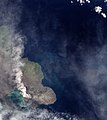
El Hierro Still Churning the Sea - NASA Earth Observatory.jpg 720 × 720; 87 KB
-
El Hierro Submarine Volcano Eruption - NASA Earth Observatory.jpg 720 × 720; 145 KB
-
Elkhills ali 2009066.jpg 720 × 480; 407 KB
-
Enewetak Atoll 2005-09-01, EO-1 bands 10-8-2-1, 15m resolution, no annotations.png 3,126 × 3,138; 11.72 MB
-
Enewetak Atoll 2005-09-01, EO-1 bands 10-8-2-1, 15m resolution.png 3,092 × 2,983; 12.59 MB
-
Enewetak Atoll 2005-09-01, EO-1 bands 10-8-2-1.png 4,328 × 4,136; 25.19 MB
-
EO-1 ALI image of the flooding in Rockhampton (close-up).jpg 720 × 480; 299 KB
-
EO-1 ALI image of the flooding in Rockhampton.jpg 3,117 × 2,550; 2.42 MB
-
EO1 ALI Lamay Island.jpg 530 × 455; 227 KB
-
Eruption at Nabro Volcano, Eritrea 06-24-2011.png 1,216 × 1,461; 3.07 MB
-
Eruption at Nabro Volcano, Eritrea, 06-24-2011.png 719 × 478; 826 KB
-
Eruption from Llaima Volcano, Chile.jpg 4,000 × 4,000; 4.83 MB
-
Eruption of Eyjafjallajökull Volcano, Iceland 2010-03-24 lrg.jpg 1,570 × 1,570; 471 KB
-
Eruption of Eyjafjallajökull Volcano, Iceland 2010-03-24.jpg 720 × 480; 112 KB
-
Eruption of Eyjafjallajökull Volcano, Iceland 2010-04-04 lrg.jpg 4,013 × 4,013; 2.88 MB
-
Eruption of Eyjafjallajökull Volcano, Iceland 2010-04-04.jpg 720 × 480; 125 KB
-
Eruption of Gaua Volcano 2010-04-24 lrg.jpg 4,872 × 4,872; 2.34 MB
-
Eruption of Gaua Volcano 2010-04-24.jpg 720 × 480; 99 KB
-
Eruption of Tolbachik Volcano 01dec2012 EO-1 vis+if.jpg 801 × 1,201; 852 KB
-
Eruption of Tolbachik Volcano 01dec2012 EO-1.jpg 2,400 × 3,600; 3.02 MB
-
Eruption of Tolbachik Volcano 22dec2012 EO-1.jpg 3,140 × 2,123; 1.56 MB
-
Evidence of Fresh Lava at Puyehue-Cordón Caulle October 9, 2011.png 719 × 479; 757 KB
-
Evidence of Fresh Lava at Puyehue-Cordón Caulle, October 9, 2011.jpg 3,399 × 2,520; 1.46 MB
-
Evidence of Fresh Lava at Puyehue-Cordón Caulle, October 9, 2011.png 718 × 479; 621 KB
-
Fargo Areal Photo.jpg 3,600 × 4,800; 4.52 MB
-
Flood Waters Inundate a Bangkok Airport - NASA Earth Observatory.jpg 720 × 540; 194 KB
-
Flood Waters Inundate a Bangkok Airport cropped.jpg 620 × 830; 197 KB
-
Flood Waters Inundate a Bangkok Airport.jpg 3,469 × 6,000; 4.18 MB
-
Flooding along the Rio Negro, Uruguay.jpg 2,049 × 1,366; 1.61 MB
-
Flooding in North Dakota.jpg 2,352 × 4,000; 2.29 MB
-
Flooding near Huron, South Dakota 2010-03-20 lrg.jpg 3,000 × 4,000; 4.34 MB
-
Flooding near Huron, South Dakota 2010-03-20.jpg 720 × 480; 329 KB
-
Flooding near the Betsiboka River, Madagascar 2010-03-23 lrg.jpg 3,000 × 3,000; 5.34 MB
-
Flooding near the Betsiboka River, Madagascar 2010-03-23.jpg 720 × 480; 258 KB
-
Flooding on the Kabul and Indus Rivers, Pakistan 2010.jpg 1,120 × 993; 893 KB
-
Floods Recede around the Wabash-Ohio Confluence.jpg 2,968 × 3,821; 3.38 MB
-
Floods Swamp Historic City in Thailand - NASA Earth Observatory.jpg 720 × 964; 377 KB
-
Fogo, 2009.jpg 720 × 480; 388 KB
-
Fogo, Cape Verde Islands.jpg 2,800 × 2,800; 3.49 MB
-
Fresh Lava Flow on Bagana Volcano - NASA Earth Observatory.jpg 720 × 480; 109 KB
-
Fresh Lava Flows Surround Pu'u 'O'o - NASA Earth Observatory.jpg 720 × 480; 112 KB
-
Funchal ali 10mar07.jpg 720 × 360; 405 KB
-
Gandoman, Iran.jpg 3,146 × 3,500; 4.47 MB
-
Gas emissions at Volcán Copahue, January 5, 2013.jpg 2,160 × 1,713; 1.11 MB
-
Gas emissions at Volcán Copahue, January 5, 2013.PNG 720 × 480; 744 KB
-
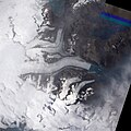
Glaciers Flow into a Greenland Valley.jpg 2,559 × 3,207; 981 KB
-
Goat Paddock Crater.jpg 3,000 × 3,000; 4.5 MB
-
Grand Staircase-Escalante National Monument, Utah.jpg 3,013 × 3,200; 4.67 MB
-
Greece ali 2009239 lrg.jpg 2,856 × 4,000; 4.13 MB
-
Greece ali 2009239 swir lrg.jpg 1,350 × 1,350; 2.02 MB
-
Greenland Melt Ponds (wallpaper).jpg 1,600 × 1,200; 128 KB
-
Greenland Melt Ponds.jpg 4,224 × 4,224; 4.02 MB
-
Grinnell Glacier, Glacier National Park.jpg 1,903 × 2,945; 872 KB
-
Grímsvötn Volcano, Iceland - NASA Earth Observatory.jpg 1,024 × 1,024; 266 KB
-
Guam - NASA Earth Observatory.jpg 720 × 480; 164 KB
-
Guam ali 2011364 lrg.jpg 3,994 × 5,148; 4.36 MB
-
Guam space image (cropped).jpg 3,737 × 4,738; 4.9 MB
-
Gwadar satellite view showing island created by 2013 earthquake.jpg 2,000 × 2,000; 861 KB
-
Gwadar satellite view.jpg 2,000 × 2,000; 636 KB
-
Har Nuur, Mongolia.jpg 3,311 × 2,207; 4.04 MB
-
Henrietta Island, Russia.jpg 2,000 × 2,000; 2.22 MB
-
Himalayan Glacier, Southern China 2009-12-25. lrg.jpg 3,000 × 3,000; 4.41 MB
-
Himalayan Glacier, Southern China 2009-12-25.jpg 720 × 720; 355 KB
-
Himalayan Glacier, Southern China.jpg 3,000 × 3,000; 4.42 MB
-
HowlandIsland-eo1.png 306 × 564; 7 KB
-
Hunza Valley Landslide Lake (cropped).jpg 2,400 × 1,704; 2.11 MB
-
Hunza Valley Landslide Lake.jpg 2,400 × 3,600; 4.24 MB
-
Ice Island Calves off Petermann Glacier.jpg 4,896 × 3,672; 4.2 MB
-
Icebergb17b amo 2009309 lrg.jpg 4,448 × 4,448; 4.75 MB
-
Imja Tsho, Nepal.jpg 2,400 × 2,400; 3.65 MB
-
Irrigation Project along the Orange River.jpg 3,159 × 3,600; 2.84 MB
-
Jabal al tair plume 2007.jpg 731 × 695; 175 KB
-
Jesusita Fire, 5-10-09.jpg 720 × 480; 241 KB
-
Joggins Cliffs, Nova Scotia.jpg 3,000 × 3,000; 4.64 MB
-
Johnston Atoll 2009-03-17, EO-1 bands 5-4-3-1, 15m resolution.png 2,928 × 2,040; 11.13 MB
-
Johnston Atoll 2009-05-05, EO-1 bands 5-4-3-1, 15m resolution.png 2,424 × 1,581; 6.95 MB
-
July 2011 Flooding Near Hamburg Iowa.jpg 2,063 × 6,000; 3.04 MB
-
June 2011 Fires near Yakutsk, Russia.jpg 3,789 × 3,011; 2.12 MB
-
June 2011 Flooding in Minot, North Dakota.jpg 2,778 × 2,778; 2.12 MB
-
June 2011 Landslide Scars in Taiwan.jpg 2,400 × 3,600; 3.28 MB
-
June 2011 Lava Flows at Nabro Volcano, Eritrea.jpg 3,101 × 3,893; 1.81 MB
-
Karachi, Pakistan 2010-01-08 lrg.jpg 5,000 × 5,000; 4.22 MB
-
Karachi, Pakistan 2010-01-08.jpg 720 × 480; 359 KB
-
Kenya’s Ewaso Nyiro River Dries.jpg 3,000 × 3,000; 4.47 MB
-
Khirbat en-Nahas.jpg 3,728 × 3,528; 2.05 MB
-
Kilauea ali 2012 01 28.jpg 864 × 840; 156 KB
-
Kili Island 2011-07-09, EO-1 ALI bands 10-8-2-1.png 767 × 568; 806 KB
-
Kili Island 2011-07-09, EO-1 ALI bands 5-4-2-1.png 749 × 588; 830 KB
-
Kilimanjaro Region, EO-1 ALI satellite image.jpg 2,936 × 3,416; 5.99 MB
-
Kirishima ali 2011029.jpg 720 × 480; 72 KB
-
Kirishima ali 2011034.jpg 720 × 480; 133 KB
-
Kirishima amo 2011034.jpg 720 × 480; 126 KB
-
Kong Oscar Glacier, Greenland.jpg 2,267 × 1,968; 875 KB
-
Krakatau, Indonesia.jpg 1,794 × 2,378; 438 KB
-
Kuiseb River Nears the Ocean.jpg 2,695 × 4,800; 3.97 MB
-
Lago Alajuela, Panama.jpg 3,000 × 2,340; 3.92 MB
-
Laguna Ojo de Liebre, Mexico.jpg 3,000 × 2,000; 2.58 MB
-
Lake Dundas, Western Australia - NASA Earth Observatory.jpg 720 × 480; 208 KB
-
Lake Frome, South Australia 2009-03-07 lrg.jpg 3,000 × 5,000; 3.44 MB
-
Lake Frome, South Australia 2009-03-07.jpg 720 × 480; 138 KB
-
Lake Frome, South Australia detail 2010-04-10.jpg 720 × 480; 186 KB
-
Lake Frome, South Australia.gif 2,357 × 5,000; 13.83 MB
-
Lake Minnewanka, Banff National Park, Canada.jpg 3,000 × 4,000; 4.18 MB
-
Landslide in Southern China.jpg 2,000 × 2,000; 1.7 MB
-
Landslide Lake in Northwest Pakistan (cropped).jpg 1,416 × 931; 724 KB
-
Landslide Lake in Northwest Pakistan.jpg 2,000 × 3,000; 2.96 MB
-
Large Landslide in Uganda 2010-03-11.jpg 720 × 480; 236 KB
-
Large Landslide in Uganda.jpg 3,265 × 4,000; 3.29 MB
-
Lava and Snow on Klyuchevskaya Volcano 2010-03-19 lrg.jpg 3,929 × 3,929; 3.07 MB
-
Lava and Snow on Klyuchevskaya Volcano 2010-03-19.jpg 720 × 480; 58 KB
-
Lava Flow near Nyamuragira Volcano - NASA Earth Observatory.jpg 720 × 1,204; 318 KB
-
Lava Flow on Mawson Peak, Heard Island.jpg 1,700 × 1,700; 1.73 MB
-
Lava Flows at Nabro Volcano, Eritrea 06-29-2011.jpg 1,258 × 1,258; 434 KB
-
Lava Flows at Nabro Volcano, Eritrea 06-29-2011.png 720 × 478; 651 KB
-
Lava Flows at Nabro Volcano, Eritrea, 06-29-2011.jpg 3,893 × 3,893; 2.07 MB
-
Lighthouse Reef Belize.jpg 2,743 × 4,072; 3.88 MB
-
Linear Dunes of the Caprivi Strip, Namibia - NASA Earth Observatory.jpg 720 × 480; 166 KB
-
Lithium mine, Salar del Hombre Muerto, Argentina.jpg 720 × 480; 220 KB
-
Lop Nur, Xinjiang, China.jpg 2,366 × 2,414; 372 KB
-
Luizi crater.jpg 3,000 × 3,000; 4.07 MB
-
Mackenzie Bay - Antarctica.jpg 720 × 480; 157 KB
-
Madeira ali 10mar07 lrg.jpg 3,999 × 2,999; 4.56 MB
-
Madeira ali 10mar07.jpg 720 × 360; 353 KB
-
Madeira ali 2010115 lrg.jpg 4,000 × 3,000; 3.25 MB
-
Madeira's Laurissilva Forest.jpg 3,147 × 2,998; 2.09 MB
-
Manam Volcano.jpg 3,300 × 2,200; 2.31 MB
-
Marion Island, South Africa, EO-1 ALI satellite image, 5 May 2009.jpg 3,058 × 2,222; 1.85 MB
-
Matusevich Glacier.jpg 3,456 × 2,678; 1.12 MB
-
Mauna Loa Observatory.jpg 3,802 × 3,882; 2.07 MB
-
Maupiti Island.jpg 3,055 × 2,059; 586 KB
-
May 2011 Morganza Spillway Opens in Louisiana (False Colour).jpg 748 × 2,511; 713 KB
-
May 2011 Morganza Spillway Opens in Louisiana.jpg 2,372 × 6,927; 2.63 MB
-
Montserrat ali 2009363 lrg.jpg 1,996 × 977; 694 KB
-
Mountainpass 2011.jpg 720 × 480; 100 KB
-
MountErebusNASA.jpg 627 × 1,600; 61 KB
-
Mud Volcano Emerges from the Arabian Sea.jpg 720 × 1,040; 124 KB
-
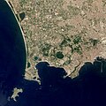
Naples - Campi Flegrei caldera cluster.jpg 2,728 × 2,727; 1.83 MB
-
Neumayer Glacier 2005.jpg 2,472 × 2,472; 2.2 MB
-
Neumayer Glacier 2009.jpg 2,472 × 2,472; 2.3 MB
-
New Fissure Eyjafjallajökull Volcano, Iceland 2010-04-01 lrg.jpg 4,669 × 4,669; 3.59 MB

