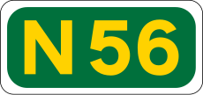
Category:N56 road (Ireland)
Jump to navigation
Jump to search
road in Ireland | |||||
| Upload media | |||||
| Instance of | |||||
|---|---|---|---|---|---|
| Location | County Donegal, Ulster, Ireland | ||||
| Length |
| ||||
| |||||
Media in category "N56 road (Ireland)"
The following 49 files are in this category, out of 49 total.
-
Ardara - Road to Gort na Mona BandB - geograph.org.uk - 1351965.jpg 640 × 427; 83 KB
-
Ardara - town centre - geograph.org.uk - 1154685.jpg 640 × 426; 203 KB
-
Ardara Bridge Bar 2014 09 05.jpg 3,245 × 2,221; 3.84 MB
-
Ardara Front Street 2014 09 05.jpg 3,362 × 2,074; 4.18 MB
-
Ardara John Doherty Sculpture at the Diamond 2014 09 05.jpg 3,408 × 2,115; 4.64 MB
-
Ardara Owentocker River Bridge 2014 09 05.jpg 3,431 × 2,311; 4.68 MB
-
Bend on the N56 west of Mount Charles - geograph.org.uk - 3217447.jpg 1,024 × 547; 86 KB
-
Conaghan's crossing cottage, Inver - geograph.org.uk - 1083241.jpg 640 × 427; 96 KB
-
Donegal Bypass at Mullans - geograph.org.uk - 1719957.jpg 3,648 × 2,736; 2.29 MB
-
Dunfanaghy - Main Street (N56) - geograph.org.uk - 1182764.jpg 640 × 426; 163 KB
-
Dunfanaghy, co Donegal - geograph.org.uk - 86845.jpg 640 × 480; 77 KB
-
Falcarragh - The Corner Bar off N56 - geograph.org.uk - 1332761.jpg 640 × 427; 80 KB
-
Front Street (N56) - Ardara - geograph.org.uk - 1154683.jpg 639 × 426; 188 KB
-
Garage and shop, Gortahork - geograph.org.uk - 1424502.jpg 640 × 414; 245 KB
-
Garage on N56 - geograph.org.uk - 1048285.jpg 640 × 427; 57 KB
-
Junction of N56 and R252 - geograph.org.uk - 1031803.jpg 640 × 480; 88 KB
-
Kilmacrenan Village - geograph.org.uk - 910550.jpg 640 × 480; 48 KB
-
Kilmacrenan, Co. Donegal - geograph.org.uk - 1386207.jpg 640 × 480; 77 KB
-
Manicured frontage along the N56 road - geograph.org.uk - 921418.jpg 640 × 330; 68 KB
-
Milltown Bar on N56 - geograph.org.uk - 1132674.jpg 640 × 360; 47 KB
-
N56 Donegal Bypass at Drumlonagher - geograph.org.uk - 1720046.jpg 800 × 600; 75 KB
-
N56 road looking north east - geograph.org.uk - 1030307.jpg 640 × 480; 73 KB
-
N56, Croghyboyle - geograph.org.uk - 2424226.jpg 640 × 480; 49 KB
-
N56, Meenacung - geograph.org.uk - 2462741.jpg 640 × 480; 55 KB
-
New bridge over the River Eske - geograph.org.uk - 798999.jpg 640 × 480; 87 KB
-
Old Eske road - geograph.org.uk - 1083251.jpg 640 × 375; 77 KB
-
Port and Drumfin Roads cross the N56 - geograph.org.uk - 924627.jpg 640 × 480; 106 KB
-
River Eske beneath N56, Donegal Town - geograph.org.uk - 1118767.jpg 640 × 427; 70 KB
-
Road by Port na Blagh - geograph.org.uk - 773400.jpg 640 × 458; 359 KB
-
Road near Kill - geograph.org.uk - 773434.jpg 640 × 480; 383 KB
-
Road near Woodhill (2) - geograph.org.uk - 773424.jpg 640 × 360; 289 KB
-
Road near Woodhill - geograph.org.uk - 773422.jpg 640 × 487; 455 KB
-
The N56 through Dunfanaghy - geograph.org.uk - 1051347.jpg 640 × 480; 72 KB
-
Turning to Kerrytown - geograph.org.uk - 1437015.jpg 640 × 426; 109 KB
-
Bridge on N56 - geograph.org.uk - 1437026.jpg 640 × 426; 111 KB
-
Gortahork - geograph.org.uk - 1424497.jpg 640 × 411; 255 KB


