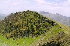
Category:Mynydd Drws-y-coed
Jump to navigation
Jump to search
mountain (695m) in Gwynedd | |||||
| Upload media | |||||
| Instance of | |||||
|---|---|---|---|---|---|
| Part of | |||||
| Location | Gwynedd, Wales | ||||
| Mountain range | |||||
| Topographic prominence |
| ||||
| Elevation above sea level |
| ||||
| Parent peak | |||||
 | |||||
Media in category "Mynydd Drws-y-coed"
The following 23 files are in this category, out of 23 total.
-
Clogwyn Marchnad - geograph.org.uk - 1512537.jpg 640 × 480; 102 KB
-
Drwsycoed.jpg 500 × 331; 126 KB
-
Looking towards Moel Hebog - geograph.org.uk - 1512530.jpg 640 × 480; 67 KB
-
Nantlle Ridge - geograph.org.uk - 51710.jpg 640 × 427; 60 KB
-
Nantlle Ridge from Mynydd Mawr Summit - geograph.org.uk - 823152.jpg 640 × 427; 45 KB
-
Start of Nantlle Ridge - geograph.org.uk - 1348333.jpg 640 × 426; 28 KB
-
The Nantlle Ridge, as seen from Y Fron, with fields in the foreground.jpg 4,608 × 2,128; 2.56 MB
-
Towards Y Garn - geograph.org.uk - 1348266.jpg 640 × 426; 40 KB
-
From the Rhyd-Ddu Path - geograph.org.uk - 546229.jpg 640 × 477; 80 KB
-
Snowdon from Mynydd Drws-y-coed - geograph.org.uk - 219241.jpg 640 × 480; 46 KB
-
The Old Tollgate - geograph.org.uk - 252137.jpg 640 × 480; 122 KB


