Category:Municipality limit maps of communes in Saône-et-Loire
Jump to navigation
Jump to search
Departments of Metropolitan France: Ain [01] · Aisne [02] · Allier [03] · Hautes-Alpes [05] · Ardèche [07] · Ariège [09] · Aude [11] · Cantal [15] · Charente [16] · Charente-Maritime [17] · Corrèze [19] · Corse-du-Sud [2A]† · Haute-Corse [2B]† · Côte-d’Or [21] · Creuse [23] · Dordogne [24] · Doubs [25] · Drôme [26] · Eure-et-Loir [28] · Finistère [29] · Haute-Garonne [31] · Gers [32] · Gironde [33] · Hérault [34] · Ille-et-Vilaine [35] · Isère [38] · Landes [40] · Loir-et-Cher [41] · Loire [42] · Haute-Loire [43] · Lot [46] · Lot-et-Garonne [47] · Manche [50] · Marne [51] · Haute-Marne [52] · Mayenne [53] · Meurthe-et-Moselle [54] · Morbihan [56] · Moselle [57] · Nièvre [58] · Nord [59] · Oise [60] · Pas-de-Calais [62] · Puy-de-Dôme [63] · Pyrénées-Atlantiques [64] · Hautes-Pyrénées [65] · Bas-Rhin [67] · Haut-Rhin [68] · departmental district of the Rhône [69] · Rhône [69D]‡ · Metropolis of Lyon [69M]‡ · Saône-et-Loire [71] · Savoie [73] · Haute-Savoie [74] · Deux-Sèvres [79] · Somme [80] · Tarn [81] · Vienne [86] · Haute-Vienne [87] · Vosges [88] · Yonne [89] · Territoire de Belfort [90]
| NO WIKIDATA ID FOUND! Search for Municipality limit maps of communes in Saône-et-Loire on Wikidata | |
| Upload media |
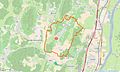
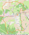
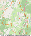
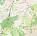
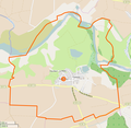
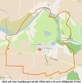
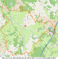
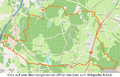
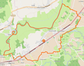
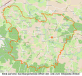
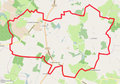
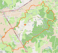
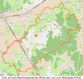
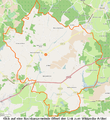
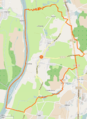
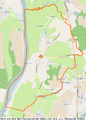
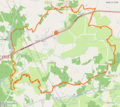
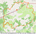
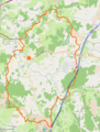
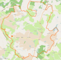
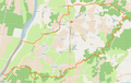
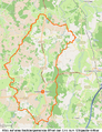
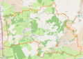
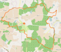
English: Limits of communes in the department of Saône-et-Loire.
Français : Limites communales dans le département de la Saône-et-Loire.

Subcategories
This category has only the following subcategory.
Media in category "Municipality limit maps of communes in Saône-et-Loire"
The following 147 files are in this category, out of 147 total.
-
 Authumes Gemeindeschema Plan.svg 290 × 355; 383 KB
-
 Baudrières Gemeindeschema.png 1,110 × 1,283; 849 KB
-
 Bussières Gemeindeschema OSM.png 955 × 804; 481 KB
-
 Clessé (Saône-et-Loire) Limite communale.jpg 957 × 571; 174 KB
-
 Clux-Villeneuve.png 1,102 × 778; 257 KB
-
 Condal Gemeindeschema OSM.xcf 933 × 818; 809 KB
-
 Condal Gemeindeschema.png 933 × 850; 411 KB
-
 Cuiseaux Gemeindeschema OSM.xcf 1,453 × 842; 1.27 MB
-
 Cuiseaux Gemeindeschema.png 1,453 × 880; 690 KB
-
 Cuisery Gemeindeschema OSM.xcf 653 × 777; 506 KB
-
 Cuisery Gemeindeschema.png 653 × 795; 244 KB
-
 Dampierre-en-Bresse Gemeindeschema OSM.xcf 799 × 659; 398 KB
-
 Dampierre-en-Bresse Gemeindeschema.png 799 × 685; 114 KB
-
 Devrouze Gemeindeschema OSM.xcf 822 × 885; 611 KB
-
 Devrouze Gemeindeschema.png 822 × 910; 304 KB
-
 Diconne Gemeindeschema OSM.xcf 1,068 × 711; 553 KB
-
 Diconne Gemeindeschema.png 1,068 × 740; 274 KB
-
 Dommartin-lès-Cuiseaux Gemeindeschema OSM.xcf 876 × 1,025; 932 KB
-
 Dommartin-lès-Cuiseaux Gemeindeschema.png 876 × 1,025; 452 KB
-
 Flacey-en-Bresse Gemeindeschema OSM.xcf 855 × 821; 664 KB
-
 Flacey-en-Bresse Gemeindeschema.png 855 × 850; 341 KB
-
 Frangy-en-Bresse Gemeindeschema OSM.xcf 1,420 × 929; 1.13 MB
-
 Frangy-en-Bresse Gemeindeschema.png 1,420 × 960; 622 KB
-
 Fretterans Gemeindeschema OSM.xcf 692 × 674; 281 KB
-
 Fretterans Gemeindeschema.png 692 × 699; 140 KB
-
 Frontenard Gemeindeschema OSM.xcf 828 × 884; 606 KB
-
 Frontenard Gemeindeschema.png 828 × 915; 294 KB
-
 Frontenaud Gemeindeschema OSM.xcf 893 × 872; 823 KB
-
 Frontenaud Gemeindeschema.png 893 × 900; 431 KB
-
 Huilly-sur-Seille Gemeindeschema OSM.xcf 651 × 855; 446 KB
-
 Huilly-sur-Seille Gemeindeschema.png 651 × 873; 211 KB
-
 Joudes Gemeindeschema OSM.xcf 934 × 569; 586 KB
-
 Joudes Gemeindeschema.png 934 × 600; 302 KB
-
 Jouvençon Gemeindeschema OSM.xcf 736 × 576; 434 KB
-
 Jouvençon Gemeindeschema.png 736 × 600; 225 KB
-
 Juif Gemeindeschema OSM.xcf 851 × 696; 515 KB
-
 Juif Gemeindeschema.png 851 × 730; 264 KB
-
 L'Abergement-de-Cuisery Gemeindeschema OSM.xcf 674 × 774; 480 KB
-
 L'Abergement-de-Cuisery Gemeindeschema.png 674 × 796; 226 KB
-
 L'Abergement-Sainte-Colombe Gemeindeschema.png 661 × 480; 226 KB
-
 La Chapelle-Naude Gemeindeschema.png 931 × 910; 595 KB
-
 La Chapelle-Thècle Gemeindeschema.png 962 × 900; 576 KB
-
 La Chaux Gemeindeschema OSM.xcf 867 × 605; 438 KB
-
 La Chaux Gemeindeschema.png 852 × 690; 205 KB
-
 La Frette Gemeindeschema OSM.xcf 901 × 614; 402 KB
-
 La Frette Gemeindeschema.png 901 × 650; 188 KB
-
 La Genête Gemeindeschema OSM.xcf 874 × 802; 767 KB
-
 La Genête Gemeindeschema.png 874 × 830; 408 KB
-
 La Racineuse Gemeindeschema OSM.xcf 616 × 583; 263 KB
-
 La Racineuse Gemeindeschema.png 616 × 610; 134 KB
-
 Lays-sur-le-Doubs Gemeindeschema OSM.xcf 631 × 879; 327 KB
-
 Lays-sur-le-Doubs Gemeindeschema.png 631 × 900; 170 KB
-
 Le Fay Gemeindeschema OSM.xcf 964 × 1,022; 842 KB
-
 Le Fay Gemeindeschema.png 964 × 1,050; 434 KB
-
 Le Miroir Gemeindeschema OSM.xcf 927 × 1,019; 993 KB
-
 Le Miroir Gemeindeschema.png 927 × 1,050; 507 KB
-
 Le Planois Gemeindeschema OSM.xcf 629 × 853; 431 KB
-
 Le Planois Gemeindeschema.png 629 × 880; 212 KB
-
 Le Tartre Gemeindeschema OSM.xcf 822 × 814; 367 KB
-
 Le Tartre Gemeindeschema.png 822 × 840; 182 KB
-
 Lessard-en-Bresse Gemeindeschema.png 1,150 × 823; 2.71 MB
-
 Loisy Gemeindeschema OSM.xcf 964 × 955; 780 KB
-
 Loisy Gemeindeschema.png 964 × 990; 369 KB
-
 Longepierre Gemeindeschema.png 1,050 × 783; 250 KB
-
 Louhans Gemeindeschema OSM.xcf 1,061 × 885; 1.23 MB
-
 Louhans Gemeindeschema.png 1,061 × 920; 676 KB
-
 Mervans Gemeindeschema OSM.xcf 765 × 716; 663 KB
-
 Mervans Gemeindeschema.png 765 × 750; 356 KB
-
 Montagny-près-Louhans Gemeindeschema OSM.xcf 709 × 691; 488 KB
-
 Montagny-près-Louhans Gemeindeschema.png 709 × 720; 255 KB
-
 Montcony Gemeindeschema OSM.xcf 741 × 706; 522 KB
-
 Montcony Gemeindeschema.png 741 × 735; 276 KB
-
 Montjay Gemeindeschema OSM.xcf 890 × 743; 493 KB
-
 Montjay Gemeindeschema.png 890 × 770; 257 KB
-
 Montpont-en-Bresse Gemeindeschema OSM.xcf 679 × 665; 753 KB
-
 Montpont-en-Bresse Gemeindeschema.png 679 × 685; 419 KB
-
 Montret Gemeindeschema OSM.xcf 934 × 1,016; 881 KB
-
 Montret Gemeindeschema.png 934 × 1,040; 463 KB
-
 Mouthier-en-Bresse Gemeindeschema OSM.xcf 812 × 638; 586 KB
-
 Mouthier-en-Bresse Gemeindeschema.png 812 × 670; 319 KB
-
 Ménetreuil Gemeindeschema OSM.xcf 1,166 × 653; 871 KB
-
 Ménetreuil Gemeindeschema.png 1,166 × 700; 493 KB
-
 Navilly Gemeindeschema.png 761 × 751; 223 KB
-
 Ormes Gemeindeschema OSM.xcf 620 × 851; 480 KB
-
 Ormes Gemeindeschema.png 620 × 866; 220 KB
-
 Ouroux-sur-Saône Gemeindeschema.png 1,054 × 1,180; 841 KB
-
 Pierre-de-Bresse Gemeindeschema OSM.xcf 1,260 × 1,013; 935 KB
-
 Pierre-de-Bresse Gemeindeschema.png 1,260 × 1,043; 506 KB
-
 Pourlans Gemeindeschema OSM (1).png 542 × 805; 319 KB
-
 Pourlans Gemeindeschema OSM.xcf 542 × 785; 560 KB
-
 Rancy Gemeindeschema OSM.xcf 497 × 631; 335 KB
-
 Rancy Gemeindeschema.png 497 × 648; 173 KB
-
 Ratenelle Gemeindeschema.png 1,250 × 1,270; 742 KB
-
 Ratenelle Gemeindeschema.svg 400 × 406; 1.03 MB
-
 Ratte Gemeindeschema OSM.xcf 696 × 622; 466 KB
-
 Ratte Gemeindeschema.png 696 × 650; 241 KB
-
 Romenay Gemeindeschema Plan.svg 705 × 381; 2.56 MB
-
 Romenay Gemeindeschema.png 2,202 × 1,258; 1.7 MB
-
 Sagy Gemeindeschema OSM.xcf 598 × 791; 689 KB
-
 Sagy Gemeindeschema.png 598 × 820; 370 KB
-
 Saillenard Gemeindeschema OSM.xcf 966 × 867; 767 KB
-
 Saillenard Gemeindeschema.png 966 × 900; 413 KB
-
 Saint-André-en-Bresse Gemeindeschema OSM.xcf 517 × 605; 235 KB
-
 Saint-André-en-Bresse Gemeindeschema.png 517 × 630; 110 KB
-
 Saint-Bonnet-en-Bresse Gemeindeschema OSM.xcf 953 × 739; 549 KB
-
 Saint-Bonnet-en-Bresse Gemeindeschema.png 953 × 770; 272 KB
-
 Saint-Christophe-en-Bresse Gemeindeschema.png 1,359 × 1,291; 873 KB
-
 Saint-Germain-du-Bois Gemeindeschema OSM.xcf 579 × 616; 467 KB
-
 Saint-Germain-du-Bois Gemeindeschema.png 579 × 640; 249 KB
-
 Saint-Germain-du-Plain Gemeindeschema.png 1,385 × 1,294; 1.05 MB
-
 Saint-Martin-du-Mont Gemeindeschema OSM.xcf 677 × 555; 412 KB
-
 Saint-Martin-du-Mont Gemeindeschema.png 677 × 580; 216 KB
-
 Saint-Usuge Gemeindeschema OSM.xcf 714 × 657; 713 KB
-
 Saint-Usuge Gemeindeschema.png 714 × 685; 384 KB
-
 Saint-Vincent-en-Bresse Gemeindeschema OSM.xcf 896 × 789; 550 KB
-
 Saint-Vincent-en-Bresse Gemeindeschema.png 896 × 815; 271 KB
-
 Saint-Étienne-en-Bresse Gemeindeschema OSM.xcf 1,047 × 851; 676 KB
-
 Saint-Étienne-en-Bresse Gemeindeschema.png 1,047 × 880; 349 KB
-
 Sainte-Croix Gemeindeschema OSM.xcf 448 × 614; 421 KB
-
 Sainte-Croix Gemeindeschema.png 448 × 626; 232 KB
-
 Savigny-en-Revermont Gemeindeschema OSM.xcf 1,233 × 888; 960 KB
-
 Savigny-en-Revermont Gemeindeschema.png 1,233 × 915; 520 KB
-
 Savigny-sur-Seille Gemeindeschema OSM.xcf 923 × 857; 621 KB
-
 Savigny-sur-Seille Gemeindeschema.png 923 × 890; 318 KB
-
 Sens-sur-Seille Gemeindeschema OSM.xcf 953 × 774; 671 KB
-
 Sens-sur-Seille Gemeindeschema.png 953 × 800; 343 KB
-
 Serley Gemeindeschema OSM.xcf 986 × 959; 726 KB
-
 Serley Gemeindeschema.png 1,089 × 1,035; 456 KB
-
 Serrigny-en-Bresse Gemeindeschema OSM.xcf 714 × 862; 382 KB
-
 Serrigny-en-Bresse Gemeindeschema.png 714 × 890; 188 KB
-
 Simandre Gemeindeschema OSM.xcf 1,403 × 886; 976 KB
-
 Simandre Gemeindeschema.png 1,403 × 930; 466 KB
-
 Simard Gemeindeschema OSM.xcf 990 × 1,019; 836 KB
-
 Simard Gemeindeschema.png 990 × 1,050; 449 KB
-
 Sornay Gemeindeschema OSM.xcf 1,088 × 714; 856 KB
-
 Sornay Gemeindeschema.png 1,088 × 750; 465 KB
-
 Thurey Gemeindeschema OSM.xcf 1,159 × 873; 761 KB
-
 Thurey Gemeindeschema.png 1,159 × 910; 385 KB
-
 Torpes Gemeindeschema OSM.xcf 903 × 884; 612 KB
-
 Torpes Gemeindeschema.png 903 × 910; 316 KB
-
 Tronchy Gemeindeschema.png 1,214 × 1,134; 770 KB
-
 Varennes-Saint-Sauveur Gemeindeschema OSM.xcf 668 × 843; 816 KB
-
 Varennes-Saint-Sauveur Gemeindeschema.png 668 × 867; 428 KB
-
 Vincelles Gemeindeschema OSM.xcf 1,196 × 846; 843 KB
-
 Vincelles Gemeindeschema.png 1,196 × 875; 432 KB
-
 Vérissey Gemeindeschema OSM.xcf 738 × 635; 350 KB
-
 Vérissey Gemeindeschema.png 738 × 660; 168 KB


_Limite_communale.jpg)


.png)


