Category:Mungrisdale
Jump to navigation
Jump to search
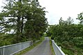
English: Mungrisdale is a small village in the north east of the English Lake District.
village and civil parish in Cumbria, United Kingdom  | |||||
| Upload media | |||||
| Instance of | |||||
|---|---|---|---|---|---|
| Location | Eden, Cumbria, North West England, England | ||||
| Population |
| ||||
| Said to be the same as | Mungrisdale (Wikimedia duplicated page, civil parish) | ||||
 | |||||
Subcategories
This category has the following 11 subcategories, out of 11 total.
B
- Bannerdale Crags (58 F)
- Berrier (31 F)
- Bowscale (16 F)
C
- Carrock Fell (85 F)
H
- Hutton Moor End (14 F)
- Hutton Roof, Eden (5 F)
K
M
- Mungrisdale Common (31 F)
S
- Souther Fell (36 F)
Media in category "Mungrisdale"
The following 200 files are in this category, out of 702 total.
(previous page) (next page)-

-
 A fine pair - geograph.org.uk - 6240987.jpg 1,600 × 778; 494 KB
-
 A seven barred gate. - geograph.org.uk - 97786.jpg 640 × 454; 62 KB
-
 A66 by the Mungrisdale turning - geograph.org.uk - 3093682.jpg 800 × 568; 70 KB
-
 A66 near Lisco - geograph.org.uk - 3376381.jpg 640 × 480; 474 KB
-
 A66 near Lowside - geograph.org.uk - 3376397.jpg 640 × 480; 516 KB
-
 A66 to Mungrisdale road - geograph.org.uk - 6569982.jpg 1,024 × 683; 481 KB
-
 Abandoned house at Farend - geograph.org.uk - 5353790.jpg 1,499 × 879; 1.54 MB
-
 Abandoned Mines - geograph.org.uk - 3479708.jpg 640 × 427; 471 KB
-
 Above Blackhazel Beck - geograph.org.uk - 5421613.jpg 1,920 × 1,280; 540 KB
-
 Above Mungrisdale - geograph.org.uk - 2498467.jpg 2,560 × 1,920; 2.1 MB
-
 Above The Fold - geograph.org.uk - 2929613.jpg 2,560 × 1,920; 2.07 MB
-
 Above The Fold - geograph.org.uk - 4577194.jpg 4,608 × 3,456; 3.59 MB
-
 Above The Glenderamackin - geograph.org.uk - 2929597.jpg 2,560 × 1,920; 731 KB
-
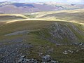
 Across Miller Moss to the 609m top - geograph.org.uk - 2525208.jpg 640 × 480; 52 KB
-
 Adit and Waterfall - geograph.org.uk - 3479775.jpg 640 × 427; 502 KB
-
 Along the road near High Murrah - geograph.org.uk - 6569469.jpg 1,024 × 683; 492 KB
-
 An easy crossing of the River Caldew - geograph.org.uk - 1961948.jpg 640 × 480; 99 KB
-
 Approaching Knott from the east - geograph.org.uk - 5779418.jpg 2,592 × 1,944; 1.71 MB
-
 Approaching Lingy Hut - geograph.org.uk - 3285478.jpg 2,560 × 1,920; 2.07 MB
-
 Approaching Little Lingy Hill - geograph.org.uk - 4919966.jpg 4,608 × 3,072; 3.18 MB
-
 Approaching Mungrisdale from the north - geograph.org.uk - 1749294.jpg 800 × 530; 149 KB
-
 Approaching the A66 junction - geograph.org.uk - 6569968.jpg 1,024 × 683; 423 KB
-
 Approaching the hut on Great Lingy Hill - geograph.org.uk - 4234298.jpg 3,776 × 2,520; 3.91 MB
-
 Apronful of Stones - geograph.org.uk - 2331896.jpg 4,320 × 3,240; 2.87 MB
-
 Arm o' Grain - geograph.org.uk - 2000293.jpg 427 × 640; 319 KB
-
 Arm o' Grain - geograph.org.uk - 2389257.jpg 2,560 × 1,920; 1.31 MB
-
 Arm o' Grain - geograph.org.uk - 898583.jpg 480 × 640; 115 KB
-
 Ascending Brandy Gill - geograph.org.uk - 3479754.jpg 427 × 640; 431 KB
-
 Ascending Coomb Height - geograph.org.uk - 3895927.jpg 2,560 × 1,920; 2.08 MB
-
 Ascending Coomb Height - geograph.org.uk - 3895929.jpg 2,560 × 1,920; 2.1 MB
-
 Atkinson Pike and Foule Crag - geograph.org.uk - 3676676.jpg 4,608 × 3,456; 6.21 MB
-
 Autumn colours on the lane to Newsham - geograph.org.uk - 5164067.jpg 640 × 480; 348 KB
-
 Back road from Scales to Mungrisdale - geograph.org.uk - 3857818.jpg 480 × 640; 112 KB
-
 Back Road to Mungrisdale - geograph.org.uk - 1177040.jpg 640 × 427; 80 KB
-
 Bales under the trees - geograph.org.uk - 5164064.jpg 640 × 480; 316 KB
-
 Bank stabilisation, River Glenderamackin - geograph.org.uk - 5973251.jpg 640 × 427; 125 KB
-
 Bannerdale Beck - geograph.org.uk - 2036542.jpg 640 × 480; 114 KB
-
 Bannerdale Beck - geograph.org.uk - 2757817.jpg 2,560 × 1,920; 844 KB
-
 Bannerdale Valley - geograph.org.uk - 2927849.jpg 800 × 600; 315 KB
-
 Barn at Undercrag - geograph.org.uk - 559001.jpg 640 × 480; 168 KB
-
 Barn north-east of Southerfell Cottage.jpg 1,800 × 1,350; 650 KB
-
 Beck near Moss Dyke Farm - geograph.org.uk - 1032479.jpg 640 × 521; 135 KB
-
 Bells Farm, Berrier - geograph.org.uk - 2595428.jpg 2,592 × 1,944; 1.49 MB
-
 Bend on the road - geograph.org.uk - 6567046.jpg 1,024 × 683; 438 KB
-
 Bield above Poddy Gill - geograph.org.uk - 3285453.jpg 2,560 × 1,920; 1.08 MB
-
 Bield above the Caldew - geograph.org.uk - 3689026.jpg 2,560 × 1,920; 2.14 MB
-
 Blackhazel Beck - geograph.org.uk - 1027404.jpg 640 × 480; 97 KB
-
 Blackhazel Beck - geograph.org.uk - 1520675.jpg 640 × 268; 46 KB
-
 Blackhazel Beck - geograph.org.uk - 1961973.jpg 640 × 480; 76 KB
-
 Blackhazel Beck - geograph.org.uk - 2758623.jpg 2,560 × 1,920; 517 KB
-
 Blackhazel Beck - geograph.org.uk - 5421601.jpg 1,762 × 1,175; 503 KB
-
 Blackhazel Beck - geograph.org.uk - 5421611.jpg 1,920 × 1,280; 547 KB
-
 Blake Hills Farm - geograph.org.uk - 2634499.jpg 3,872 × 2,592; 4.56 MB
-
 Blakebeck - geograph.org.uk - 97158.jpg 640 × 427; 105 KB
-
 Blencathra in the Clouds - geograph.org.uk - 1175538.jpg 640 × 427; 46 KB
-
 Boulder problem, foot of Carrock Fell - geograph.org.uk - 1046755.jpg 640 × 480; 104 KB
-
 Boulder under Carrock Fell - geograph.org.uk - 6567069.jpg 683 × 1,024; 455 KB
-
 Boulders in the River Caldew - geograph.org.uk - 2627081.jpg 1,500 × 1,125; 1.44 MB
-
 Boulders on moorland north of Mosedale - geograph.org.uk - 2622572.jpg 1,500 × 952; 1.28 MB
-
 Boundary Stone 2, Low Mill.jpg 1,800 × 1,350; 778 KB
-
 Boundary Stone near Carrhead footbridge.jpg 480 × 640; 364 KB
-
 Boundary Stone, Low Mill.jpg 1,350 × 1,800; 808 KB
-
 Bowscale Moss - geograph.org.uk - 2631844.jpg 1,500 × 941; 1.09 MB
-
 Bowscale Moss - geograph.org.uk - 3748463.jpg 2,592 × 1,944; 1.14 MB
-
 Bowscale Moss - geograph.org.uk - 5163770.jpg 640 × 480; 292 KB
-
 Bowscale Moss - geograph.org.uk - 5291317.jpg 1,600 × 1,067; 331 KB
-
 Bowscale Moss - geograph.org.uk - 5507252.jpg 640 × 427; 45 KB
-
 Bracken-covered hillside near Mungrisdale - geograph.org.uk - 2629135.jpg 3,872 × 2,592; 4.03 MB
-
 Bracken-covered slopes above Mungrisdale - geograph.org.uk - 2634467.jpg 3,872 × 2,592; 5.28 MB
-
 Brandy Gill - geograph.org.uk - 3479724.jpg 640 × 427; 452 KB
-
 Brandy Gill - geograph.org.uk - 3479745.jpg 427 × 640; 472 KB
-
 Brandy Gill - geograph.org.uk - 3479759.jpg 640 × 427; 373 KB
-
 Brandy Gill - geograph.org.uk - 3479765.jpg 640 × 427; 417 KB
-
 Brandy Gill - geograph.org.uk - 4345422.jpg 427 × 640; 119 KB
-
 Brandy Gill - geograph.org.uk - 5177653.jpg 640 × 427; 583 KB
-
 Bridge near Wallthwaite - geograph.org.uk - 2353132.jpg 4,224 × 3,168; 2.94 MB
-
 Bridge over Bullfell Beck - geograph.org.uk - 2036554.jpg 640 × 479; 111 KB
-
 Bridge over Grainsgill Beck - geograph.org.uk - 4234243.jpg 3,776 × 2,520; 4.33 MB
-
 Bridge over Grainsgill Beck - geograph.org.uk - 5675578.jpg 2,592 × 1,944; 2.84 MB
-
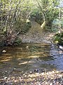
 Bridge over River Glendermackin - geograph.org.uk - 6549507.jpg 683 × 1,024; 689 KB
-

-
 Bridge over the Glenderamackin - geograph.org.uk - 5976760.jpg 2,000 × 1,500; 3.77 MB
-

-
 Bridge over the River Caldew - geograph.org.uk - 6569445.jpg 1,024 × 683; 597 KB
-
 Bridge over the River Glenderamackin - geograph.org.uk - 3857776.jpg 640 × 480; 52 KB
-
 Bridge over the River Glenderamackin - geograph.org.uk - 3857779.jpg 640 × 480; 86 KB
-
 Bridleway to Bowscale Tarn - geograph.org.uk - 3674981.jpg 4,608 × 3,456; 5.36 MB
-
 Bridleway to Bowscale Tarn - geograph.org.uk - 3676841.jpg 4,608 × 3,456; 5.37 MB
-
 Bridleway to Bowscale Tarn - geograph.org.uk - 5291311.jpg 1,600 × 1,067; 459 KB
-
 Brunt Knott - geograph.org.uk - 1028756.jpg 640 × 480; 94 KB
-
 Buck Kirk - geograph.org.uk - 2695579.jpg 2,592 × 3,888; 1.8 MB
-
 By Blackhazel Beck - geograph.org.uk - 1961963.jpg 640 × 480; 109 KB
-
 By Further Gill Sike - geograph.org.uk - 2888372.jpg 2,560 × 1,920; 2.08 MB
-
 By The Caldew - geograph.org.uk - 2027502.jpg 2,560 × 1,920; 1.7 MB
-
 Cairn on Coomb Height - geograph.org.uk - 3895934.jpg 2,560 × 1,920; 2.12 MB
-
 Cairn on Great Lingy Hill - geograph.org.uk - 6667055.jpg 5,472 × 3,648; 7.4 MB
-
 Caldew valley at Swineside - geograph.org.uk - 5177704.jpg 640 × 427; 407 KB
-
 Car park at Eycott Hill - geograph.org.uk - 6569503.jpg 1,024 × 683; 405 KB
-
 Chapel House, Mungrisdale.jpg 4,000 × 3,000; 4.89 MB
-
 Chapel Side - geograph.org.uk - 2695301.jpg 3,888 × 2,592; 2.03 MB
-
 Climbing Grainsgill Beck - geograph.org.uk - 2000291.jpg 427 × 640; 264 KB
-

-

-
 Cloven Stone - geograph.org.uk - 4863567.jpg 640 × 480; 131 KB
-
 Col at head of The Glendermackin Valley - geograph.org.uk - 4039879.jpg 640 × 426; 406 KB
-
 Colourful Hagg - geograph.org.uk - 3245229.jpg 1,847 × 1,526; 1 MB
-
 Coomb Height - geograph.org.uk - 5779409.jpg 2,592 × 1,944; 1.53 MB
-
 Cow Snout Wood - geograph.org.uk - 2595410.jpg 2,592 × 1,944; 1.82 MB
-
 Cow Snout Wood - geograph.org.uk - 4320521.jpg 1,500 × 1,086; 1.49 MB
-
 Cows near Mungrisdale - geograph.org.uk - 2629119.jpg 3,872 × 2,592; 3.8 MB
-
 Crag Near Waterfall, River Glenderamackin - geograph.org.uk - 97707.jpg 640 × 480; 101 KB
-
 Crags at the top of the east ridge. - geograph.org.uk - 5788734.jpg 640 × 427; 65 KB
-
 Croft House - geograph.org.uk - 6549505.jpg 1,024 × 683; 453 KB
-
 Crook-a-Fleet.jpg 1,800 × 1,350; 451 KB
-
 Crossing of the Bannerdale Beck - geograph.org.uk - 3857797.jpg 640 × 480; 105 KB
-
 Crossing the River Caldew - geograph.org.uk - 6569444.jpg 1,024 × 683; 493 KB
-
 Cumbria Way near Swineside - geograph.org.uk - 1961915.jpg 640 × 480; 52 KB
-
 Cumbrian landscape - geograph.org.uk - 5164092.jpg 640 × 480; 300 KB
-
 Cycle lane beside the A66 - geograph.org.uk - 6569970.jpg 1,024 × 683; 456 KB
-
 Descending Blue Screes, Atkinson Pike - geograph.org.uk - 2103008.jpg 960 × 720; 307 KB
-
 Descent From Mousewaite Col - geograph.org.uk - 1175605.jpg 640 × 427; 67 KB
-
 Driveway to Low Murrah - geograph.org.uk - 5164096.jpg 640 × 480; 323 KB
-
 Dry stone walls - geograph.org.uk - 4970120.jpg 1,600 × 1,200; 350 KB
-
 Drycomb Beck - geograph.org.uk - 1749233.jpg 800 × 530; 236 KB
-
 Drycomb Beck - geograph.org.uk - 4969710.jpg 900 × 1,200; 241 KB
-
 Entering Mungrisdale - geograph.org.uk - 2634484.jpg 3,872 × 2,592; 4.89 MB
-
 Eycott Farm - geograph.org.uk - 5164120.jpg 640 × 480; 243 KB
-
 Eycott Farm - geograph.org.uk - 6569525.jpg 1,024 × 683; 450 KB
-
 Eycott Hill - geograph.org.uk - 1032385.jpg 640 × 480; 78 KB
-
 Eycott Hill Nature Reserve - geograph.org.uk - 5164140.jpg 640 × 480; 313 KB
-
 Eycott Hill Nature Reserve - geograph.org.uk - 5164146.jpg 640 × 480; 266 KB
-
 Eycott Hill Nature Reserve - geograph.org.uk - 5164151.jpg 640 × 480; 301 KB
-
 Far Howe - geograph.org.uk - 1718587.jpg 640 × 427; 264 KB
-
 Far Southerfell - geograph.org.uk - 2694937.jpg 3,556 × 2,108; 1.61 MB
-
 Farm buildings at Wilton Hill - geograph.org.uk - 3343292.jpg 1,500 × 959; 1.29 MB
-
 Farm track near Nobles Farm - geograph.org.uk - 6569531.jpg 1,024 × 683; 413 KB
-
 Farmland near Mungrisdale - geograph.org.uk - 4866932.jpg 2,592 × 1,944; 1.19 MB
-
 Farmland south of Beckside - geograph.org.uk - 6569986.jpg 1,024 × 683; 474 KB
-
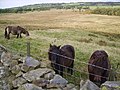 Fell Ponies - geograph.org.uk - 653211.jpg 640 × 480; 106 KB
-
 Fell ponies at Mungrisdale - geograph.org.uk - 5775.jpg 640 × 425; 60 KB
-

-
 Field east of Nobles Farm - geograph.org.uk - 4321245.jpg 1,500 × 1,125; 1.74 MB
-
 Field Head - geograph.org.uk - 2695346.jpg 3,888 × 2,526; 1.91 MB
-
 Field near a track - geograph.org.uk - 6569491.jpg 1,024 × 683; 449 KB
-
 Field near Low Murrah - geograph.org.uk - 6569464.jpg 1,024 × 683; 488 KB
-
 Field near Mungrisdale - geograph.org.uk - 6549509.jpg 1,024 × 683; 409 KB
-
 Field near Wilton Hill - geograph.org.uk - 1177931.jpg 640 × 427; 73 KB
-
 Field sloping down to River Caldew - geograph.org.uk - 2628518.jpg 1,500 × 1,125; 2.05 MB
-
 Field with drainage ditch - geograph.org.uk - 2630199.jpg 1,500 × 1,125; 1.6 MB
-
 Field with rushes on north side of A66 - geograph.org.uk - 3110675.jpg 1,500 × 1,125; 1.41 MB
-
 Fields and woods near Eycott Hill - geograph.org.uk - 2595426.jpg 2,592 × 1,944; 1.7 MB
-
 Fields at Gill Field Farm - geograph.org.uk - 3592173.jpg 2,592 × 1,944; 1.85 MB
-
 Fields at Low Murrah - geograph.org.uk - 2595405.jpg 2,592 × 1,944; 1.26 MB
-
 Fields below Cow Snout Wood - geograph.org.uk - 5164098.jpg 640 × 480; 253 KB
-
 Fields below Southerfell Farm - geograph.org.uk - 3857813.jpg 640 × 480; 68 KB
-
 Fields of Caldew valley separated by fence - geograph.org.uk - 2627056.jpg 1,500 × 1,125; 1.87 MB
-
 Fields south of Bank Farm - geograph.org.uk - 2630183.jpg 1,500 × 946; 1.21 MB
-
 Footbridge and path junction - geograph.org.uk - 3990558.jpg 3,240 × 3,818; 2.16 MB
-
 Footbridge and village hall, Mungrisdale - geograph.org.uk - 6188200.jpg 1,600 × 1,066; 695 KB
-
 Footbridge at Low Beckside - geograph.org.uk - 6188197.jpg 1,600 × 1,066; 556 KB
-
 Footbridge over the Bullfell Beck - geograph.org.uk - 3857809.jpg 640 × 480; 84 KB
-
 Footbridge over the River Glenderamackin - geograph.org.uk - 3857829.jpg 640 × 480; 144 KB
-

-
 Footpath from the old A66 - geograph.org.uk - 4107306.jpg 640 × 480; 90 KB
-
 Footpath near Wilton Hill Farm - geograph.org.uk - 2634493.jpg 3,872 × 2,592; 3.6 MB
-
 Footpath to Mungrisdale - geograph.org.uk - 2214421.jpg 640 × 480; 91 KB
-
 Footpath to Mungrisdale - geograph.org.uk - 2214503.jpg 640 × 480; 88 KB
-
 Footpath to the Mill Inn - geograph.org.uk - 2628934.jpg 3,872 × 2,592; 5.58 MB
-
 Ford at Mungrisdale - geograph.org.uk - 3894857.jpg 3,872 × 2,592; 4.56 MB
-
-
 Ford over Bannerdale Beck - geograph.org.uk - 4039894.jpg 640 × 398; 438 KB
-
 Forest path at Millfield Lodge - geograph.org.uk - 5230937.jpg 640 × 480; 120 KB
-
 Former school and post office, Mungrisdale.jpg 4,000 × 3,000; 4.8 MB
-
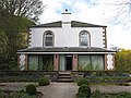 Former school, Mungrisdale.jpg 4,000 × 3,000; 3.36 MB
-
 Foule Crag - geograph.org.uk - 2065750.jpg 1,613 × 2,000; 2.67 MB
-
 Foule Crag - geograph.org.uk - 4813252.jpg 640 × 480; 74 KB
-
 Foxgloves at Mungrisdale - geograph.org.uk - 4576739.jpg 4,608 × 3,456; 3.73 MB
-
 Friends Meeting House Garden - geograph.org.uk - 5177711.jpg 640 × 427; 570 KB
-
 From Round Knott - geograph.org.uk - 2888395.jpg 2,560 × 1,920; 665 KB
-
 Frozen pool on Souther Fell - geograph.org.uk - 3343313.jpg 1,500 × 991; 1.15 MB
-
 Further Gill Syke - geograph.org.uk - 3090005.jpg 1,920 × 2,560; 2.11 MB
-
 Gabbro at Iron Crags - geograph.org.uk - 3479793.jpg 640 × 427; 427 KB
-
 Gabbro rock outcrop - geograph.org.uk - 5005431.jpg 640 × 480; 119 KB
-
 Gate and flooded road on the C2C - geograph.org.uk - 3857791.jpg 640 × 480; 118 KB
-
 Gate Farm, Mungrisdale 01.jpg 4,000 × 3,000; 5 MB
-
 Gate Farm, Mungrisdale 02.jpg 4,000 × 3,000; 4.91 MB
-
 Gated road beside River Caldew - geograph.org.uk - 2630248.jpg 1,500 × 1,125; 1.64 MB
-
 Gated road to Mosedale - geograph.org.uk - 6569457.jpg 1,024 × 683; 426 KB
-
 Gates into farmland - geograph.org.uk - 6569453.jpg 1,024 × 683; 556 KB
-
 Gill Head Caravan and Camping Park - geograph.org.uk - 631057.jpg 640 × 480; 60 KB
-
 Glenderamackin Valley - geograph.org.uk - 1718582.jpg 640 × 427; 255 KB
-
 Glenderamackin Valley - geograph.org.uk - 2927877.jpg 800 × 600; 323 KB
-
 Glenderamackin Waterfall - geograph.org.uk - 4617203.jpg 3,264 × 2,176; 3.18 MB
-
 Glenderamakin col. - geograph.org.uk - 2275640.jpg 640 × 321; 48 KB
-
 Glenderamakin valley. - geograph.org.uk - 2275637.jpg 480 × 640; 68 KB
-
 Glendermackin Beck - geograph.org.uk - 6549503.jpg 1,024 × 683; 528 KB
-
 Gorse flowers in Mosedale - geograph.org.uk - 1264332.jpg 640 × 426; 128 KB
-
 Grainsgill Beck - geograph.org.uk - 1519814.jpg 640 × 359; 106 KB
-
 Grainsgill Beck - geograph.org.uk - 1521761.jpg 640 × 388; 108 KB


