Category:Much Marcle
Jump to navigation
Jump to search
village and civil parish in Herefordshire, United Kingdom  | |||||
| Upload media | |||||
| Instance of | |||||
|---|---|---|---|---|---|
| Location | Herefordshire, West Midlands, England | ||||
| Population |
| ||||
| Said to be the same as | Much Marcle (Wikimedia duplicated page, civil parish) | ||||
| official website | |||||
 | |||||
Cymraeg: Pentref yn Swydd Henffordd, Gorllewin Canolbarth Lloegr, Lloegr ydy Much Marcle. (→Much Marcle)
English: Much Marcle is a village and civil parish in Herefordshire, England, between Ross-on-Wye and Ledbury. The 2011 Census recorded the parish's population as 660. The name Marcle comes from the Anglo-Saxon word for a boundary field, mearc-leah. Much, in this case, means large or great, from the Middle English usage of the word. (→Much Marcle)
עברית: מאץ' מארקל (Much Marcle) הוא כפר קטן וקהילה אזרחית (Civil Parish) באנגליה אשר בממלכה המאוחדת. הכפר נמצא במחוז הרפורדשייר אשר במערב אנגליה, בין הערים רוס-און-וואיי ולדבורי. (→מאץ' מארקל)
Nederlands: Much Marcle is een klein dorpje in het Engelse graafschap Herefordshire. Het ligt tussen de plaatsen Ross-on-Wye en Ledbury. (→Much Marcle)
Polski: Much Marcle – wieś w Anglii, w hrabstwie Herefordshire. Leży 17 km na południowy wschód od miasta Hereford i 173 km na zachód od Londynu. (→Much Marcle)

Subcategories
This category has the following 10 subcategories, out of 10 total.
H
- Homme House (2 F)
M
- Much Marcle Steam Rally (4 F)
O
- Oasts in Much Marcle (3 F)
P
- Phillips House, Much Marcle (3 F)
R
- Ridge Hill Transmitter (10 F)
- Rushall, Herefordshire (10 F)
Media in category "Much Marcle"
The following 200 files are in this category, out of 424 total.
(previous page) (next page)-

-
 A vintage cattle crush - geograph.org.uk - 4278442.jpg 600 × 800; 149 KB
-

-
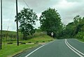
 A449 at Much Marcle village boundary - geograph.org.uk - 3059049.jpg 640 × 480; 63 KB
-
 A449 near Bodenham Farm - geograph.org.uk - 3059043.jpg 640 × 480; 68 KB
-
 A449 near Homme House - geograph.org.uk - 2088078.jpg 640 × 480; 75 KB
-
 A449 passes The Royal Oak - geograph.org.uk - 3059054.jpg 640 × 481; 66 KB
-
 A449 south of Much Marcle - geograph.org.uk - 2088059.jpg 640 × 480; 45 KB
-
 Acer leaf - geograph.org.uk - 3767456.jpg 799 × 800; 338 KB
-
 Acer leaves - geograph.org.uk - 3767457.jpg 800 × 602; 269 KB
-
 Approach to Much Marcle on the A449 - geograph.org.uk - 5041124.jpg 800 × 509; 75 KB
-
 Arable land at Cockyard Farm - geograph.org.uk - 2198533.jpg 1,024 × 768; 406 KB
-
 Armorial Bearings of the AUDLEY family of Much Marcle, Herefordshire.png 1,200 × 1,200; 884 KB
-
 Armorial Bearings of the BALUN family of Much Marcle, Herefordshire.png 1,200 × 1,200; 313 KB
-
 Avenue, Much Marcle - geograph.org.uk - 722201.jpg 640 × 427; 324 KB
-
 Awnell's orchard - geograph.org.uk - 3178395.jpg 640 × 427; 349 KB
-
 Awnells Farm - geograph.org.uk - 2639016.jpg 5,184 × 3,456; 6.11 MB
-
 Awnells in winter - geograph.org.uk - 2044058.jpg 640 × 480; 231 KB
-
 B4024 to Much Marcle - geograph.org.uk - 4442458.jpg 3,696 × 2,448; 2.24 MB
-
 Back to Herefordshire - geograph.org.uk - 2088052.jpg 640 × 480; 53 KB
-
 Barns near Bickerton Court 1 - geograph.org.uk - 1929199.jpg 640 × 480; 228 KB
-
 Barns near Bickerton Court 2 - geograph.org.uk - 1929203.jpg 640 × 480; 226 KB
-
 Bend in the road near Hooper's Oak - geograph.org.uk - 1893404.jpg 1,024 × 768; 390 KB
-
 Black-and -white cottage, Much Marcle - geograph.org.uk - 895990.jpg 640 × 480; 125 KB
-
 Blackberries on Marcle Hill - geograph.org.uk - 2198539.jpg 1,024 × 727; 344 KB
-
 Bodenham Farmhouse (geograph 6792345).jpg 1,024 × 768; 318 KB
-
 Bovine residents at Hellens - geograph.org.uk - 6177454.jpg 1,600 × 898; 529 KB
-
 Bridge over Kempley Brook - geograph.org.uk - 3420279.jpg 1,024 × 768; 127 KB
-
 Bridge over the Preston Brook - geograph.org.uk - 1108262.jpg 640 × 427; 367 KB
-
 Can Can^ - geograph.org.uk - 891672.jpg 640 × 480; 92 KB
-
 Cattle grazing near Awnells - geograph.org.uk - 2523825.jpg 1,024 × 680; 229 KB
-
 Cattle in a barn - geograph.org.uk - 859279.jpg 640 × 480; 97 KB
-
 Centre on the village, Much Marcle - geograph.org.uk - 3774761.jpg 800 × 515; 93 KB
-
 Church Corner B^B, Much Marcle - geograph.org.uk - 3774753.jpg 800 × 541; 170 KB
-
 Cider and Perry Orchard, Awnells Farm, Much Marcle - geograph.org.uk - 2638959.jpg 4,655 × 2,847; 7.46 MB
-
 Cider and Perry Orchard, Awnells Farm, Much Marcle - geograph.org.uk - 2639047.jpg 5,184 × 2,815; 7.62 MB
-
 Commemorative Royal Wedding Plaque - geograph.org.uk - 583256.jpg 640 × 289; 229 KB
-
 Common Toad - geograph.org.uk - 4666095.jpg 2,000 × 2,000; 1.55 MB
-
 Converted farm building in Rushall - geograph.org.uk - 5344322.jpg 1,024 × 768; 200 KB
-
 Cottage in Rushall - geograph.org.uk - 5339675.jpg 1,024 × 768; 243 KB
-
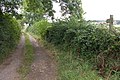 Country Lane and Footpath - geograph.org.uk - 55231.jpg 640 × 426; 163 KB
-

-
 Cow pasture, Awnell's Farm. Much Marcle - geograph.org.uk - 3179201.jpg 640 × 426; 318 KB
-
 Cross-roads near Much Marcle - geograph.org.uk - 3796573.jpg 4,320 × 3,240; 2.99 MB
-
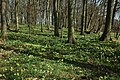 Daffodils on Hallwood - geograph.org.uk - 1211544.jpg 640 × 426; 145 KB
-
 Drinking trough in hillside pasture - geograph.org.uk - 1079693.jpg 640 × 480; 141 KB
-
 Driveway to Hellens - geograph.org.uk - 4666053.jpg 2,000 × 1,552; 1.33 MB
-
 Driveway to Hellens - geograph.org.uk - 6180670.jpg 1,600 × 901; 635 KB
-
 Dual species apple tree, Lyne Down - geograph.org.uk - 1530136.jpg 640 × 427; 313 KB
-
 East flank of Marcle Hill - geograph.org.uk - 1893397.jpg 1,024 × 768; 227 KB
-
 Eastern flank of Marcle Hill - geograph.org.uk - 1893162.jpg 1,024 × 768; 419 KB
-
 Eastern slopes of Ridge Hill - geograph.org.uk - 1079701.jpg 640 × 480; 109 KB
-
 Elderly apple tree, Awnells, Much Marcle - geograph.org.uk - 3178374.jpg 640 × 448; 334 KB
-
 Eleven, Twelve, Ditch and Delve - geograph.org.uk - 1105892.jpg 640 × 427; 336 KB
-
 Entrance to Bodenham Farm - geograph.org.uk - 5041738.jpg 800 × 547; 89 KB
-
 Entrance to Homme house - geograph.org.uk - 1217027.jpg 640 × 424; 80 KB
-
 Farm buildings at Lower Redding End - geograph.org.uk - 94508.jpg 640 × 426; 175 KB
-
 Farm land west of Park Farm - geograph.org.uk - 938386.jpg 640 × 480; 79 KB
-
 Farm track and footpath - geograph.org.uk - 4770195.jpg 1,600 × 901; 736 KB
-
 Farm track and Gwynne's Hill - geograph.org.uk - 1056449.jpg 640 × 480; 89 KB
-
 Farm track to Little Hill Farm - geograph.org.uk - 3879391.jpg 2,592 × 3,872; 4.15 MB
-
 Farmland east of Marcle Hill - geograph.org.uk - 2197642.jpg 1,024 × 768; 313 KB
-
 Farmland east of Marcle Hill - geograph.org.uk - 2197651.jpg 1,024 × 768; 313 KB
-
 Farmland near Gwynne's Hill - geograph.org.uk - 1051350.jpg 640 × 480; 222 KB
-
 Farmland near Hill Barn - geograph.org.uk - 3758229.jpg 2,592 × 1,944; 1.6 MB
-
 Farmland near Lyne Down - geograph.org.uk - 3757828.jpg 2,592 × 1,944; 1.3 MB
-
 Farmland on Marcle Hill - geograph.org.uk - 3758244.jpg 2,592 × 1,944; 1.34 MB
-
 Farmland on Marcle Hill - geograph.org.uk - 5339664.jpg 1,024 × 576; 167 KB
-

-
 Farmland south of Putley - geograph.org.uk - 2197656.jpg 1,024 × 768; 274 KB
-
 Fenced off stiles - geograph.org.uk - 1342628.jpg 640 × 480; 101 KB
-
 Fenced off stiles - geograph.org.uk - 1342636.jpg 640 × 480; 128 KB
-

-
 Field near Little Acre - geograph.org.uk - 3624448.jpg 640 × 296; 52 KB
-
 Fields near Hallend Farm - geograph.org.uk - 3620582.jpg 640 × 427; 64 KB
-
 Floral trailer - geograph.org.uk - 5475586.jpg 1,024 × 768; 310 KB
-
 Footbridge in farmland between Little Marcle and Rushall - geograph.org.uk - 3684511.jpg 1,200 × 1,600; 314 KB
-
 Footpath sign at Upper Wolton - geograph.org.uk - 4770201.jpg 1,200 × 1,600; 1.14 MB
-
 Footpath sign, steps and stile - geograph.org.uk - 3879377.jpg 2,592 × 3,872; 4.37 MB
-
 Footpath to Kempley - geograph.org.uk - 2752869.jpg 1,024 × 680; 247 KB
-
 Forage crop - geograph.org.uk - 1895825.jpg 1,024 × 768; 391 KB
-
 Former chapel at Kynaston - geograph.org.uk - 2198071.jpg 1,024 × 768; 266 KB
-
 Former chapel, Marcle Hill - geograph.org.uk - 437995.jpg 640 × 426; 117 KB
-
 From Marcle Hill to the Malvern Hills - geograph.org.uk - 1895918.jpg 3,648 × 2,736; 2.25 MB
-
 Garage on A449 at Much Marcle - geograph.org.uk - 768093.jpg 640 × 426; 57 KB
-
 Garden and building at Westons Cider - geograph.org.uk - 3620570.jpg 427 × 640; 108 KB
-
 Gates and green fields on Gwynne's Hill - geograph.org.uk - 3420301.jpg 1,024 × 768; 176 KB
-
 Glimpse of the brook - geograph.org.uk - 1056484.jpg 640 × 480; 157 KB
-

-
 Grave of Christopher Basil Jones (Much Marcle) - geograph.org.uk - 6591503.jpg 2,955 × 2,216; 1.39 MB
-

-
 Great Moorcourt Farm - geograph.org.uk - 1069609.jpg 640 × 480; 95 KB
-
 Gregg's Pit Cottage, Much Marcle - geograph.org.uk - 2639333.jpg 5,184 × 3,011; 6.86 MB
-
 Half Timbered House, Much Marcle - geograph.org.uk - 1223997.jpg 640 × 424; 76 KB
-
 Hall Court - geograph.org.uk - 2198084.jpg 1,024 × 756; 402 KB
-
 Hall Court, Rushall - geograph.org.uk - 73154.jpg 640 × 426; 136 KB
-
 Hedgerow and tree in low cloud - geograph.org.uk - 5652260.jpg 1,024 × 576; 96 KB
-
 Hereford cattle, Awnells Farm, Much Marcle - geograph.org.uk - 2639369.jpg 5,184 × 3,456; 7.47 MB
-
 Herefords, Much Marcle - geograph.org.uk - 722208.jpg 640 × 439; 308 KB
-
 Herefordshire Trail leading to Ridge Hill - geograph.org.uk - 3879288.jpg 2,592 × 3,872; 4.26 MB
-
 Hill End and Hallend - geograph.org.uk - 5215509.jpg 1,024 × 768; 253 KB
-
 Hill west of Whittock's End - geograph.org.uk - 3420284.jpg 1,024 × 768; 110 KB
-
 Honeysuckle berries - geograph.org.uk - 2656022.jpg 800 × 600; 516 KB
-
 House at Baynham's Lane - geograph.org.uk - 1056428.jpg 640 × 386; 52 KB
-
 Houses on Marcle Hill - geograph.org.uk - 5652266.jpg 1,024 × 768; 214 KB
-

-
 Huntley's Cottages - geograph.org.uk - 1106545.jpg 640 × 432; 275 KB
-
 Huntleys farm - geograph.org.uk - 1217243.jpg 640 × 424; 60 KB
-
 Jubilee commemorations at Much Marcle - geograph.org.uk - 767484.jpg 426 × 640; 111 KB
-
 Junction of streams - geograph.org.uk - 1105880.jpg 640 × 427; 355 KB
-
 Kempley Road, Much Marcle - geograph.org.uk - 2044063.jpg 640 × 480; 214 KB
-
 Kynaston - geograph.org.uk - 5215504.jpg 1,024 × 768; 263 KB
-
 Kynaston Lane - geograph.org.uk - 4770207.jpg 1,600 × 901; 630 KB
-
 Land near Much Marcle Church - geograph.org.uk - 1738217.jpg 1,600 × 1,061; 494 KB
-
 Lane at Hall End farm - geograph.org.uk - 4770209.jpg 1,600 × 901; 604 KB
-
 Lane from Lyne Down to Kempley - geograph.org.uk - 1051330.jpg 640 × 480; 157 KB
-
 Lane leaves Much Marcle - geograph.org.uk - 4665741.jpg 2,000 × 1,333; 1.2 MB
-
 Large sheep pasture at Kynaston - geograph.org.uk - 2198056.jpg 1,024 × 768; 356 KB
-
 Little Acre Cottage - geograph.org.uk - 1562323.jpg 640 × 424; 74 KB
-
 Little Hill Farm - geograph.org.uk - 3879394.jpg 3,872 × 2,592; 3.24 MB
-
 Little Moorend, Much Marcle - geograph.org.uk - 2639351.jpg 5,184 × 3,456; 5.75 MB
-
 Local landmarks - geograph.org.uk - 1079746.jpg 480 × 640; 53 KB
-
 Logging in beech wood - geograph.org.uk - 1056491.jpg 640 × 480; 174 KB
-

-
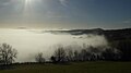
 Low cloud in Leadon valley - geograph.org.uk - 5653136.jpg 1,024 × 768; 315 KB
-
 Low lying cloud below Marcle Hill - geograph.org.uk - 5652244.jpg 1,024 × 576; 99 KB
-
 Lower Redding End - geograph.org.uk - 1106664.jpg 640 × 427; 350 KB
-
 Lower Redding end - geograph.org.uk - 1217255.jpg 640 × 424; 69 KB
-
 Lyne Down (lane) - geograph.org.uk - 3603287.jpg 3,540 × 2,204; 5.32 MB
-
 Lyne Down, Big Apple open day - geograph.org.uk - 1530130.jpg 640 × 427; 332 KB
-
 Maize field near Bickerton Court - geograph.org.uk - 6207482.jpg 1,600 × 900; 575 KB
-
 Malvern view from the Herefordshire Trail, Marcle Hill - geograph.org.uk - 1895911.jpg 3,648 × 2,736; 1.83 MB
-
 Matthew's Farm, Kempley - geograph.org.uk - 2752862.jpg 1,024 × 680; 218 KB
-
 May Hill from Cherry Orchard Lane - geograph.org.uk - 5346116.jpg 1,600 × 899; 963 KB
-
 Metal barn - geograph.org.uk - 1449952.jpg 640 × 480; 248 KB
-

-
 Minor road to Rushall - geograph.org.uk - 1081704.jpg 640 × 480; 82 KB
-
 Minor roads, Much Marcle - geograph.org.uk - 5215345.jpg 1,024 × 768; 301 KB
-
 Mist below Marcle Hill - geograph.org.uk - 5652254.jpg 1,024 × 768; 130 KB
-
 Modern Cider Orchards - geograph.org.uk - 723604.jpg 640 × 427; 292 KB
-
 Monks Meadow, Much Marcle - geograph.org.uk - 3774654.jpg 800 × 566; 156 KB
-
 Monks Walk, Much Marcle - geograph.org.uk - 3774657.jpg 800 × 600; 207 KB
-
 Morris Dancers, Gregg's Pit, Much Marcle - geograph.org.uk - 3178425.jpg 640 × 427; 361 KB
-
 Much Marcle - geograph.org.uk - 5215305.jpg 1,024 × 768; 407 KB
-
 Much Marcle Castle - geograph.org.uk - 6591540.jpg 3,648 × 2,736; 4.82 MB
-
 Much Marcle crossroads - geograph.org.uk - 2088057.jpg 640 × 480; 56 KB
-
 Much Marcle from Gregg's Pit - geograph.org.uk - 2639571.jpg 5,184 × 3,456; 6.41 MB
-
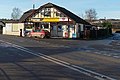
 Much Marcle Garage - geograph.org.uk - 1123137.jpg 640 × 480; 58 KB
-
 Much Marcle Garage - geograph.org.uk - 2723211.jpg 640 × 387; 33 KB
-
 Much Marcle Garage - geograph.org.uk - 3771825.jpg 800 × 522; 114 KB
-
 Much Marcle Garage - geograph.org.uk - 4665734.jpg 2,000 × 1,333; 1.29 MB
-
 Much Marcle Garage - geograph.org.uk - 5215316.jpg 1,024 × 768; 273 KB
-
 Much Marcle Garage, Much Marcle - geograph.org.uk - 4001598.jpg 1,600 × 1,064; 575 KB
-
 Much Marcle oak - geograph.org.uk - 4793051.jpg 1,600 × 1,600; 1.18 MB
-
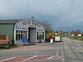
 Much Marcle Post Office ^ Stores - geograph.org.uk - 3771827.jpg 800 × 536; 104 KB
-
 Much Marcle Primary School - geograph.org.uk - 723716.jpg 640 × 427; 260 KB
-
 Much Marcle school - geograph.org.uk - 3774656.jpg 800 × 593; 168 KB
-
 Much Marcle sewage treatment works - geograph.org.uk - 2656346.jpg 800 × 600; 349 KB
-
 Much Marcle Steam Rally - As you do^ - geograph.org.uk - 5880664.jpg 640 × 480; 93 KB
-
 Much Marcle Steam Rally - balance plough - geograph.org.uk - 5880059.jpg 640 × 480; 113 KB
-

-

-
 Much Marcle Steam Rally 2005 - geograph.org.uk - 1960793.jpg 421 × 640; 83 KB
-
 Much Marcle Steam Rally 2005 - geograph.org.uk - 1960812.jpg 640 × 419; 89 KB
-
 Much Marcle Steam Rally 2018 - geograph.org.uk - 5880666.jpg 640 × 480; 70 KB
-
 Much Marcle Stores - geograph.org.uk - 1217045.jpg 640 × 424; 50 KB
-
 Much Marcle Stores and Post Office - geograph.org.uk - 723016.jpg 640 × 427; 278 KB
-
 Much Marcle telephone exchange - geograph.org.uk - 2656354.jpg 760 × 800; 532 KB
-
 Much Marcle.jpg 2,048 × 1,536; 657 KB
-
 Oak in Westons car park, Much Marcle - geograph.org.uk - 3771822.jpg 800 × 755; 198 KB
-
 Oat field at Lyne Down - geograph.org.uk - 3603280.jpg 3,696 × 2,448; 2.26 MB
-

-
 Old orchard, New House Farm - geograph.org.uk - 644613.jpg 640 × 480; 152 KB
-
 Old orchards - geograph.org.uk - 2044064.jpg 640 × 480; 204 KB
-
 Old Pike Bounds Turn - geograph.org.uk - 5215335.jpg 1,024 × 768; 426 KB
-
 Orchard near Huntley's Farm - geograph.org.uk - 1106648.jpg 640 × 427; 346 KB
-
 Orchard, Lyne Down - geograph.org.uk - 1530132.jpg 640 × 427; 291 KB
-
 Orchard, Much Marcle - geograph.org.uk - 5215302.jpg 1,024 × 768; 379 KB
-
 Orchard, Much Marcle - geograph.org.uk - 5215341.jpg 1,024 × 768; 302 KB
-
 Orchard, Much Marcle - geograph.org.uk - 723600.jpg 640 × 427; 316 KB
-
 Pasture south of Much Marcle - geograph.org.uk - 732824.jpg 640 × 480; 158 KB
-
 Patchwork of fields - geograph.org.uk - 859265.jpg 640 × 480; 84 KB
-
 Path from Much Marcle Church - geograph.org.uk - 722184.jpg 640 × 427; 245 KB
-
 Path to St Bartholomew's Church - geograph.org.uk - 723654.jpg 640 × 427; 293 KB
-
 Pavilion, Much Marcle - geograph.org.uk - 723578.jpg 640 × 427; 252 KB
-
 Pea crop on Ridge Hill - geograph.org.uk - 1916384.jpg 1,024 × 758; 72 KB
-
 Phillips House (Much Marcle) - geograph.org.uk - 6591545.jpg 3,648 × 2,736; 4.73 MB
-
 Pike House - geograph.org.uk - 1527461.jpg 640 × 480; 141 KB
-
 Pike house - geograph.org.uk - 642031.jpg 640 × 480; 113 KB
-
-
 Plaque on the Bridge to the Showground - geograph.org.uk - 723046.jpg 640 × 356; 239 KB
-
 Plaque on the Jubilee Seat - geograph.org.uk - 339475.jpg 640 × 354; 233 KB
-
 Plaque on the Jubilee Tree Railings - geograph.org.uk - 339461.jpg 640 × 427; 296 KB
-
 Post box, Lyne Down - geograph.org.uk - 5215337.jpg 768 × 1,024; 432 KB
-
 Press at Westons Cider - geograph.org.uk - 3620609.jpg 480 × 640; 96 KB
-
 Pressing the Cheeses, Gregg's Pit - geograph.org.uk - 65693.jpg 479 × 640; 98 KB
-
 Rich tapestry - geograph.org.uk - 5346126.jpg 1,600 × 899; 874 KB
-
 Ridge Hill - geograph.org.uk - 2656034.jpg 800 × 600; 384 KB
-
 Ridge Hill transmitter - geograph.org.uk - 3879321.jpg 2,592 × 3,872; 4.47 MB
-
 Ridge Hill transmitter - geograph.org.uk - 3879330.jpg 2,592 × 3,872; 4.03 MB


.jpg)


_-_geograph.org.uk_-_6591503.jpg)


_-_geograph.org.uk_-_3603287.jpg)


.jpg)


_-_geograph.org.uk_-_6591545.jpg)


