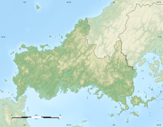
Category:Mountains of Yamaguchi prefecture
Jump to navigation
Jump to search
Wikimedia category | |||||
| Upload media | |||||
| Instance of | |||||
|---|---|---|---|---|---|
| Category combines topics | |||||
| Yamaguchi Prefecture | |||||
prefecture of Japan | |||||
| Instance of | |||||
| Named after |
| ||||
| Location | Japan | ||||
| Located in or next to body of water | |||||
| Capital | |||||
| Legislative body | |||||
| Executive body | |||||
| Anthem |
| ||||
| Head of government |
| ||||
| Mascot | |||||
| Legal form |
| ||||
| Highest point |
| ||||
| Population |
| ||||
| Area |
| ||||
| Replaces |
| ||||
| official website | |||||
 | |||||
日本語: 山口県の山
English: Mountains of Yamaguchi prefecture, Japan
Subcategories
This category has the following 13 subcategories, out of 13 total.
A
H
- Mount Hanao (Yamaguchi) (3 F)
- Mount Hime (Yamaguchi) (2 F)
I
K
- Mount Kasa (Yamaguchi) (6 F)
M
- Mount Migita (3 F)
O
- Mount Ohira (Yamaguchi) (5 F)
S
- Mount Shizuki (25 F)
Media in category "Mountains of Yamaguchi prefecture"
The following 69 files are in this category, out of 69 total.
-
Akiyoshi Plateau 20160522-2.jpg 3,264 × 2,448; 2.29 MB
-
Bridge of San'in Main Line on Kajikurigawa River.jpg 3,962 × 2,971; 2.97 MB
-
Chofu Station Crossroads of Japan National Route 2.JPG 3,264 × 2,448; 2.04 MB
-
Dangugawa River and Mount Ryojusen from Kotonourahashi Bridge.JPG 3,264 × 2,448; 2.56 MB
-
Fushinogawa River and Mount Himeyama.jpg 3,987 × 2,991; 3.21 MB
-
Fushinogawa River from Aiwatasebashi Bridge 1.jpg 4,032 × 3,024; 2.46 MB
-
Fushinogawa River from Aiwatasebashi Bridge 4.jpg 4,032 × 3,024; 2.59 MB
-
Garyubashi Bridge and Mount Iwakuniyama.jpg 3,992 × 2,994; 2.92 MB
-
Garyubashi-dori Street and Mount Iwakuniyama.jpg 3,979 × 2,984; 3 MB
-
Gokurakubashi Bridge and moat from base of Tenshu of Hagi Castle 2.jpg 4,007 × 3,005; 3.05 MB
-
Hashimotogawa River from Tokiwabashi Bridge 3.jpg 4,032 × 3,024; 2.52 MB
-
Hofu heiya.jpg 2,816 × 2,112; 859 KB
-
Hofu Mt. Ohira 02.JPG 2,048 × 1,536; 761 KB
-
Hofu Mt.Tenjin 02.JPG 2,048 × 1,536; 1.18 MB
-
Hofu Mt.Tenjin.JPG 3,240 × 2,430; 3.14 MB
-
InlandSeaZenitsubo.jpg 1,708 × 1,160; 494 KB
-
Katuragisan001.jpg 3,456 × 2,304; 4.89 MB
-
Kurakakesenninnduka01.jpg 5,472 × 3,648; 7.19 MB
-
Migitagatake.JPG 2,816 × 2,112; 837 KB
-
Mount Konomine 20170407.jpg 3,987 × 2,991; 3.12 MB
-
Mount Nishikiyama and Mount Edomariyama from train near Tonomi Station.jpg 4,010 × 3,008; 2.96 MB
-
Mount Ryojusen and Sumiyoshi Park.jpg 4,032 × 3,024; 2 MB
-
Mount Ryugoho 20160522.jpg 3,264 × 2,448; 1.82 MB
-
Mount Ryugoho from Akiyoshi Plateau.jpg 3,264 × 2,448; 2.28 MB
-
Mount Ryugoho from Akiyoshidai Karst Observation Deck.jpg 3,264 × 2,448; 1.54 MB
-
Mount Tenguyama and moat from base of Tenshu of Hagi Castle.jpg 4,032 × 3,024; 2.65 MB
-
Mount Zenjojisan from north entrance of Shin-Yamaguchi Station.jpg 3,264 × 2,448; 2.8 MB
-
Mt.Jakuchisan.jpg 2,592 × 1,944; 1.9 MB
-
Mt.Onigazyoyama.jpg 2,304 × 1,728; 1.09 MB
-
Mt.Rakanzan.jpg 2,304 × 1,728; 1.18 MB
-
Nisihoubenzan001.jpg 3,456 × 2,304; 2.63 MB
-
Nyoigadake001.jpg 3,456 × 2,304; 2.17 MB
-
Platform of Kajikuri-Godaichi Station 4.jpg 3,961 × 2,971; 2.44 MB
-
Platform of Kajikuri-Godaichi Station 5.jpg 4,009 × 3,007; 3.33 MB
-
Platform of Kajikuri-Godaichi Station.jpg 3,990 × 2,992; 3.23 MB
-
Platform of Yamaguchi Station (JR).jpg 4,032 × 3,024; 2.46 MB
-
Rengeyama01.jpg 5,472 × 3,648; 5.26 MB
-
Shimonoseki Mt.Aoyama.JPG 2,527 × 1,895; 678 KB
-
Shimonoseki Mt.Katsuyama.JPG 2,404 × 1,802; 1.26 MB
-
Shizukigawa River from Fukanobashi Bridge 2.jpg 4,032 × 3,024; 2.29 MB
-
Shizukigawa River from Shizukibashi Bridge 3.jpg 4,032 × 3,024; 2.55 MB
-
Shizukigawa River near Fukanobashi Bridge.jpg 4,032 × 3,024; 2.94 MB
-
Takanoko mountain in winter 冬季、鷹子山 - panoramio.jpg 2,141 × 1,764; 1.93 MB
-
View from Akiyoshidai Karst Observation Deck (southeast).jpg 3,264 × 2,448; 2.71 MB
-
View from Kameyama Park (northwest).jpg 4,032 × 3,024; 2.96 MB
-
View from north entrance of Shin-Yamaguchi Station.jpg 3,264 × 2,448; 2.3 MB
-
View from overpass of Kajikuri-Godaichi Station (north).jpg 3,934 × 2,951; 3.01 MB
-
View from overpass of Kajikuri-Godaichi Station.jpg 4,002 × 3,001; 3.48 MB
-
View from overpass of Shin-Yamaguchi Station (east) 2.jpg 4,032 × 3,024; 2.91 MB
-
View from overpass of Shin-Yamaguchi Station (east) 3.jpg 4,032 × 3,024; 2.9 MB
-
View from platform of Jifuku Station 2.jpg 4,032 × 3,024; 3.29 MB
-
View of Haiden and torii of Mekari Shrine.JPG 3,264 × 2,448; 2.14 MB
-
View of Mount Ryuozan near Shimonoseki City Archaeological Museum 2.jpg 3,997 × 2,998; 3.44 MB
-
View of Mount Ryuozan near Shimonoseki City Archaeological Museum 3.jpg 3,986 × 2,989; 3.72 MB
-
View of Mount Ryuozan near Shimonoseki City Archaeological Museum.jpg 4,032 × 3,024; 3.52 MB
-
Wakamiya Ancient Grave and Wakamiya No.3 Ancient Grave in Ayaragigo Ruins.jpg 3,998 × 2,999; 3.26 MB
-
Wakamiya Ancient Grave in Ayaragigo Ruins 3.jpg 3,994 × 2,996; 3.76 MB
-
Yamaguchi Kounomine castle 03.JPG 2,077 × 1,557; 915 KB
-
Yamaguchi Prefectural Road No.34 near Shin-Shimonoseki Station 2.jpg 4,003 × 3,003; 3.23 MB
-
ZENJYOUJI.jpg 508 × 386; 96 KB
-
兄弟山.jpg 203 × 147; 35 KB
-
兄弟山の初夏の風景.jpg 251 × 158; 39 KB
-
小野バス停付近から勝山を見る - panoramio.jpg 2,560 × 1,920; 1.86 MB
-
山口県岩国市 鞍掛山.jpg 5,472 × 3,648; 4.4 MB
-
氷室岳.jpg 640 × 480; 58 KB
-
湯野地区山林 - panoramio.jpg 900 × 598; 681 KB
-
湯野温泉、県道27号線 - panoramio.jpg 900 × 598; 401 KB
-
火ノ山と山陽自動車道を山陽新幹線から見る 山口市鋳銭司 - Dec 30, 2013.jpg 3,264 × 2,448; 1.74 MB
-
白滝山.JPG 3,456 × 2,304; 1.81 MB


