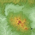
Category:Mount Kirishima
Jump to navigation
Jump to search
mountain in Kagoshima Prefecture, Japan | |||||
| Upload media | |||||
| Instance of | |||||
|---|---|---|---|---|---|
| Part of |
| ||||
| Made from material | |||||
| Located in protected area |
| ||||
| Location | |||||
| Width |
| ||||
| Length |
| ||||
| Highest point | |||||
| Elevation above sea level |
| ||||
 | |||||
English: Category for Mount Kirishima (Kirishima Mountains) in Kagoshima and Miyazaki Prefectures, Japan
日本語: 鹿児島県/宮崎県・霧島山に関するカテゴリ
Subcategories
This category has the following 7 subcategories, out of 7 total.
Media in category "Mount Kirishima"
The following 21 files are in this category, out of 21 total.
-
ETH-BIB-Friedlaender-Krishimakette von Westen gesehen-Ans 05420-017-AL-FL.tif 3,213 × 1,853; 17.07 MB
-
ETH-BIB-Friedlaender-Otani Kratersee, im Hintergrund der West-Kirishima-Ans 05420-021-AL-FL.tif 3,236 × 1,859; 17.25 MB
-
Kirishima deer (52018715696).jpg 5,809 × 3,873; 8.8 MB
-
Kirishima deers (52018759618).jpg 5,920 × 3,947; 9.82 MB
-
Kirishima hiking (52018715021).jpg 5,882 × 3,921; 11.93 MB
-
Kirishima hiking (52018759478).jpg 5,921 × 3,947; 12.46 MB
-
Kirishima landscapes (52017681847).jpg 5,760 × 3,840; 11.78 MB
-
Kirishima mountains (52018968884).jpg 5,741 × 3,827; 10.51 MB
-
Kirishima panorama (52017682012).jpg 13,799 × 5,473; 30.09 MB
-
Kirishima road (52019237040).jpg 5,948 × 3,965; 10.08 MB
-
Kirishima scenery (52017681342).jpg 5,867 × 3,911; 11.58 MB
-
Kirishima scenery (52017681672).jpg 5,914 × 3,943; 11.58 MB
-
Kirishima Volcano & Kakuto Caldera Relief Map, SRTM-1.jpg 3,000 × 3,000; 4.02 MB
-
Kirishima volcano 20111125.jpg 4,000 × 2,672; 3.97 MB
-
Kirishima Volcano Relief Map, SRTM-1.jpg 3,000 × 3,000; 3.69 MB
-
Kirishima's volcano (52018714851).jpg 5,704 × 3,803; 9.29 MB
-
Mount Kirishima 20080205.jpg 3,072 × 2,304; 2.81 MB
-
Shinmoe-dake Volcano Erupts on Kyushu Feb 2011.jpg 2,604 × 2,287; 1.62 MB
-
桜島フェリーから眺めた霧島連峰.jpg 3,846 × 2,564; 1.4 MB
-
駐車場 - panoramio (5).jpg 4,608 × 3,456; 3.56 MB
-
高千穂峰から霧島連峰.jpg 8,192 × 1,856; 3.06 MB


