Category:Motacillidae distribution maps
Jump to navigation
Jump to search
Subcategories
This category has only the following subcategory.
M
Media in category "Motacillidae distribution maps"
The following 22 files are in this category, out of 22 total.
-
 Anthus bogotensis map.svg 1,181 × 1,732; 1.9 MB
-
 Anthus brevirostris map.svg 1,181 × 1,732; 1.9 MB
-
 Anthus chacoensis map.svg 1,181 × 1,732; 1.9 MB
-
 Anthus correndera map.svg 1,181 × 1,732; 2.22 MB
-
 Anthus furcatus map 2.svg 1,181 × 1,732; 1.91 MB
-
 Anthus furcatus map.svg 1,181 × 1,732; 1.91 MB
-
 Anthus hellmayri map.svg 1,181 × 1,732; 1.92 MB
-
 Anthus lutescens map.svg 454 × 608; 195 KB
-
 Anthus nattereri map.svg 1,181 × 1,732; 1.9 MB
-
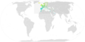
 Anthus peruvianus map.svg 820 × 1,000; 1 MB
-
 Anthus petrosus map.png 720 × 600; 75 KB
-
 Anthus spinoletta mapcomm.png 685 × 400; 178 KB
-
 Anthus trivialis distr.png 2,428 × 2,218; 298 KB
-
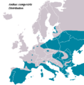 AnthusCampestris distribution.PNG 415 × 422; 11 KB
-
 AnthusTrivialisIUCNver2018 2.png 3,507 × 2,480; 841 KB
-
 Jones pipit map sept23 2010 final.jpg 2,550 × 3,300; 1.08 MB
-
 Meadow Pipit ebird data map.png 3,750 × 1,890; 577 KB
-
 Motacilla capensis, verspreidingskaart met subspp, a.png 1,000 × 1,000; 93 KB
-
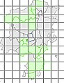
 Motacilla tschutschensis map.svg 717 × 477; 1.79 MB
-
 MotacillaFlavaIUCN.svg 1,052 × 744; 16.7 MB
-
 MotacillaFlavaIUCNver2019 1.png 3,507 × 2,480; 865 KB
-
 Trobat - Hàbitat Solsonès.jpg 229 × 299; 20 KB


