Category:Moortown, West Yorkshire
Jump to navigation
Jump to search
human settlement in United Kingdom | |||||
| Upload media | |||||
| Instance of | |||||
|---|---|---|---|---|---|
| Location | Leeds, West Yorkshire, Yorkshire and the Humber, England | ||||
 | |||||
Subcategories
This category has the following 9 subcategories, out of 9 total.
Media in category "Moortown, West Yorkshire"
The following 45 files are in this category, out of 45 total.
-
A misty afternoon on King Alfred's Fields - geograph.org.uk - 6669097.jpg 1,024 × 768; 191 KB
-
Allerton Grange Croft, Moortown, Leeds - DSC07618.JPG 3,648 × 2,736; 3.52 MB
-
Alwoodley Royal Mail Nursery Lane 2016.jpg 2,260 × 1,398; 2.03 MB
-
Bentcliffe Gardens, Moortown, Leeds - DSC07616.JPG 3,648 × 2,736; 3.55 MB
-
BP garage on Harrogate Road, Leeds (geograph 5844743).jpg 1,600 × 1,065; 525 KB
-
Bridleway - Ring Road, Meanwood - geograph.org.uk - 3001698.jpg 480 × 640; 108 KB
-
Cresta Guest House - Street Lane - geograph.org.uk - 1446841.jpg 540 × 640; 200 KB
-
Culvert - Allerton Grange Way - geograph.org.uk - 1447865.jpg 480 × 640; 330 KB
-
DarkwoodLS17.jpg 1,600 × 1,200; 360 KB
-
Electrical substation, Allerton Grange Way, Moortown, Leeds - DSC07619.JPG 3,648 × 2,736; 3.63 MB
-
Former Chapel - Shadwell Lane - geograph.org.uk - 586303.jpg 640 × 513; 65 KB
-
Harrogate Road at Street Lane, Leeds (geograph 5844752).jpg 1,600 × 1,065; 503 KB
-
Harrogate Road Moortown Leeds Yorkshire - geograph.org.uk - 288346.jpg 640 × 480; 116 KB
-
Harrogate Road sign Moortown Corner 2018.jpg 2,586 × 676; 1.01 MB
-
JCB at Allerton Grange Avenue, Moortown, Leeds - DSC07617.JPG 3,648 × 2,736; 3.67 MB
-
Beth Hamidrash Hagadol Synagogue 2016.jpg 2,592 × 1,944; 2.32 MB
-
LingfieldFlats1.JPG 3,264 × 2,448; 2.87 MB
-
Lubavitch Menorah 15 July 2014.jpg 2,592 × 1,944; 1.95 MB
-
M A Ziff Centre.jpg 3,076 × 1,975; 877 KB
-
Moortown 1825 milestone Nov 2019.jpg 2,093 × 2,303; 1.42 MB
-
Moortown corner 1.jpg 1,395 × 869; 210 KB
-
Moortown Corner 7 Jan 2018 1a.jpg 3,231 × 1,883; 3.25 MB
-
Moortown Methodist Chapel 2016.jpg 3,264 × 2,448; 3.14 MB
-
Moortown Primary School, Leeds - geograph.org.uk - 60948.jpg 640 × 480; 138 KB
-
Moortown Water Tower.JPG 1,536 × 2,048; 1.62 MB
-
MoortownBaptist.jpg 2,427 × 1,473; 961 KB
-
MoortownSocialClub.jpg 3,264 × 2,448; 1.33 MB
-
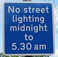
No street lighting Leeds July 2014.jpg 1,277 × 1,253; 605 KB
-
Old Milestone (geograph 6098474).jpg 1,112 × 2,347; 303 KB
-
Ringroadmoortown.JPG 600 × 344; 57 KB
-
Sainsbury'sMoortown.JPG 2,048 × 1,536; 500 KB
-
Shadwell Grange 20 April 2019 W.jpg 4,000 × 3,000; 2.72 MB
-
Showers of Mercy Leeds 2016 view 01.jpg 2,559 × 1,301; 1.64 MB
-
Snicket Moortown Leeds Yorkshire - geograph.org.uk - 288364.jpg 640 × 480; 189 KB
-
St Stephens Church, Moortown, Leeds - geograph.org.uk - 721532.jpg 640 × 480; 243 KB
-
St Stephens Church, Moortown, Leeds - geograph.org.uk - 721534.jpg 640 × 480; 154 KB
-
Street Lane sign Moortown Corner 2018.jpg 2,300 × 811; 372 KB
-
Talbot Crescent, Moortown, Leeds - DSC07613.JPG 3,648 × 2,736; 3.59 MB
-
The Spinney - Street Lane - geograph.org.uk - 1446847.jpg 640 × 480; 307 KB
-
This will be Belgravia - geograph.org.uk - 837508.jpg 640 × 480; 66 KB
-
Path Moortown Leeds Yorkshire - geograph.org.uk - 288371.jpg 640 × 480; 179 KB


