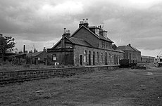
Category:Montrose and Bervie Railway
Jump to navigation
Jump to search
Scottish railway company established 1865 | |||||
| Upload media | |||||
| Instance of |
| ||||
|---|---|---|---|---|---|
| Location | Scotland | ||||
| Operator |
| ||||
| Inception |
| ||||
| Date of official opening |
| ||||
| Length |
| ||||
| Terminus |
| ||||
| |||||
Subcategories
This category has the following 6 subcategories, out of 6 total.
Media in category "Montrose and Bervie Railway"
The following 38 files are in this category, out of 38 total.
-
Approaching Gourdon - geograph.org.uk - 2723785.jpg 640 × 480; 110 KB
-
Bervie rly & nbr.gif 2,003 × 3,062; 199 KB
-
Bervie rly & snjr.gif 2,003 × 3,062; 210 KB
-
Bervie rly 1869.gif 1,209 × 1,621; 79 KB
-
Bridge, Johnshaven to Gourdon - geograph.org.uk - 2140318.jpg 3,648 × 2,736; 2.41 MB
-
Coast path - geograph.org.uk - 2723781.jpg 640 × 480; 117 KB
-
Coast path, Inverbervie - geograph.org.uk - 2974272.jpg 640 × 480; 88 KB
-
Coastal Path South of Gourdon - geograph.org.uk - 575748.jpg 640 × 427; 283 KB
-
Cutting, Kinnaber - geograph.org.uk - 5566929.jpg 1,024 × 683; 518 KB
-
Dismantled railway, Gourdon - geograph.org.uk - 2140252.jpg 3,648 × 2,736; 2.41 MB
-
End of the line, Gourdon - geograph.org.uk - 2140307.jpg 3,648 × 2,736; 2.3 MB
-
Fence posts, Johnshaven - geograph.org.uk - 2139466.jpg 3,648 × 2,736; 2.35 MB
-
Former Railway - geograph.org.uk - 1971829.jpg 640 × 480; 96 KB
-
Former Railway Embankment - geograph.org.uk - 1971888.jpg 640 × 480; 59 KB
-
Former railway line, Montrose - geograph.org.uk - 1779466.jpg 640 × 480; 107 KB
-
Inverbervie to Gourdon - geograph.org.uk - 1943217.jpg 640 × 480; 77 KB
-
Millennium Milepost - geograph.org.uk - 5566945.jpg 427 × 640; 111 KB
-
Montrose and Bervie Railway - geograph.org.uk - 1512793.jpg 640 × 480; 132 KB
-
Montrose and Bervie Railway - geograph.org.uk - 1512796.jpg 640 × 480; 86 KB
-
Montrose and Bervie trackbed - geograph.org.uk - 5566919.jpg 1,024 × 683; 462 KB
-
Montrose and Bervie trackbed - geograph.org.uk - 5566923.jpg 1,024 × 683; 477 KB
-
MP498 - Sustrans Millennium Milepost.jpg 2,304 × 4,096; 2.41 MB
-
National Cycle Network, north of Montrose - geograph.org.uk - 5566925.jpg 1,024 × 683; 486 KB
-
National Cycle Route 1 - geograph.org.uk - 4442644.jpg 640 × 427; 379 KB
-
NCN 1, Bloomfield Crescent - geograph.org.uk - 1779481.jpg 640 × 480; 107 KB
-
Old railway bridge at Johnshaven - geograph.org.uk - 2139426.jpg 3,648 × 2,736; 2.26 MB
-
Once were trains (2) - geograph.org.uk - 5036418.jpg 4,320 × 3,240; 3.51 MB
-
Once were trains (2) - geograph.org.uk - 5043137.jpg 4,320 × 3,240; 4.16 MB
-
Once were trains (2) - geograph.org.uk - 5044207.jpg 4,320 × 3,240; 4.59 MB
-
Once were trains (3) - geograph.org.uk - 5044210.jpg 4,241 × 3,181; 4.26 MB
-
Passing Bottle Craig - geograph.org.uk - 2724012.jpg 640 × 480; 93 KB
-
Path to Kinnaber - geograph.org.uk - 5126384.jpg 4,189 × 2,793; 2.57 MB
-
Railway embankment, Johnshaven - geograph.org.uk - 2139444.jpg 3,648 × 2,736; 2.34 MB
-
Route of old railway - geograph.org.uk - 1434950.jpg 640 × 480; 79 KB
-
Track to Nether Knox, Gourdon - geograph.org.uk - 2140271.jpg 3,648 × 2,736; 2.4 MB
-
View of Dismantled Railway at St. Cyrus - geograph.org.uk - 1161168.jpg 640 × 427; 105 KB


