Category:Montagne (Isère)
Jump to navigation
Jump to search
commune in Isère, France   | |||||
| Upload media | |||||
| Instance of | |||||
|---|---|---|---|---|---|
| Location |
| ||||
| Street address |
| ||||
| Population |
| ||||
| Area |
| ||||
| Elevation above sea level |
| ||||
| Different from | |||||
| official website | |||||
 | |||||
Subcategories
This category has the following 2 subcategories, out of 2 total.
M
- Maps of Montagne (Isère) (5 F)
É
Media in category "Montagne (Isère)"
The following 13 files are in this category, out of 13 total.
-
 Chemin Col Vert Forêt.jpg 6,000 × 4,000; 3.97 MB
-
 Chemin Col Vert Haut.jpg 6,000 × 4,000; 3.34 MB
-
 Chemin Col Vert Moyen.jpg 6,000 × 4,000; 2.88 MB
-
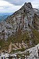 Col Vert Nord.jpg 3,722 × 5,583; 2.78 MB
-
 Grave Of Willi Münzenberg.jpg 3,264 × 4,928; 6.63 MB
-
 LePinetCharteuse1.png 735 × 525; 660 KB
-
 LePinetCharteuse2.png 734 × 524; 694 KB
-
 LePinetCharteuse3.png 785 × 561; 997 KB
-
 Montagne - Eglise et MM.jpg 2,816 × 2,112; 1.06 MB
-
 Montagne 38, l'entrée du village en 1920, p 132 de L'Isère les 533 communes.jpg 2,062 × 1,371; 1.97 MB
-
 Parc Paul-Mistral.jpg 4,032 × 1,960; 3.95 MB
-
 Plantations anti avalanche sur le versant sud est de la crête de l'Archat.jpg 4,128 × 3,096; 6.03 MB
-
 Population - Municipality code 38245.svg 475 × 355; 13 KB


