Category:Mon Line
Jump to navigation
Jump to search
rail line belonging to Norfolk Southern along Monongahela River | |||||
| Upload media | |||||
| Instance of | |||||
|---|---|---|---|---|---|
| Part of | |||||
| Location |
| ||||
| Located in or next to body of water | |||||
| Connects with | |||||
| Owned by | |||||
| Operator | |||||
| Date of official opening |
| ||||
| Length |
| ||||
| |||||
Subcategories
This category has the following 2 subcategories, out of 2 total.
P
- Point Bridge station (4 F)
Media in category "Mon Line"
The following 51 files are in this category, out of 51 total.
-
 19671112 12 PRR Pittsburgh, PA (14529293233).jpg 1,800 × 1,180; 236 KB
-
 19680330 67 PAT 1664 Carson St. @ New Arlington Ave.jpg 1,801 × 1,210; 361 KB
-
 19680330 68 PAT 1644 Arlington Ave. @ Carson St (16255823142).jpg 1,800 × 1,225; 223 KB
-
 19680330 69 PAT 1664 Carson St. @ New Arlington Ave. 2 (5542449885).jpg 1,801 × 1,225; 391 KB
-
 19680330 71 PAT 1621 Carson St. @ 3rd St. (5542449915).jpg 1,800 × 1,230; 459 KB
-
 19680526 53 PC Pittsburgh, PA (3294311948).jpg 1,800 × 1,230; 267 KB
-
 4a12735u.tif 4,070 × 5,195; 20.2 MB
-
 Becks Run (8223.1806.RR).jpg 3,000 × 2,400; 1.49 MB
-
 Braddock Lock and Dam.jpg 6,470 × 2,877; 1.07 MB
-
 Double Stack Mon Line locomotives.jpg 4,032 × 3,024; 5.18 MB
-
 Downtown View from Duquesne Heights (715.3421205.CP).jpg 2,083 × 3,000; 1.1 MB
-
 Dravosburg-Duquesne - Road Result of Cloud Burst July 4, 1928 (20180813-hpichswp-0152).png 4,188 × 2,932; 9.46 MB
-
 Duquesne Heights Steps (715.3421203.CP).jpg 4,829 × 3,409; 3.53 MB
-
 Duquesne Incline and Indian Trail Steps (715.3525242.CP).jpg 3,000 × 2,095; 1.07 MB
-
 Duquesne Incline over railroad tracks.jpg 1,578 × 1,086; 278 KB
-
 East Sycamore Street Bridge.jpg 4,032 × 3,024; 5.29 MB
-
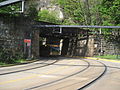
 FtPitttunnel.jpg 640 × 480; 134 KB
-

-
 Homestead Steel Works, Homestead, Pa. (det.4a10138).tif 5,000 × 3,985; 19.03 MB
-
 Homestead Steel Works, Homestead, Pa. (det.4a55013).tif 4,996 × 3,989; 19.04 MB
-
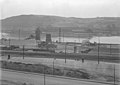
 HomesteadPennsylvaniaRailroadStation.jpg 600 × 386; 71 KB
-
 Incline (715.111876.CP).jpg 3,000 × 2,017; 959 KB
-
 Incline (715.195487.CP).jpg 3,000 × 2,197; 1.7 MB
-
 Liberty Bridge.jpg 1,984 × 1,488; 613 KB
-
 Locomotives behind trees on Mon Line.jpg 4,032 × 3,024; 6.38 MB
-
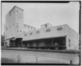
 Mission Street Pumping Station (715.122823A.CP).png 3,000 × 2,279; 3.36 MB
-
 Mon Line locomotives.jpg 4,032 × 3,024; 4.63 MB
-
 Mon Line thru south side.jpg 4,032 × 3,024; 4.21 MB
-
 Mon Line tracks South Side.jpg 4,032 × 3,024; 5.29 MB
-
 Mon Line train by Mount Washington.jpg 4,032 × 3,024; 5.08 MB
-
 Mount Washington Roadway (715.3317902.CP).jpg 3,000 × 2,107; 1.18 MB
-
 Mount Washington Tunnel Pittsburgh.JPG 2,048 × 1,536; 2.05 MB
-
 Mt. Washington Road Extension (715.2910922.CP).png 4,848 × 3,312; 11.98 MB
-
 Mt. Washington Road Extension (715.2910923.CP).png 4,872 × 3,360; 11.99 MB
-
 Mt. Washington Road Extension (715.3114243.CP).png 4,819 × 3,438; 12.24 MB
-
 Oo IMG 20150430 145213 (24129304032) (2).jpg 3,264 × 2,448; 1.93 MB
-
 Pennsylvania State Route 837 (4181939985).jpg 1,024 × 768; 310 KB
-
 Pittsburgh waterfront. Monongahela and Allegheny Rivers, Pennsylvania (fsa.8b28267).tif 5,944 × 4,702; 26.69 MB
-
 Point Bridge Station (715.216004.CP).jpg 3,000 × 2,174; 1.01 MB
-
 Railroad Station Near the River (715.3216737.CP).jpg 3,000 × 2,125; 1.15 MB
-
 Sky line view of Pittsburg, 1907 LCCN2007661527 (cropped).tif 3,559 × 920; 9.38 MB
-
 South Busway (7108277199).jpg 2,816 × 2,112; 1.86 MB
-

-

-
-
 Suburban-type GM New Look bus - Pittsburgh, 1984.jpg 1,493 × 866; 376 KB
-
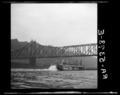
 Train & bridges (6189856060).jpg 2,468 × 1,707; 1,003 KB
-

-
 WBvillestreetrunning.jpg 3,664 × 2,748; 2.02 MB
-

-
 William Street Slide (715.3318244.CP).jpg 3,000 × 2,074; 940 KB
.jpg)

.jpg)
.jpg)
.jpg)
.jpg)
.jpg)


.jpg)
.png)
.jpg)
.jpg)


.jpg)
.jpg)


.png)


.jpg)

.png)
.png)
.png)
_(2).jpg)
.jpg)
.jpg)
.jpg)
.jpg)

.jpg)

.png)
.jpg)