Category:Mining maps of Colorado
Jump to navigation
Jump to search
Media in category "Mining maps of Colorado"
The following 26 files are in this category, out of 26 total.
-
IndependenceMine.jpg 368 × 474; 74 KB
-
IndependenceMine2.jpg 587 × 505; 118 KB
-
IndependenceMine3.jpg 417 × 566; 87 KB
-
Map of Gilpin Co., Colo. - DPLA - 337f0de111963c22003de78799daa7a3.jpg 9,000 × 7,077; 11.15 MB
-
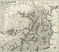
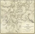
Map of the San Juan Mining Districts - DPLA - 304607d7a05a54e66435043681cc21a6.jpg 4,887 × 7,000; 4.32 MB
-
Map of the San Juan Triangle - DPLA - 55859ece2e344a9869d30ea82bb9a33f.jpg 8,108 × 8,999; 10.88 MB
-
Mines developed by the Newhouse Tunnel - DPLA - 086fdeabd205b0482fc6f306474efbdf.jpg 2,047 × 9,000; 2.15 MB
-
Mining claims of Leadville Lake County Colo. - DPLA - ef57e69eba534660a0931b9eff37a67b.jpg 9,000 × 5,240; 5.97 MB
-
Old Town Mine plat with map - DPLA - ffc206aae71ba3c96eb014283650f56d.jpg 6,000 × 3,070; 2.76 MB
-
Route to the Colorado gold regions - DPLA - 46e32de95e50c374f33d3d8735411ca0.jpg 8,000 × 5,663; 4.58 MB
-
The Leadville mining district - DPLA - 9b91a1e983d70d0c26da37439af088cc.jpg 7,277 × 8,999; 9.13 MB


