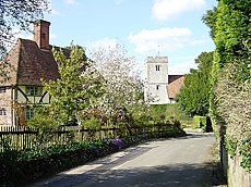
Category:Milstead
Jump to navigation
Jump to search
village in United Kingdom | |||||
| Upload media | |||||
| Instance of |
| ||||
|---|---|---|---|---|---|
| Location | Swale, Kent, South East England, England | ||||
| Population |
| ||||
 | |||||
Subcategories
This category has the following 3 subcategories, out of 3 total.
M
- Milstead Manor (2 F)
O
- Oasts in Milstead (3 F)
Media in category "Milstead"
The following 64 files are in this category, out of 64 total.
-
A viaduct on the M2 - geograph.org.uk - 6700320.jpg 517 × 640; 80 KB
-
Abstract art in the hedgerow - geograph.org.uk - 178953.jpg 480 × 640; 100 KB
-
Bottom Pond Farm, Bottom Pond Road - geograph.org.uk - 6930626.jpg 640 × 453; 82 KB
-
Bottom Pond Road - geograph.org.uk - 4401861.jpg 1,600 × 1,060; 190 KB
-
Bottom Pond Road, near Wormshill - geograph.org.uk - 5016890.jpg 3,264 × 2,448; 2.28 MB
-
Bottom Pond, Kent - geograph.org.uk - 4674745.jpg 640 × 470; 446 KB
-
Coppiced woodland - geograph.org.uk - 3842585.jpg 640 × 480; 124 KB
-
Coppiced woodland in Lade Wood - geograph.org.uk - 2345028.jpg 640 × 480; 109 KB
-
Cromer's Wood Nature Reserve - geograph.org.uk - 1118105.jpg 640 × 481; 118 KB
-
Crossroads Near Milstead - geograph.org.uk - 2051338.jpg 1,496 × 1,122; 633 KB
-
Entrance to Cromer's Wood - geograph.org.uk - 1118099.jpg 640 × 481; 112 KB
-
Entrance to Great Higham Farm - geograph.org.uk - 1221750.jpg 640 × 480; 77 KB
-
Footpath near Milstead, Kent - geograph.org.uk - 4674773.jpg 638 × 640; 672 KB
-
Frinsted Road, Milstead - geograph.org.uk - 5016333.jpg 3,264 × 2,448; 2.06 MB
-
Frinsted Road, Milstead - geograph.org.uk - 5016336.jpg 3,264 × 2,448; 1.64 MB
-
Guarding the blackberries - geograph.org.uk - 239803.jpg 640 × 480; 102 KB
-
Horn Hill, Milstead - geograph.org.uk - 5016330.jpg 3,264 × 2,448; 2.12 MB
-
House on Sawpit Road - geograph.org.uk - 1421317.jpg 640 × 427; 74 KB
-
Junction of Broadoak Road - geograph.org.uk - 1449673.jpg 640 × 480; 95 KB
-
Lane from Bottom Pond Road to Rawling Street - geograph.org.uk - 6169144.jpg 1,024 × 768; 305 KB
-
Lane from Rawling Street to Bottom Pond Road - geograph.org.uk - 6169142.jpg 1,024 × 768; 524 KB
-
Lion Farm - geograph.org.uk - 6169087.jpg 1,024 × 684; 318 KB
-
M2 bridge over Rawling Street - geograph.org.uk - 6169135.jpg 1,024 × 768; 455 KB
-
M2 viaduct - geograph.org.uk - 6169152.jpg 1,024 × 768; 352 KB
-
M2, westbound - geograph.org.uk - 5208028.jpg 640 × 426; 52 KB
-
Manor Road, Holly Bushes, near Milstead - geograph.org.uk - 5016241.jpg 3,264 × 2,448; 2.51 MB
-
Manor Road, Holly Bushes, near Milstead - geograph.org.uk - 5016245.jpg 3,264 × 2,448; 2.13 MB
-
Milstead Village Hall - geograph.org.uk - 1461609.jpg 640 × 480; 67 KB
-
Mintching Wood Lane, near Milstead - geograph.org.uk - 1908936.jpg 3,488 × 2,616; 2.17 MB
-
Mintching Wood Lane, near Milstead - geograph.org.uk - 5016250.jpg 3,264 × 2,448; 1.75 MB
-
Mintching Wood Lane, near Milstead - geograph.org.uk - 5016258.jpg 3,264 × 2,448; 1.89 MB
-
Mintching Wood Lane, near Milstead - geograph.org.uk - 5016305.jpg 3,264 × 2,448; 1.82 MB
-
Mintching Wood Lane, near Milstead - geograph.org.uk - 5016308.jpg 3,264 × 2,448; 2.8 MB
-
Moremuck Barn - geograph.org.uk - 1221716.jpg 640 × 480; 71 KB
-
Motorway Bridge over Rawling Street, Milstead - geograph.org.uk - 5016311.jpg 3,264 × 2,448; 2.17 MB
-
Rawling Street, Milstead - geograph.org.uk - 4716.jpg 640 × 480; 163 KB
-
Rawling Street, Milstead - geograph.org.uk - 5016327.jpg 3,264 × 2,448; 2.33 MB
-
Red Lion, Milstead - geograph.org.uk - 5016326.jpg 3,264 × 2,448; 1.85 MB
-
Rose Cottage, Milstead - geograph.org.uk - 1461620.jpg 640 × 480; 80 KB
-
Rose Cottage, Milstead - geograph.org.uk - 6930652.jpg 640 × 539; 123 KB
-
Signpost and cottage, Milstead - geograph.org.uk - 6930650.jpg 640 × 463; 116 KB
-
Slough Road - geograph.org.uk - 1449675.jpg 640 × 480; 106 KB
-
Slough Road - geograph.org.uk - 4413949.jpg 640 × 480; 136 KB
-
Southbound M2 - geograph.org.uk - 3721297.jpg 640 × 480; 208 KB
-
The Lodge - geograph.org.uk - 1223169.jpg 640 × 480; 89 KB
-
Triangle of Woodland - geograph.org.uk - 1221711.jpg 640 × 480; 67 KB
-
Unnamed lane leading to Holly Bushes, near Milstead - geograph.org.uk - 5016231.jpg 3,264 × 2,448; 2.49 MB
-
Unnamed lane, Holly Bushes, near Milstead - geograph.org.uk - 5016236.jpg 3,264 × 2,448; 2.41 MB
-
View from the lane north of Frinsted - geograph.org.uk - 6930638.jpg 640 × 488; 85 KB
-
Village sign, Milstead - geograph.org.uk - 6930655.jpg 440 × 640; 85 KB
-
Wyatt Cottage, Wormshill - geograph.org.uk - 6930632.jpg 640 × 488; 121 KB
-
Free range poultry on an improvised perch - geograph.org.uk - 736303.jpg 640 × 604; 131 KB


