Category:Millom Without
Jump to navigation
Jump to search
civil parish in Cumbria, UK  | |||||
| Upload media | |||||
| Instance of | |||||
|---|---|---|---|---|---|
| Location | Copeland, Cumbria, North West England, England | ||||
| Population |
| ||||
 | |||||
Subcategories
This category has the following 4 subcategories, out of 4 total.
Media in category "Millom Without"
The following 200 files are in this category, out of 411 total.
(previous page) (next page)-
 A boulder on Barrow - geograph.org.uk - 3740728.jpg 800 × 600; 162 KB
-
 A layby on the A595 at Stanley Wood - geograph.org.uk - 3126263.jpg 800 × 600; 259 KB
-
 A pool on Lath Rigg - geograph.org.uk - 3740550.jpg 800 × 600; 156 KB
-
 A public private path - geograph.org.uk - 2920411.jpg 4,000 × 3,000; 4.52 MB
-
 A typical view of Arnaby Marsh - geograph.org.uk - 2914567.jpg 4,000 × 3,000; 5.27 MB
-

-
 A5093 near Millom Castle - geograph.org.uk - 3782372.jpg 4,368 × 2,912; 4.66 MB
-
 A5093 towards Langthwaite Farm - geograph.org.uk - 6322338.jpg 800 × 600; 80 KB
-
 A595 in the Duddon Valley - geograph.org.uk - 3211172.jpg 640 × 420; 45 KB
-
 A595, Ladyhall turning - geograph.org.uk - 3211178.jpg 640 × 430; 41 KB
-
 Approach to the cave at Barrow - geograph.org.uk - 2926369.jpg 4,000 × 3,000; 7.79 MB
-
 Archway of the Duddon Iron Furnace - geograph.org.uk - 3738447.jpg 480 × 640; 158 KB
-
 Ascending Barrow - geograph.org.uk - 5385907.jpg 1,920 × 1,280; 504 KB
-
 Ash House - geograph.org.uk - 3738505.jpg 640 × 480; 94 KB
-
 Bankside and outbuildings from the road - geograph.org.uk - 3219801.jpg 4,000 × 2,664; 2.27 MB
-
 Bankside and the Whicham Valley - geograph.org.uk - 3221013.jpg 4,000 × 2,664; 2.2 MB
-
 Bankside and Whicham Valley Panorama - geograph.org.uk - 3782356.jpg 2,048 × 333; 138 KB
-
 Bankside farm - geograph.org.uk - 1176686.jpg 640 × 398; 42 KB
-
 Bankside Farm - geograph.org.uk - 4370088.jpg 640 × 480; 86 KB
-
 Bankside with Black Combe Corrie in background - geograph.org.uk - 3219783.jpg 4,000 × 2,664; 1.39 MB
-
 Barn at Hallthwaites - geograph.org.uk - 3215988.jpg 4,000 × 2,664; 3.87 MB
-
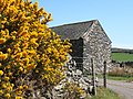 Barn near gorse in full bloom - geograph.org.uk - 540529.jpg 640 × 480; 149 KB
-
 Beck Bank Farm - geograph.org.uk - 2926675.jpg 4,000 × 3,000; 3.96 MB
-
 Behind Green Road Railway Station - geograph.org.uk - 4469236.jpg 640 × 480; 44 KB
-
 Bend in the A595 - geograph.org.uk - 2629871.jpg 640 × 430; 77 KB
-
 Black Beck - geograph.org.uk - 2162677.jpg 640 × 480; 109 KB
-
 Black Beck wending its way across Shaw Marsh - geograph.org.uk - 2927688.jpg 4,000 × 3,000; 6.31 MB
-
 Black Combe from Lowscales Bank - geograph.org.uk - 3222340.jpg 4,000 × 2,664; 1.04 MB
-
 Black Combe from the edge of Millom Park - geograph.org.uk - 3222355.jpg 4,000 × 2,664; 997 KB
-
 Black Crag - geograph.org.uk - 5010128.jpg 4,608 × 3,072; 3.01 MB
-
 Bluebells, Furnace Wood - geograph.org.uk - 5385881.jpg 1,920 × 1,280; 548 KB
-
 Boadhole Farm - geograph.org.uk - 2926659.jpg 4,000 × 3,000; 7.68 MB
-
 Boulder and rocks outside Millom Park - geograph.org.uk - 3219675.jpg 4,000 × 2,664; 3.27 MB
-
 Boundary Stone - geograph.org.uk - 6299741.jpg 989 × 1,024; 485 KB
-
 Bowscale - geograph.org.uk - 3622938.jpg 640 × 480; 93 KB
-
 Bridge across Logan Beck - geograph.org.uk - 3074057.jpg 1,920 × 1,440; 2.74 MB
-
 Bridge across the Duddon - geograph.org.uk - 3074078.jpg 4,000 × 3,000; 7.61 MB
-
 Bridge at Hallthwaites - geograph.org.uk - 3215980.jpg 4,000 × 2,664; 2.6 MB
-
 Bridge End Hallthwaites - geograph.org.uk - 3215937.jpg 3,446 × 2,355; 1.11 MB
-
 Bridge over Black Beck Hallthwaites - geograph.org.uk - 2920324.jpg 4,000 × 3,000; 4.29 MB
-
 Bridge, Beckstones - geograph.org.uk - 1822666.jpg 640 × 480; 161 KB
-
 Bridleway near Lath Rigg - geograph.org.uk - 1822769.jpg 640 × 482; 165 KB
-
 Broughton-in-Furness - geograph.org.uk - 3740714.jpg 800 × 600; 207 KB
-
 Buildings at Lowscales - geograph.org.uk - 2921772.jpg 4,000 × 3,000; 2.51 MB
-
 Buildings at Waterblean - geograph.org.uk - 3002336.jpg 4,000 × 3,000; 3.63 MB
-
 Bull at Dunningwell Farm - geograph.org.uk - 3223772.jpg 2,592 × 1,944; 1.07 MB
-
 By Lowscales Bank - geograph.org.uk - 1176785.jpg 640 × 480; 50 KB
-
 Cairn on Buckbarrow - geograph.org.uk - 4422580.jpg 3,008 × 2,000; 1,011 KB
-
 Cattle graze near Millom Castle - geograph.org.uk - 3782369.jpg 4,368 × 2,912; 6.74 MB
-
 Cattle grazing near Lady Hall - geograph.org.uk - 3605169.jpg 14,641 × 2,422; 7.37 MB
-
 Charity Chair sheepfold - geograph.org.uk - 3073259.jpg 4,000 × 3,000; 7.29 MB
-
 Cloven Stone, Thwaites Fell - geograph.org.uk - 3622920.jpg 800 × 600; 201 KB
-
 Corney Fell road - geograph.org.uk - 1097812.jpg 640 × 480; 70 KB
-
 Corney Fell road - geograph.org.uk - 1097949.jpg 640 × 480; 94 KB
-
 Corney Fell Road Bridge - geograph.org.uk - 3073350.jpg 3,891 × 2,853; 6.31 MB
-

-
 Corney Fell road east of the summit - geograph.org.uk - 1097929.jpg 539 × 640; 91 KB
-
 Corney Road - geograph.org.uk - 2192138.jpg 1,024 × 681; 111 KB
-
 Country south of Logan Beck - geograph.org.uk - 2532541.jpg 2,592 × 1,944; 2.11 MB
-
 Crossing Black Beck - geograph.org.uk - 3738550.jpg 800 × 600; 258 KB
-
 Crossing marshy ground at Applehead - geograph.org.uk - 2921845.jpg 4,000 × 3,000; 7.21 MB
-
 Cumbria Coastal Way goes West - geograph.org.uk - 2914673.jpg 4,000 × 3,000; 2.69 MB
-
 Date stone, Logan Beck Bridge - geograph.org.uk - 3624520.jpg 640 × 269; 104 KB
-
 Deep water on Millom Marsh - geograph.org.uk - 2914484.jpg 4,000 × 3,000; 5.39 MB
-
 Derelict building at Knottend - geograph.org.uk - 3211184.jpg 2,592 × 1,944; 1.08 MB
-
 Derelict building at Po House - geograph.org.uk - 3219995.jpg 4,000 × 2,664; 3.58 MB
-
 Derelict buildings at High Shaw - geograph.org.uk - 2920360.jpg 4,000 × 3,000; 6.71 MB
-
 Derelict buildings at High Shaw - geograph.org.uk - 2920376.jpg 4,000 × 3,000; 2.76 MB
-
 Derelict Farm Buildings at Holme - geograph.org.uk - 2927603.jpg 4,000 × 3,000; 6.17 MB
-
 Descending Barrow - geograph.org.uk - 5385920.jpg 1,920 × 1,280; 500 KB
-
 Distorted decaying tree trunk - geograph.org.uk - 3782319.jpg 3,576 × 2,806; 4.59 MB
-
 Disused Sheepfold between Fenwick and Swinside - geograph.org.uk - 2926227.jpg 4,000 × 3,000; 6.62 MB
-
 Dog Crag on Pohouse Bank - geograph.org.uk - 3219953.jpg 4,000 × 2,664; 2.55 MB
-
 Drainage Ditch at Salthouse - geograph.org.uk - 3230610.jpg 4,000 × 2,664; 3.88 MB
-
 Drive to Beck Bank Farm - geograph.org.uk - 1828332.jpg 640 × 481; 147 KB
-
 Driving up The Hill - geograph.org.uk - 1882650.jpg 640 × 463; 72 KB
-
 Dry Tarn, Barrow - geograph.org.uk - 5385886.jpg 1,920 × 1,280; 538 KB
-
 Duddon estuary from railway bridge - geograph.org.uk - 1002921.jpg 640 × 479; 54 KB
-
 Duddon Hall.jpg 2,592 × 1,944; 1.45 MB
-
 Duddon iron furnace (disused) - geograph.org.uk - 5571167.jpg 640 × 480; 138 KB
-
 Duddon Iron Furnace - charcoal store - geograph.org.uk - 4580393.jpg 640 × 424; 339 KB
-
 Duddon Iron Furnace - charging hole - geograph.org.uk - 4580370.jpg 640 × 424; 306 KB
-
 Duddon Iron Furnace - geograph.org.uk - 4403969.jpg 640 × 480; 116 KB
-
 Duddon Iron Furnace - geograph.org.uk - 4580336.jpg 640 × 424; 323 KB
-
 Duddon Iron Furnace - geograph.org.uk - 4580350.jpg 640 × 424; 265 KB
-
 Duddon Iron Furnace - geograph.org.uk - 4580353.jpg 424 × 640; 331 KB
-
 Duddon Iron Furnace - geograph.org.uk - 4580356.jpg 640 × 424; 305 KB
-
 Duddon Iron Furnace - geograph.org.uk - 4580365.jpg 640 × 424; 301 KB
-
 Duddon Iron Furnace - geograph.org.uk - 4580386.jpg 640 × 424; 331 KB
-
 Duddon Iron Furnace - geograph.org.uk - 4580397.jpg 640 × 424; 322 KB
-

-
 Duddon Iron Furnace - wheel pit - geograph.org.uk - 4580342.jpg 424 × 640; 329 KB
-
 Duddon Iron Furnace - wheel pit - geograph.org.uk - 4580347.jpg 640 × 424; 322 KB
-
 Duddon Iron Works - geograph.org.uk - 2927586.jpg 4,000 × 3,000; 4.22 MB
-
 Duddon Sands looking North - geograph.org.uk - 2986320.jpg 4,000 × 3,000; 5.46 MB
-
 Duddon Sands near Millom, Cumbria - geograph.org.uk - 3791722.jpg 11,149 × 2,178; 7.63 MB
-
 Dwelling in Hallthwaites - geograph.org.uk - 6422755.jpg 1,200 × 803; 1.36 MB
-
 Electricity Pylon near Arnaby - geograph.org.uk - 3791687.jpg 2,304 × 3,072; 3.26 MB
-
 Elf Hall - geograph.org.uk - 6422745.jpg 1,200 × 828; 1.45 MB
-
 Entrance Drive to Bankside - geograph.org.uk - 3219808.jpg 4,000 × 2,664; 2.23 MB
-
 Entrance gate to Millom Park - geograph.org.uk - 3219660.jpg 4,000 × 2,664; 4.1 MB
-
 Environment Agency patrolling the Cumbrian Coastal Way - geograph.org.uk - 2914631.jpg 4,000 × 3,000; 2.72 MB
-
 Farm and outbuildings at Swinside - geograph.org.uk - 3211299.jpg 2,592 × 1,944; 821 KB
-
 Farm at Thwaite Yeat - geograph.org.uk - 2929049.jpg 4,000 × 3,000; 4.67 MB
-
 Farm building at Pohouse Bridge - geograph.org.uk - 3219859.jpg 4,000 × 2,664; 1.08 MB
-
 Farm Buildings at Windy Slack - geograph.org.uk - 2926327.jpg 4,000 × 3,000; 2.54 MB
-
 Farm buildings near Hallthwaites - geograph.org.uk - 2162684.jpg 640 × 480; 94 KB
-
 Farm outbuildings at High Lowscales - geograph.org.uk - 3219703.jpg 4,000 × 2,664; 3.1 MB
-
 Farmland at Lady Hall - geograph.org.uk - 3696014.jpg 2,592 × 1,944; 1.28 MB
-
 Farmland to West of Beck Farm - geograph.org.uk - 3782379.jpg 2,901 × 4,215; 7.78 MB
-
 Fence, Peathouse Beck - geograph.org.uk - 796052.jpg 640 × 480; 72 KB
-
 Fenwick Farm - geograph.org.uk - 2926258.jpg 4,000 × 3,000; 3.78 MB
-
 Fenwick Farm - geograph.org.uk - 2926277.jpg 4,000 × 3,000; 3.48 MB
-
 Fields near Brockwood Hall - geograph.org.uk - 3586396.jpg 2,592 × 1,944; 1.67 MB
-
 Fields near Low Scales - geograph.org.uk - 2162032.jpg 640 × 480; 72 KB
-
 Footbridge near High Boghouse Farm - geograph.org.uk - 2920466.jpg 4,000 × 3,000; 3.49 MB
-
 Footbridge over Peathouse Beck - geograph.org.uk - 2926240.jpg 4,000 × 3,000; 5.07 MB
-
 Footpath below Lath Rigg - geograph.org.uk - 3741691.jpg 640 × 480; 86 KB
-
 Footpath from Lady Hall to Broadgate - geograph.org.uk - 3585994.jpg 2,592 × 1,944; 1.85 MB
-
 Footpath from Low Shaw to Green Road - geograph.org.uk - 2914717.jpg 4,000 × 3,000; 5.65 MB
-
 Footpath in Furnace Woods - geograph.org.uk - 2926540.jpg 4,000 × 3,000; 5.21 MB
-
 Footpath in Stanley Wood - geograph.org.uk - 4403978.jpg 640 × 480; 158 KB
-
 Footpath near Duddon Bridge - geograph.org.uk - 1822691.jpg 640 × 480; 142 KB
-
 Footpath through Stanley Wood - geograph.org.uk - 3738460.jpg 640 × 480; 208 KB
-
 Footpath to Fenwick - geograph.org.uk - 1823110.jpg 640 × 479; 135 KB
-
 Forest Edge - geograph.org.uk - 5385925.jpg 1,920 × 1,280; 531 KB
-
 Forest track, Millom Park - geograph.org.uk - 4370102.jpg 640 × 480; 139 KB
-
 Former quarry on the edge of Lowscales bank - geograph.org.uk - 3219824.jpg 2,664 × 4,000; 1.69 MB
-
 Four stones at the Swinside circle - geograph.org.uk - 3741670.jpg 800 × 600; 142 KB
-
 Fox's Wood - geograph.org.uk - 2905248.jpg 4,000 × 3,000; 7.16 MB
-
 Fox's Wood - geograph.org.uk - 3586003.jpg 2,592 × 1,944; 1.44 MB
-
 Foxfield from the estuary - geograph.org.uk - 2927661.jpg 4,000 × 3,000; 4.52 MB
-
 From Black Crag - geograph.org.uk - 796403.jpg 640 × 480; 57 KB
-
 From the centre of the Duddon Estuary....... - geograph.org.uk - 2997071.jpg 3,918 × 2,924; 5.19 MB
-
 Furnace Woods - geograph.org.uk - 2926595.jpg 4,000 × 3,000; 6.32 MB
-

-

-
 Gateway near Ash House - geograph.org.uk - 3738473.jpg 640 × 480; 93 KB
-
-
 Ghyll Scaur Quarry Crusher - geograph.org.uk - 3470838.jpg 640 × 424; 267 KB
-
 Gorse at Logan Beck - geograph.org.uk - 1822679.jpg 640 × 480; 214 KB
-
 Grazing near Fenwick - geograph.org.uk - 3791658.jpg 9,351 × 2,334; 7.48 MB
-
 Grazing near Langthwaite Farm - geograph.org.uk - 6322339.jpg 800 × 524; 52 KB
-
 Green Road - geograph.org.uk - 6422648.jpg 1,200 × 806; 1.82 MB
-

-
 Green Road Station - geograph.org.uk - 2313183.jpg 600 × 450; 250 KB
-
 Green Road station - geograph.org.uk - 4365796.jpg 3,890 × 2,026; 6.08 MB
-

-
 Green Road-looking towards Millom - geograph.org.uk - 4469230.jpg 640 × 480; 52 KB
-
 H shaped channels Millom Marsh - geograph.org.uk - 2914512.jpg 4,000 × 3,000; 1.9 MB
-
 Heading to Fenwick - geograph.org.uk - 3740101.jpg 800 × 600; 111 KB
-
 Heading up Thwaites Fell - geograph.org.uk - 3622886.jpg 800 × 600; 201 KB
-
 High Boghouse Farm - geograph.org.uk - 2920469.jpg 4,000 × 3,000; 3.43 MB
-
 High Lowscales Farm - geograph.org.uk - 2158451.jpg 640 × 480; 53 KB
-
 High Lowscales Farmhouse - geograph.org.uk - 3219685.jpg 4,000 × 2,664; 2.89 MB
-
 High Lowscales Farmhouse - geograph.org.uk - 3219694.jpg 3,921 × 2,521; 1.67 MB
-
 House with stone gable wall Roanlands Brow - geograph.org.uk - 3605093.jpg 3,072 × 2,304; 3.07 MB
-
 Inside of the cave at Barrow - geograph.org.uk - 2926410.jpg 4,000 × 3,000; 5.93 MB
-
 Jerry Bridge Hallthwaites - geograph.org.uk - 3215958.jpg 3,113 × 2,116; 834 KB
-
 Just surface water - geograph.org.uk - 2997175.jpg 4,000 × 3,000; 5.94 MB
-
 Knott Hill - geograph.org.uk - 2926178.jpg 4,000 × 3,000; 6.17 MB
-
 Knott Hill from Thwaites Fell - geograph.org.uk - 4567540.jpg 2,000 × 1,333; 1.5 MB
-
 Lady Hall - geograph.org.uk - 6422716.jpg 1,200 × 825; 1.54 MB
-
 Lady Hall village - geograph.org.uk - 3585985.jpg 2,592 × 1,944; 1.46 MB
-
 Lane and track near Bankside - geograph.org.uk - 1176737.jpg 640 × 480; 105 KB
-
 Lane and tracks - geograph.org.uk - 1176782.jpg 640 × 480; 80 KB
-
 Lane beneath Lowscales Bank - geograph.org.uk - 1176683.jpg 640 × 432; 70 KB
-
 Lane near Bankside - geograph.org.uk - 1176684.jpg 640 × 480; 88 KB
-
 Lane up Dunnerdale - geograph.org.uk - 3211190.jpg 640 × 430; 75 KB
-
 Langthwaite Farm - geograph.org.uk - 3202943.jpg 4,000 × 2,664; 2.16 MB
-
 Lath Rigg - geograph.org.uk - 3740539.jpg 800 × 600; 152 KB
-
 Level crossing at Underhill cottages - geograph.org.uk - 2914737.jpg 4,000 × 3,000; 2.95 MB
-
 Limekiln near Boadhole - geograph.org.uk - 2926645.jpg 4,000 × 3,000; 3.83 MB
-
 Limekiln near Boadhole viewed from above - geograph.org.uk - 2930272.jpg 4,000 × 3,000; 5.65 MB
-
 Limekiln near Boadhole. Close-up of kiln - geograph.org.uk - 2930251.jpg 4,000 × 3,000; 7.41 MB
-
 Little Paddy Crag - geograph.org.uk - 2532083.jpg 2,592 × 1,944; 1.05 MB
-
 Logan Beck - geograph.org.uk - 5385927.jpg 1,920 × 1,280; 540 KB
-
 Looking across Borwick Rails Harbour to The Hill - geograph.org.uk - 3222403.jpg 4,000 × 2,664; 1.05 MB
-
 Looking down on Bankside - geograph.org.uk - 1176739.jpg 640 × 480; 70 KB
-

-
 Low House Farm - geograph.org.uk - 3214928.jpg 4,000 × 2,664; 1.62 MB
-
 Low Wood in autumn - geograph.org.uk - 3204422.jpg 4,000 × 2,664; 1.03 MB
-

-
 Lowscales Bank - geograph.org.uk - 1176753.jpg 640 × 480; 83 KB
-
 Lowscales Bank - geograph.org.uk - 3219718.jpg 4,000 × 2,664; 2.73 MB
-
 Lowscales Bank - geograph.org.uk - 3219730.jpg 4,000 × 2,664; 2.38 MB
-
 Lowscales Bank - geograph.org.uk - 3219737.jpg 4,000 × 2,664; 2.83 MB
-
 Lowscales Bank - geograph.org.uk - 3782349.jpg 4,368 × 2,912; 6.53 MB
-

-
 Lowscales Bank from inside Millom Park - geograph.org.uk - 3215014.jpg 4,000 × 2,664; 3.11 MB
-
 Lowscales Bank from the edge of Millom Park - geograph.org.uk - 3219749.jpg 4,000 × 2,664; 3.3 MB
-
 Lowscales Hill - geograph.org.uk - 3309290.jpg 1,600 × 1,200; 1.05 MB
-
 Major channel Millom Marsh - geograph.org.uk - 2914497.jpg 4,000 × 3,000; 5.94 MB
-
 Midlow Hill - geograph.org.uk - 4370114.jpg 640 × 480; 73 KB
-
 Millom Marsh abruptly gives way to sand - geograph.org.uk - 2914545.jpg 4,000 × 3,000; 6.2 MB
-
 Millom Park Transmitter - geograph.org.uk - 2985050.jpg 4,000 × 3,000; 6.56 MB
-
 Millom Park Transmitter - geograph.org.uk - 3215037.jpg 2,664 × 4,000; 1.25 MB
-
 Millom Park Transmitter and service buildings - geograph.org.uk - 3215043.jpg 2,664 × 4,000; 1,014 KB
-
 Minor road north-west of The Hill - geograph.org.uk - 3586408.jpg 2,592 × 1,944; 1.32 MB
-
 Minor road to Silecroft - geograph.org.uk - 3586430.jpg 2,592 × 1,944; 1.49 MB


_-_geograph.org.uk_-_5571167.jpg)


