Category:Millers Dale
Jump to navigation
Jump to search
village in Derbyshire Dales, UK  | |||||
| Upload media | |||||
| Instance of | |||||
|---|---|---|---|---|---|
| Located in protected area |
| ||||
| Location | Tideswell, Derbyshire Dales, Derbyshire, East Midlands, England | ||||
| Located in or next to body of water | |||||
| Different from | |||||
 | |||||
Subcategories
This category has the following 9 subcategories, out of 9 total.
A
- Anglers Rest, Millers Dale (3 F)
E
- East Buxton Lime (11 F)
M
- Millers Dale Bridge 75 (7 F)
- Millers Dale Meal Mill (3 F)
- Millers Dale North Viaduct (26 F)
- Millers Dale railway station (32 F)
- Millers Dale South Viaduct (22 F)
R
- Raven Tor, Miller's Dale (20 F)
S
Media in category "Millers Dale"
The following 89 files are in this category, out of 89 total.
-
 -i---i- (5019505129).jpg 1,296 × 1,944; 1.61 MB
-
 500px photo (45279614).jpeg 2,048 × 1,536; 1.22 MB
-
 A creeping thistle above Miller's Dale - geograph.org.uk - 3673028.jpg 3,648 × 2,736; 2.16 MB
-
 A holly bush above Miller's Dale, Derbyshire - geograph.org.uk - 3673022.jpg 3,648 × 2,736; 2.09 MB
-
 Abandoned water wheel in Miller's Dale - geograph.org.uk - 2290790.jpg 1,024 × 768; 345 KB
-
 Above Miller's Dale - geograph.org.uk - 2967884.jpg 800 × 600; 158 KB
-

-
 Blue Flowers (9008092829).jpg 2,592 × 4,608; 3.01 MB
-
 Bridge on the River Kwai...I mean, Wye! - geograph.org.uk - 3673162.jpg 3,496 × 2,622; 1.76 MB
-
 Bridge over the River Wye - geograph.org.uk - 2981214.jpg 600 × 800; 209 KB
-
 Cat (9017933805).jpg 2,592 × 4,608; 3.21 MB
-
 Cattle grazing above Miller's Dale - geograph.org.uk - 3087779.jpg 1,024 × 768; 198 KB
-
 Dewpond above Miller's Dale - geograph.org.uk - 2861584.jpg 1,024 × 768; 228 KB
-
 Disused Bridge - Millers Dale - geograph.org.uk - 2854160.jpg 640 × 424; 256 KB
-
 Disused limestone quarry at Miller's Dale - geograph.org.uk - 2829515.jpg 2,403 × 1,803; 1.48 MB
-
 Disused Quarry , Miller's Dale - geograph.org.uk - 3003443.jpg 1,600 × 1,064; 536 KB
-
 Disused quarry in Miller's Dale - geograph.org.uk - 2289856.jpg 1,024 × 769; 350 KB
-
 Entrance to Miller's Dale Quarry - geograph.org.uk - 1859346.jpg 3,296 × 2,472; 1.11 MB
-
 Footbridge over River Wye in Millers Dale - geograph.org.uk - 519126.jpg 640 × 480; 133 KB
-
 Former Corn Mill - Millers Dale - geograph.org.uk - 2855205.jpg 640 × 424; 315 KB
-
 Gentle slopes above Miller's Dale - geograph.org.uk - 2861582.jpg 1,024 × 380; 83 KB
-
 Glimpse of houses in Miller's Dale - geograph.org.uk - 2861573.jpg 1,024 × 768; 346 KB
-
 Lane into Miller's Dale village from Litton Mill - geograph.org.uk - 2840108.jpg 1,024 × 768; 278 KB
-
 Lime kilns at Miller's Dale - geograph.org.uk - 1902161.jpg 640 × 426; 95 KB
-
 Lime kilns at Millers Dale - geograph.org.uk - 5324434.jpg 1,800 × 1,350; 614 KB
-
 Lime kilns near Miller's Dale - geograph.org.uk - 4023555.jpg 2,816 × 2,112; 2.83 MB
-
 Lime Kilns, Miller's Dale Lime Works - geograph.org.uk - 4798002.jpg 640 × 426; 96 KB
-
 Limekiln portal - geograph.org.uk - 5324436.jpg 1,800 × 1,350; 701 KB
-
 Limestone Kiln Top at Miller's Dale - geograph.org.uk - 2829518.jpg 2,506 × 1,880; 1.15 MB
-
 Limestone Way above Miller's Dale - geograph.org.uk - 3087789.jpg 1,024 × 797; 307 KB
-
 Looking up river - geograph.org.uk - 1766944.jpg 640 × 480; 146 KB
-

-

-
 Miller's Dale - geograph.org.uk - 1003903.jpg 640 × 426; 145 KB
-
 Miller's Dale - geograph.org.uk - 4803073.jpg 640 × 426; 101 KB
-
 Miller's Dale - geograph.org.uk - 5494972.jpg 5,184 × 3,456; 1.88 MB
-
 Miller's Dale - geograph.org.uk - 670.jpg 640 × 480; 60 KB
-

-
 Miller's Dale - Road view from above - geograph.org.uk - 945922.jpg 640 × 480; 136 KB
-
 Miller's Dale from the Limestone Way - geograph.org.uk - 1022201.jpg 640 × 480; 101 KB
-
 Miller's Dale Lime Kilns - geograph.org.uk - 1003925.jpg 426 × 640; 138 KB
-
 Miller's Dale limekilns - geograph.org.uk - 2853645.jpg 640 × 417; 111 KB
-
 Miller's Dale on a Fine Spring Afternoon - geograph.org.uk - 2289681.jpg 3,296 × 2,472; 1.03 MB
-
 Miller's Dale Quarry - geograph.org.uk - 2404057.jpg 640 × 427; 91 KB
-
 Miller's Dale Quarry - geograph.org.uk - 2849466.jpg 3,872 × 2,592; 5.17 MB
-
 Miller's dale railway cutting - geograph.org.uk - 765406.jpg 640 × 426; 110 KB
-
 Miller's Dale, cliffs by Water-cum-Jolly Dale.jpg 5,000 × 1,830; 2.83 MB
-
 Miller's Dale, Derbyshire, England-LCCN2002696702.jpg 3,670 × 2,738; 3.72 MB
-
 Miller's Dale, Derbyshire, England-LCCN2002696702.tif 3,670 × 2,738; 28.75 MB
-
 Miller's Dale, footpath along the Wye.jpg 4,000 × 2,660; 4.12 MB
-
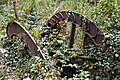 Miller's Dale, old waterwheel.jpg 3,700 × 2,469; 3.71 MB
-
 Miller's Dale, old waterwheels.jpg 3,000 × 2,000; 2.85 MB
-
 Miller's Dale, river Wye.jpg 4,000 × 2,660; 3.89 MB
-
 Millers Dale - footbridge near Ravenstor - geograph.org.uk - 1656361.jpg 480 × 640; 152 KB
-
 Millers Dale along the Monsal Trail - geograph.org.uk - 666.jpg 640 × 480; 49 KB
-
 Millers Dale Limekilns - Draughting Hole - geograph.org.uk - 2854221.jpg 424 × 640; 294 KB
-
 Millers Dale Limekilns - geograph.org.uk - 2854172.jpg 640 × 424; 268 KB
-
 Millers Dale Limekilns - geograph.org.uk - 2854210.jpg 424 × 640; 254 KB
-
 Millers Dale Limekilns - geograph.org.uk - 2854880.jpg 640 × 424; 293 KB
-
 Millers Dale Quarry - geograph.org.uk - 2854267.jpg 640 × 424; 261 KB
-
 Millers Dale viewed from Long Lane - geograph.org.uk - 618557.jpg 640 × 480; 72 KB
-
 Millers Dale, river Wye and footpath.jpg 4,000 × 2,660; 4.36 MB
-
 Monsal Trail, atop the viaduct to the west of Miller's Dale - geograph.org.uk - 5834383.jpg 5,182 × 2,915; 4.26 MB
-
 On the bank of the River Wye - geograph.org.uk - 1765868.jpg 640 × 480; 124 KB
-
 Ordnance Survey Sheet SK 17 Tideswell, Published 1958.jpg 7,208 × 7,867; 5.64 MB
-
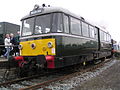 Railbus 79964 at York Railfest.JPG 2,048 × 1,536; 644 KB
-
 River Wye - geograph.org.uk - 1212980.jpg 640 × 480; 184 KB
-
 River Wye - geograph.org.uk - 4797901.jpg 640 × 426; 131 KB
-
 River Wye at Miller's Dale - geograph.org.uk - 1003908.jpg 426 × 640; 147 KB
-
 River Wye at Miller's Dale - geograph.org.uk - 1022211.jpg 640 × 480; 169 KB
-
 River Wye at Miller's Dale - geograph.org.uk - 2289881.jpg 1,024 × 768; 209 KB
-

-

-
 River Wye near Miller's Dale - geograph.org.uk - 1213068.jpg 640 × 480; 182 KB
-
 River Wye near Miller's Dale - geograph.org.uk - 3948749.jpg 1,024 × 697; 299 KB
-
 River Wye, Millers Dale - geograph.org.uk - 1318973.jpg 2,048 × 1,536; 1.51 MB
-
 Road in Miller Dale - geograph.org.uk - 4766032.jpg 640 × 426; 80 KB
-
 Road through Miller's Dale - geograph.org.uk - 2840100.jpg 1,024 × 768; 314 KB
-
 Road to Litton Mill - geograph.org.uk - 2817009.jpg 2,060 × 2,872; 3.31 MB
-
 Road to Litton Mill - geograph.org.uk - 2855137.jpg 640 × 424; 260 KB
-

-
 Top of the pots - geograph.org.uk - 1003935.jpg 640 × 426; 132 KB
-
 View from Long Lane, Limestone Way, approaching Miller's Dale.jpg 4,000 × 2,660; 4.09 MB
-

-

-
 Weir on the River Wye - Millers Dale - geograph.org.uk - 2856362.jpg 4,608 × 3,072; 3.55 MB
-
 Witches Butter fungi in Millers Dale - geograph.org.uk - 618580.jpg 640 × 480; 87 KB
-
 Woodland path by the River Wye - geograph.org.uk - 2840075.jpg 1,024 × 768; 393 KB
-

.jpg)
.jpeg)


.jpg)


.jpg)


