Category:Millbrook, Greater Manchester
Jump to navigation
Jump to search
English: Millbrook is a village near Stalybridge, northwest England. It is part of the Stalybridge South ward of Tameside metropolitan borough.
village in Great Manchester, England | |||||
| Upload media | |||||
| Instance of | |||||
|---|---|---|---|---|---|
| Location | Tameside, Greater Manchester, North West England, England | ||||
 | |||||
Subcategories
This category has the following 4 subcategories, out of 4 total.
Media in category "Millbrook, Greater Manchester"
The following 55 files are in this category, out of 55 total.
-
Brushes - Poplars Road - geograph.org.uk - 1399292.jpg 640 × 480; 176 KB
-
Castle Lane, Micklehurst, Mossley - geograph.org.uk - 2574.jpg 512 × 339; 35 KB
-
Croft Bank - geograph.org.uk - 3205540.jpg 640 × 480; 160 KB
-
Disused Chapel on Fitzroy Street - geograph.org.uk - 3014916.jpg 640 × 480; 544 KB
-
Electricity Pylon at Millbrook - geograph.org.uk - 4777685.jpg 2,728 × 3,818; 2.57 MB
-
Electricity Substation at Spring Bank Lane - geograph.org.uk - 2462601.jpg 1,280 × 960; 790 KB
-
Estate Agents' signs - geograph.org.uk - 3205701.jpg 640 × 480; 159 KB
-
Grouse Butts at Turf Pits - geograph.org.uk - 81545.jpg 640 × 480; 156 KB
-
Hilltop Farm near Millbrook - geograph.org.uk - 4137596.jpg 1,600 × 1,200; 682 KB
-
Housing on Huddersfield Road - geograph.org.uk - 4777689.jpg 2,518 × 1,562; 911 KB
-
Huddersfield Narrow Canal, Grove Road Bridge 96 - geograph.org.uk - 1967354.jpg 3,456 × 2,304; 6.94 MB
-
Huddersfield Road, Millbrook - geograph.org.uk - 1280163.jpg 640 × 480; 132 KB
-
Manor Pharmacy - geograph.org.uk - 3204474.jpg 640 × 543; 141 KB
-
Mill Brook - geograph.org.uk - 3014927.jpg 640 × 480; 473 KB
-
Millbrook - geograph.org.uk - 4637103.jpg 5,184 × 3,456; 2 MB
-
Millbrook Care Centre - geograph.org.uk - 2322447.jpg 640 × 465; 74 KB
-
Millbrook Care Centre - geograph.org.uk - 3204168.jpg 640 × 480; 133 KB
-
Millbrook Care Centre - geograph.org.uk - 3204245.jpg 640 × 480; 151 KB
-
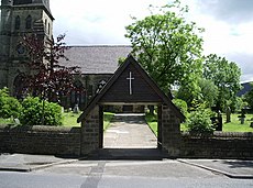
Millbrook Church, Stalybridge - geograph.org.uk - 2582.jpg 480 × 366; 33 KB
-
Millbrook Methodist Chapel - geograph.org.uk - 3204454.jpg 640 × 492; 179 KB
-
Millbrook Post Office - geograph.org.uk - 1280164.jpg 640 × 491; 114 KB
-
Millbrook Post Office and shops - geograph.org.uk - 5969879.jpg 640 × 469; 60 KB
-
Millbrook School - geograph.org.uk - 1280162.jpg 640 × 480; 124 KB
-
Millbrook village - geograph.org.uk - 1631969.jpg 640 × 428; 65 KB
-
Millbrook, Cheshire, Spring-grove Woollen Mill - geograph.org.uk - 1967364.jpg 3,456 × 2,304; 5.91 MB
-
New houses at Millbrook - geograph.org.uk - 3205565.jpg 640 × 480; 142 KB
-
Oakwood Mill - geograph.org.uk - 4635964.jpg 5,099 × 2,918; 1.82 MB
-
Oakwood Mill, Millbrook (geograph 2804701).jpg 423 × 640; 58 KB
-
Old school bell - geograph.org.uk - 3204257.jpg 1,000 × 1,636; 769 KB
-
Path to Cote Farm and Oakwood - geograph.org.uk - 6885635.jpg 4,884 × 3,663; 4.32 MB
-
Royal Oak, Millbrook - geograph.org.uk - 3205425.jpg 640 × 559; 143 KB
-
Sign of the Royal Oak - geograph.org.uk - 3205429.jpg 640 × 640; 244 KB
-
Stayley Cricket Club - Ground - geograph.org.uk - 3235644.jpg 1,600 × 1,200; 292 KB
-
Stayley Cricket Club - Pavilion - geograph.org.uk - 3235645.jpg 1,600 × 1,200; 416 KB
-
Stonemead, Carrbrook - geograph.org.uk - 2578.jpg 512 × 338; 36 KB
-
The Commercial - geograph.org.uk - 3204532.jpg 640 × 464; 151 KB
-
The Commercial at Millbrook - geograph.org.uk - 3014900.jpg 640 × 481; 471 KB
-
The Commercial on Besom Lane, Millbrook - geograph.org.uk - 2993331.jpg 800 × 600; 115 KB
-
The entrance to Shireclough Farm - geograph.org.uk - 1916012.jpg 3,872 × 2,480; 4.31 MB
-
The Hare and Hounds, Millbrook - geograph.org.uk - 4137615.jpg 1,600 × 1,200; 475 KB
-
The Millbrook at Millbrook - geograph.org.uk - 1028383.jpg 640 × 508; 103 KB
-
The Pennine Bridleway near Cooper Farm - geograph.org.uk - 6321677.jpg 4,000 × 3,000; 4.64 MB
-
The Pennine Bridleway near Cooper Farm - geograph.org.uk - 6321678.jpg 4,000 × 3,000; 4.66 MB
-
Towards Millbrook near Stalybridge - geograph.org.uk - 1191262.jpg 640 × 480; 159 KB
-
Track To Millbrook - geograph.org.uk - 1399314.jpg 640 × 480; 210 KB
-
View from the Pennine Bridleway near Cooper Farm - geograph.org.uk - 6321679.jpg 4,000 × 3,000; 4.48 MB
-
Whit Friday Band Contest - geograph.org.uk - 1017804.jpg 640 × 431; 124 KB
-
Copley, Stalybridge - geograph.org.uk - 2584.jpg 512 × 339; 35 KB
-
Frost on Swineshaw Moor - geograph.org.uk - 81552.jpg 640 × 480; 140 KB
-
Mansfield Road, Micklehurst, Mossley - geograph.org.uk - 2573.jpg 512 × 330; 36 KB
-
Millbrook, Stalybridge - geograph.org.uk - 2587.jpg 512 × 328; 36 KB
-
Slatepit Moor - geograph.org.uk - 135883.jpg 640 × 374; 83 KB
-
Swineshaw Moor - geograph.org.uk - 81543.jpg 640 × 480; 142 KB


