Category:Military history of Normandy
Jump to navigation
Jump to search
Administrative regions and territorial collectivity of Metropolitan France (‡ since start of 2016):
Bourgogne-Franche-Comté‡ · Brittany · Centre-Val de Loire · Grand Est‡ · Hauts-de-France‡ · Île-de-France · Normandy‡ · Nouvelle-Aquitaine‡ · Occitania‡ · Pays de la Loire · Provence-Alpes-Côte d'Azur
Bourgogne-Franche-Comté‡ · Brittany · Centre-Val de Loire · Grand Est‡ · Hauts-de-France‡ · Île-de-France · Normandy‡ · Nouvelle-Aquitaine‡ · Occitania‡ · Pays de la Loire · Provence-Alpes-Côte d'Azur
Wikimedia category | |||||
| Upload media | |||||
| Instance of | |||||
|---|---|---|---|---|---|
| |||||
Subcategories
This category has the following 4 subcategories, out of 4 total.
Media in category "Military history of Normandy"
The following 16 files are in this category, out of 16 total.
-
 BattleOfBourgtheroulde.png 1,294 × 676; 209 KB
-
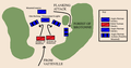 BattleOfBourgtheroulde1124.png 647 × 338; 32 KB
-
 England Normand cavalier 1066 Vinkhuijzen.jpg 558 × 760; 87 KB
-
 EudesParis.jpg 584 × 849; 347 KB
-
 NormanKnight Best.jpg 333 × 500; 36 KB
-
 Pair of Norman soldiers.jpg 1,584 × 2,448; 1.56 MB
-
 Plaque boulevard du 2e et 202 régiment d'infanterie à granville..JPG 640 × 480; 150 KB
-
 Plaque commémorative de la présence du 21e BCP.JPG 640 × 480; 92 KB
-
 Plaque commémorative des anciens combattants 1914-1918 Granville.JPG 640 × 480; 103 KB
-

-

-

-
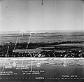 Queen sector Sword Beach.jpg 2,545 × 2,480; 1.11 MB
-
 Remake of WWII photo (14358185493).jpg 4,928 × 2,266; 6.75 MB
-
 Tugdual de Kermoysan dans la chapelle Saint Louis de Formigny - Gros plan.jpg 3,072 × 2,304; 573 KB
-
 Tugdual de Kermoysan dans la chapelle Saint Louis de Formigny. Plan large.jpg 1,913 × 2,994; 976 KB


.JPG)

.jpg)

