Category:Milford Haven
Jump to navigation
Jump to search
Cymraeg: Delweddau Aberdaugleddau, Cymru
English: Images of Milford Haven, Wales
town and community in Pembrokeshire, Wales | |||||
| Upload media | |||||
| Instance of | |||||
|---|---|---|---|---|---|
| Location | Pembrokeshire, Wales | ||||
| Located in or next to body of water | |||||
| Heritage designation |
| ||||
| Population |
| ||||
| official website | |||||
 | |||||
Subcategories
This category has the following 14 subcategories, out of 14 total.
1
A
B
D
- Dragon LNG Terminal (1 F)
G
H
M
- Milford Haven Docks (29 F)
R
- Milford Haven Refinery (6 F)
S
- Scotch Bay Jetty (7 F)
- South Hook LNG Terminal (12 F)
T
Media in category "Milford Haven"
The following 200 files are in this category, out of 640 total.
(previous page) (next page)-
'Avatar' at Milford Haven - geograph.org.uk - 5742200.jpg 1,280 × 851; 388 KB
-
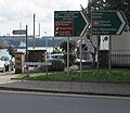
'The Bridge' on the road to Hubberston - geograph.org.uk - 5378535.jpg 640 × 480; 186 KB
-
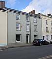
11 Hamilton Terrace Milford Haven - geograph.org.uk - 3108863.jpg 518 × 640; 66 KB
-
2010 Wales Pembrokeshire Community Milford Haven map.svg 512 × 393; 1,018 KB
-
2024 Wales Pembrokeshire Community Milford Haven map.svg 512 × 393; 1.19 MB
-
A blot on Milford Haven - geograph.org.uk - 4214605.jpg 640 × 443; 58 KB
-
A civilised section of the coast path - geograph.org.uk - 846441.jpg 640 × 504; 76 KB
-
A jetty in Milford Haven Marina - geograph.org.uk - 5378554.jpg 480 × 640; 221 KB
-
A plan of Milford Haven in the county of Pembroke south Wales.gif 1,000 × 603; 176 KB
-
A view from below The Rath - geograph.org.uk - 5669582.jpg 5,136 × 2,889; 3.14 MB
-
A4076 north of Steynton, Pembrokeshire - geograph.org.uk - 5530267.jpg 758 × 800; 163 KB
-
Abandoned supermarket trolley - geograph.org.uk - 929179.jpg 640 × 480; 144 KB
-
Aberdaugleddau - Milford Haven - geograph.org.uk - 4487952.jpg 640 × 458; 68 KB
-
Aboard the Jedforest - geograph.org.uk - 6520942.jpg 1,280 × 842; 400 KB
-
Across Gelliswick Bay - geograph.org.uk - 226195.jpg 640 × 480; 82 KB
-
Across Milford Haven Docks - geograph.org.uk - 3777927.jpg 800 × 553; 94 KB
-
Admiralty Chart No 2878 Approaches to Milford Haven, Published 1925.jpg 16,274 × 11,134; 53.99 MB
-
Admiralty Chart No 3274 Milford Haven, Published 1961.jpg 16,276 × 11,125; 65.62 MB
-
Alexanders at Gelliswick Bay - geograph.org.uk - 369714.jpg 640 × 480; 145 KB
-
All dressed up... - geograph.org.uk - 394254.jpg 640 × 506; 117 KB
-
Almost all blue, Milford Haven Marina - geograph.org.uk - 4539264.jpg 640 × 480; 161 KB
-
An eyesore in Milford Haven - geograph.org.uk - 3777903.jpg 800 × 586; 103 KB
-
Anchors outside Milford Haven Museum - geograph.org.uk - 3778088.jpg 800 × 679; 161 KB
-
Angle Bay - geograph.org.uk - 5824533.jpg 1,024 × 768; 100 KB
-
Apatura berthed at Milford Haven - geograph.org.uk - 3558608.jpg 800 × 451; 159 KB
-
Apollo at Milford Haven - geograph.org.uk - 3123228.jpg 4,000 × 3,000; 2.5 MB
-
Approaching Milford Haven station from the Docks, 2004 - geograph.org.uk - 5381092.jpg 2,365 × 1,199; 2.33 MB
-
Bandstand, The Rath, Milford Haven - geograph.org.uk -3 108638.jpg 640 × 412; 54 KB
-
Barallier House B^B, Milford Haven - geograph.org.uk - 3108794.jpg 604 × 640; 63 KB
-
Barallier House B^B, Milford Haven - geograph.org.uk - 5530845.jpg 563 × 800; 77 KB
-
Barclays Bank, Milford Haven - geograph.org.uk - 3108402.jpg 640 × 480; 57 KB
-
Barlow Street, Milford Haven - geograph.org.uk - 5530718.jpg 709 × 800; 105 KB
-
Barrallier House, Milford Haven - geograph.org.uk - 3778286.jpg 800 × 473; 68 KB
-
Bay View Drive, Milford Haven - geograph.org.uk - 3706898.jpg 800 × 575; 85 KB
-
Belhaven House Hotel, Milford Haven - geograph.org.uk - 3108775.jpg 640 × 480; 56 KB
-
Beside Milford Haven Marina - geograph.org.uk - 4539227.jpg 640 × 480; 179 KB
-
Biddis Memorial 2018-10-30 519.jpg 3,072 × 4,608; 4.95 MB
-
Blot on Milford Haven - geograph.org.uk - 4462965.jpg 640 × 480; 91 KB
-
Boat wreck in Castle Pill - geograph.org.uk - 929185.jpg 640 × 480; 115 KB
-
Boundary Stone - geograph.org.uk - 7131478.jpg 1,024 × 768; 414 KB
-
Brett Property, Milford Haven - geograph.org.uk - 3778215.jpg 600 × 800; 97 KB
-
Brick pavement, Milford Haven - geograph.org.uk - 5728957.jpg 800 × 763; 147 KB
-
Bro Deliverer at Milford Haven - geograph.org.uk - 3123280.jpg 4,000 × 3,000; 2.27 MB
-
Bro Granite at Milford Haven - geograph.org.uk - 3123204.jpg 4,000 × 3,000; 2.31 MB
-
Bungalows in Milford Haven - geograph.org.uk - 3707092.jpg 800 × 632; 97 KB
-
Burnyeats Building, Milford Haven - geograph.org.uk - 3778110.jpg 800 × 600; 73 KB
-
Camuset Close, Hakin, Milford Haven - geograph.org.uk - 6333667.jpg 1,600 × 1,060; 326 KB
-
Card Factory in Milford Haven - geograph.org.uk - 5527100.jpg 800 × 626; 100 KB
-
Castle Pill - geograph.org.uk - 1310564.jpg 640 × 480; 99 KB
-
Castle Pill Near Milford Haven - geograph.org.uk - 4824366.jpg 1,600 × 995; 207 KB
-
Castle Pill Road houses, Steynton - geograph.org.uk - 5528180.jpg 800 × 518; 74 KB
-
Celtic Hand Car Wash in Milford Haven - geograph.org.uk - 5526793.jpg 800 × 629; 130 KB
-
Celtic Hand Car Wash, Milford Haven - geograph.org.uk - 3110140.jpg 640 × 508; 82 KB
-
Celtic Hand Car Wash, Milford Haven - geograph.org.uk - 5741302.jpg 1,280 × 851; 561 KB
-
Charles Street, Milford Haven - geograph.org.uk - 2036043.jpg 1,280 × 856; 148 KB
-
Children's play area in Steynton - geograph.org.uk - 5526696.jpg 800 × 600; 138 KB
-
Church in Nantucket Avenue - geograph.org.uk - 6256155.jpg 640 × 480; 43 KB
-
Church nameboard, Steynton - geograph.org.uk - 5528109.jpg 700 × 800; 149 KB
-
Clock on Charles Street, Milford Haven - geograph.org.uk - 5082328.jpg 1,600 × 1,200; 471 KB
-
Coastal defences, Milford Haven - geograph.org.uk - 3706440.jpg 800 × 505; 99 KB
-
Coastal footpath junction, Milford Haven - geograph.org.uk - 3778351.jpg 800 × 600; 155 KB
-
Coastal houses, Milford Haven - geograph.org.uk - 3778262.jpg 800 × 600; 95 KB
-
COCO's Sunset Bar - geograph.org.uk - 6906918.jpg 1,024 × 768; 196 KB
-
Commemorative plaque in Milford Haven - geograph.org.uk - 7039833.jpg 1,024 × 792; 181 KB
-
Conservative Club, Milford Haven - geograph.org.uk - 4217208.jpg 444 × 640; 58 KB
-
Conway Drive, Steynton - geograph.org.uk - 5526706.jpg 800 × 600; 157 KB
-
Crazy But True in Milford Haven - geograph.org.uk - 5526611.jpg 800 × 519; 94 KB
-
Croft Avenue houses, Hakin, Milford Haven - geograph.org.uk - 6086061.jpg 1,024 × 808; 171 KB
-
Cutty Sark Drive, Milford Haven - geograph.org.uk - 5528479.jpg 800 × 592; 133 KB
-
Dale Road houses, Hubberston - geograph.org.uk - 6086136.jpg 1,024 × 708; 194 KB
-
Dartmouth Street, Milford Haven - geograph.org.uk - 5532872.jpg 800 × 787; 132 KB
-
Derelict House In Marine Gardens - geograph.org.uk - 4824397.jpg 4,608 × 3,072; 2.72 MB
-
Development at Milford Haven - geograph.org.uk - 6903372.jpg 535 × 768; 86 KB
-
Development at Milford Haven - geograph.org.uk - 7036249.jpg 1,024 × 683; 180 KB
-
Disembarking PS Waverley at Milford Haven - geograph.org.uk - 3123299.jpg 4,000 × 3,000; 2.85 MB
-
Dock Buildings - geograph.org.uk - 4339553.jpg 4,283 × 2,983; 1.77 MB
-
East along Neyland Road, Steynton - geograph.org.uk - 5526693.jpg 800 × 600; 143 KB
-
Eastleigh Drive, Milford Haven - geograph.org.uk - 5528577.jpg 800 × 604; 94 KB
-
Elizabeth Venmore Court, Milford Haven - geograph.org.uk - 5528648.jpg 800 × 616; 145 KB
-
Endeavour at Milford Haven - geograph.org.uk - 3123282.jpg 4,000 × 3,000; 2.27 MB
-
Exeter Road, Steynton, Milford Haven - geograph.org.uk - 5528320.jpg 800 × 448; 87 KB
-
Fairsea Close, Milford Haven - geograph.org.uk - 3706893.jpg 800 × 611; 100 KB
-
Field gates, Steynton, Milford Haven - geograph.org.uk - 5532260.jpg 800 × 569; 155 KB
-
Fields and Jetties - geograph.org.uk - 1312125.jpg 640 × 480; 60 KB
-
Fields Near Steynton - geograph.org.uk - 4801546.jpg 2,734 × 2,394; 783 KB
-
Fishing boat, Milford Haven dock entrance - geograph.org.uk - 3123197.jpg 4,000 × 3,000; 3.1 MB
-
Floatel Cabins at Milford Marina - geograph.org.uk - 5984286.jpg 1,024 × 684; 145 KB
-
Former Bridge pub in Milford Haven - geograph.org.uk - 5526788.jpg 800 × 697; 132 KB
-
Former Haven Hotel, Milford Haven - geograph.org.uk - 3108902.jpg 640 × 500; 68 KB
-
Former refinery pier, Milford Haven - geograph.org.uk - 211724.jpg 640 × 480; 69 KB
-
Francis Street, Milford Haven - geograph.org.uk - 3108768.jpg 640 × 480; 61 KB
-
Fulke Street, Milford Haven - geograph.org.uk - 3108777.jpg 640 × 502; 54 KB
-
Future Works, Milford Haven - geograph.org.uk - 5540993.jpg 800 × 635; 132 KB
-
Gelliswick Bay at Milford Haven - geograph.org.uk - 6387378.jpg 800 × 480; 82 KB
-
Gelliswick Bay oil pipeline and jetty - geograph.org.uk - 369636.jpg 640 × 404; 58 KB
-
Gelliswick Bay, Milford Haven - geograph.org.uk - 3349133.jpg 640 × 422; 84 KB
-
Gelliswick Road at Gelliswick Bay - geograph.org.uk - 6387394.jpg 800 × 579; 136 KB
-
Ger - Near Gelliswick - geograph.org.uk - 4485990.jpg 640 × 426; 74 KB
-
Great North Road houses, Milford Haven - geograph.org.uk - 5846050.jpg 1,024 × 719; 178 KB
-
Great North Road semis, Milford Haven - geograph.org.uk - 5526617.jpg 693 × 800; 130 KB
-
Green Close, Steynton - geograph.org.uk - 5528133.jpg 800 × 671; 95 KB
-
Green Terrace houses, Hubberston - geograph.org.uk - 6086224.jpg 1,024 × 768; 196 KB
-
Greville 1749 1809.jpg 329 × 400; 21 KB
-
Guggs.JPG 536 × 333; 40 KB
-
Hamilton Terrace, Milford Haven - geograph.org.uk - 2032487.jpg 1,280 × 856; 159 KB
-
Hamilton Terrace, Milford Haven - geograph.org.uk - 2036077.jpg 1,280 × 856; 172 KB
-
Harbour View Milford Haven.JPG 2,640 × 1,744; 1.79 MB
-
Haven Dental Practice in Milford Haven - geograph.org.uk - 5526640.jpg 800 × 532; 118 KB
-
Haven Hotel, Milford Haven - geograph.org.uk - 5532868.jpg 800 × 715; 122 KB
-
Haven's Head Business Park - geograph.org.uk - 5742032.jpg 1,280 × 851; 328 KB
-
Havens Head Business Park, Milford Haven - geograph.org.uk - 5526813.jpg 800 × 599; 102 KB
-
Havens Head Retail Park, Milford Haven - geograph.org.uk - 5611001.jpg 800 × 542; 162 KB
-
Havens Head Retail Park.JPG 3,591 × 1,901; 3.32 MB
-
Heart of Oak B^B, Milford Haven - geograph.org.uk - 4201532.jpg 640 × 428; 57 KB


