Category:Michaelston-le-Pit and Leckwith
Jump to navigation
Jump to search
English: Michaelston-le-Pit and Leckwith is a community in the principal area of the Vale of Glamorgan, in Wales.
community in Vale of Glamorgan, Wales | |||||
| Upload media | |||||
| Instance of | |||||
|---|---|---|---|---|---|
| Location | Vale of Glamorgan, Wales | ||||
| Population |
| ||||
| Area |
| ||||
| official website | |||||
 | |||||
Subcategories
This category has the following 2 subcategories, out of 2 total.
L
M
Media in category "Michaelston-le-Pit and Leckwith"
The following 181 files are in this category, out of 181 total.
-
Barn, Meadowvale Farm - geograph.org.uk - 5846584.jpg 4,288 × 2,848; 2.36 MB
-
Benchmark on bridge over River Cadoxton - geograph.org.uk - 6528507.jpg 530 × 640; 138 KB
-
Bend in Penyturnpike Road, Dinas Powys - geograph.org.uk - 5347907.jpg 800 × 577; 154 KB
-
Branches across footpath, West Hill Wood - geograph.org.uk - 5823315.jpg 4,242 × 2,467; 1.78 MB
-
Bridge near Cwrt-yr-ala - geograph.org.uk - 1822770.jpg 3,296 × 2,472; 1.93 MB
-
Bridge over Bullcroft Brook, Cwrt-yr-ala - geograph.org.uk - 1822773.jpg 3,296 × 2,472; 1.89 MB
-
Brynwell - geograph.org.uk - 5845842.jpg 4,288 × 2,848; 2.06 MB
-
Brynwell - geograph.org.uk - 5845845.jpg 2,848 × 4,288; 1.67 MB
-
Cadoxton River (or Wrinstone Brook^), Michaelston-le-Pit - geograph.org.uk - 1822761.jpg 3,296 × 2,472; 1.91 MB
-
Cattle near Bullcroft Brook - geograph.org.uk - 1822899.jpg 3,296 × 2,472; 1.85 MB
-
Cattle near Michaelston-le-Pit - geograph.org.uk - 2089545.jpg 2,816 × 2,112; 1.98 MB
-
CF Paws van in Michaelston-le-Pit - geograph.org.uk - 5206228.jpg 800 × 567; 127 KB
-
Chained gate on Cock Hill - geograph.org.uk - 5823259.jpg 1,832 × 3,264; 1.61 MB
-
Chapters, Ardwyn Walk, Dinas Powys - geograph.org.uk - 5205462.jpg 800 × 695; 157 KB
-
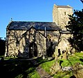
Church of St Michael ^ All Angels, Michaelston-le-Pit - geograph.org.uk - 1822731.jpg 3,296 × 2,472; 1.89 MB
-
Coed Lecwydd - Leckwith Woods - geograph.org.uk - 4387722.jpg 640 × 480; 160 KB
-
Cottages at Leckwith - geograph.org.uk - 5295462.jpg 3,264 × 2,448; 2.94 MB
-
Country lane, Leckwith, leading from Meadowvale Farm - geograph.org.uk - 1814407.jpg 3,296 × 2,472; 1.88 MB
-
Cwm George and Casehill Woods - geograph.org.uk - 4911927.jpg 2,448 × 3,264; 3.92 MB
-
Cwrt yr Ala - geograph.org.uk - 4387970.jpg 640 × 480; 120 KB
-
Cwrt-yr-ala Rd passes beneath the A4232 - geograph.org.uk - 1905889.jpg 3,296 × 2,472; 1.9 MB
-
Cwrt-yr-Ala Road, Michaelston-le-Pit - geograph.org.uk - 5206379.jpg 800 × 600; 130 KB
-
Dilapidated Building - geograph.org.uk - 5295386.jpg 3,264 × 2,448; 3.26 MB
-
Ely Bridge - geograph.org.uk - 5295378.jpg 3,264 × 2,448; 2.24 MB
-
Ely River, Leckwith Road, Cardiff - geograph.org.uk - 2006121.jpg 640 × 480; 95 KB
-
Ely trail near Leckwith, Cardiff - geograph.org.uk - 1951439.jpg 480 × 640; 130 KB
-
Ely Trail, Cardiff - geograph.org.uk - 2006108.jpg 640 × 571; 131 KB
-
Entrance to Meadowvale Farm - geograph.org.uk - 1814413.jpg 3,296 × 2,472; 1.87 MB
-
Escape lane, Leckwith Road - geograph.org.uk - 2042270.jpg 640 × 480; 110 KB
-
Field near Beggan - geograph.org.uk - 5809266.jpg 4,288 × 2,848; 1.71 MB
-
Field near Beggan - geograph.org.uk - 5823360.jpg 4,288 × 2,848; 1.74 MB
-
Field near Beggan - geograph.org.uk - 5823365.jpg 4,216 × 2,802; 1.85 MB
-
Field near Meadowvale Farm - geograph.org.uk - 5846424.jpg 4,261 × 2,291; 1.54 MB
-
Field, Brynwell - geograph.org.uk - 5846282.jpg 4,288 × 2,848; 1.63 MB
-
Field, Brynwell - geograph.org.uk - 5846345.jpg 4,288 × 2,848; 1.8 MB
-
Fields near Beggan - geograph.org.uk - 5845825.jpg 3,260 × 2,087; 918 KB
-
Footpath and fields near Michaelstone-le-Pit - geograph.org.uk - 2816910.jpg 4,000 × 3,000; 3.01 MB
-
Footpath and fields near Michaelstone-le-Pit - geograph.org.uk - 2816921.jpg 4,000 × 3,000; 3.49 MB
-
Footpath and signpost, Leckwith - geograph.org.uk - 1814395.jpg 3,296 × 2,472; 1.88 MB
-
Footpath near Beggan - geograph.org.uk - 5845821.jpg 4,288 × 2,848; 2.25 MB
-
Footpath near Dinas Powys woods - geograph.org.uk - 2816903.jpg 4,000 × 3,000; 4.13 MB
-
Footpath near Michaelstone-le-Pit - geograph.org.uk - 2816917.jpg 4,000 × 3,000; 3.34 MB
-
Footpath steps, Michaelston-le-Pit - geograph.org.uk - 1822748.jpg 3,296 × 2,472; 1.94 MB
-
Footpath to Cwrt-yr-ala - geograph.org.uk - 5846482.jpg 4,288 × 2,848; 1.97 MB
-
Footpath, West Hill Wood - geograph.org.uk - 5823340.jpg 2,848 × 4,288; 1.93 MB
-
Footpath, West Hill Wood - geograph.org.uk - 5823349.jpg 2,848 × 4,288; 2.71 MB
-
Gate near Meadowvale Farm - geograph.org.uk - 5846629.jpg 4,288 × 2,848; 2.16 MB
-
Gate on Cock Hill - geograph.org.uk - 5823224.jpg 3,264 × 1,832; 1.2 MB
-
Gates, Meadowvale Farm - geograph.org.uk - 5846601.jpg 4,288 × 2,848; 1.12 MB
-
Gateway to Cwrt-yr-ala House - geograph.org.uk - 1822789.jpg 3,296 × 2,472; 1.84 MB
-
Ger - Near Leckwith Hill Farm - geograph.org.uk - 4387727.jpg 640 × 480; 76 KB
-
Hen Eglwys, Leckwith - geograph.org.uk - 2042320.jpg 640 × 480; 107 KB
-
Heol Lecwydd - Leckwith Road - geograph.org.uk - 4387723.jpg 640 × 480; 120 KB
-
Houses in Michaelston-le-Pit - geograph.org.uk - 2089539.jpg 2,816 × 2,112; 1.95 MB
-
Houses near Meadowvale Farm - geograph.org.uk - 5846616.jpg 4,145 × 2,671; 1.5 MB
-
Inside the pillbox near Michaelston le Pit - geograph.org.uk - 1822692.jpg 3,296 × 2,472; 1.78 MB
-
Iron Age Earthworks - geograph.org.uk - 4911937.jpg 3,264 × 2,448; 4.18 MB
-
Iron Age Earthworks - geograph.org.uk - 4911941.jpg 3,264 × 2,448; 4.67 MB
-
Junction on the B4267 - geograph.org.uk - 1988429.jpg 640 × 480; 102 KB
-
Lane past abandoned buildings at Brynwell - geograph.org.uk - 2089549.jpg 2,816 × 2,112; 1.85 MB
-
Lane past abandoned buildings at Brynwell - geograph.org.uk - 2089551.jpg 2,816 × 2,112; 1.95 MB
-
Langcross Farm - geograph.org.uk - 5295388.jpg 3,264 × 2,448; 3.59 MB
-
Lay-by, Leckwith Road - geograph.org.uk - 2042526.jpg 640 × 480; 92 KB
-
Leckwith Bridge House - geograph.org.uk - 5822749.jpg 3,642 × 2,221; 1.17 MB
-
Leckwith Bridge House, Cardiff - geograph.org.uk - 2010099.jpg 640 × 480; 104 KB
-
Leckwith Concrete Products, Cardiff - geograph.org.uk - 2006116.jpg 640 × 480; 118 KB
-
Leckwith Road , the long climb - geograph.org.uk - 2042263.jpg 640 × 480; 98 KB
-
Leckwith Road approaches Leckwith - geograph.org.uk - 2042276.jpg 640 × 480; 115 KB
-
Leckwith Road reaches Vale of Glamorgan - geograph.org.uk - 2042260.jpg 640 × 480; 118 KB
-
Leckwith Road, Cardiff - geograph.org.uk - 2006100.jpg 640 × 426; 79 KB
-
Leckwith Woods - geograph.org.uk - 5822818.jpg 2,848 × 4,288; 2.08 MB
-
Leckwith Woods - geograph.org.uk - 5822834.jpg 2,700 × 3,426; 1.46 MB
-
Leckwith Woods - geograph.org.uk - 5822868.jpg 2,848 × 4,288; 2.73 MB
-
Leckwith Woods - geograph.org.uk - 5822984.jpg 640 × 401; 160 KB
-
Leckwith Woods, Cardiff - geograph.org.uk - 2005947.jpg 640 × 361; 53 KB
-
Lon Cwrt Ynyston, Leckwith - geograph.org.uk - 2042302.jpg 640 × 445; 64 KB
-
Looking across the valley from Cwrt-yr-ala - geograph.org.uk - 1822895.jpg 3,296 × 2,472; 1.93 MB
-
Michaelston-le-Pit cottages - geograph.org.uk - 5207267.jpg 800 × 680; 130 KB
-
Michaelston-le-Pit houses - geograph.org.uk - 5207063.jpg 800 × 464; 103 KB
-
Mill Farm access road, Dinas Powys - geograph.org.uk - 5347897.jpg 800 × 573; 144 KB
-
Muddy lane and field entrance - geograph.org.uk - 6032683.jpg 3,264 × 2,448; 2.64 MB
-
Oaklands, Dinas Powys - geograph.org.uk - 5205417.jpg 800 × 548; 138 KB
-
Old Leckwith Bridge - geograph.org.uk - 5822703.jpg 3,264 × 1,832; 974 KB
-
Old Leckwith Bridge - geograph.org.uk - 5822705.jpg 4,282 × 2,658; 1.4 MB
-
Old Leckwith bridge - geograph.org.uk - 6506959.jpg 1,536 × 2,048; 1.5 MB
-
On Cock Hill - geograph.org.uk - 5823007.jpg 3,137 × 1,600; 719 KB
-
Orchard House, Michaelston-le-Pit - geograph.org.uk - 5206307.jpg 800 × 664; 109 KB
-
Ordnance Survey Cut Mark - geograph.org.uk - 6964422.jpg 1,024 × 716; 205 KB
-
Ordnance Survey Cut Mark - geograph.org.uk - 6964423.jpg 1,024 × 610; 285 KB
-
Ordnance Survey Cut Mark - geograph.org.uk - 6964433.jpg 1,024 × 786; 373 KB
-
Ordnance Survey Rivet - geograph.org.uk - 6964437.jpg 1,024 × 595; 211 KB
-
Overgrown path, Brynwell - geograph.org.uk - 5846274.jpg 2,848 × 4,288; 1.6 MB
-
Park Road, Dinas Powys - geograph.org.uk - 5205167.jpg 800 × 583; 138 KB
-
Pasture land near Brynwell - geograph.org.uk - 5845832.jpg 4,059 × 2,478; 1.92 MB
-
Path into Leckwith Woods - geograph.org.uk - 5822990.jpg 3,264 × 1,832; 1.38 MB
-
Path junction, Leckwith Woods - geograph.org.uk - 5822791.jpg 2,848 × 4,288; 2.68 MB
-
Path near Brynwell - geograph.org.uk - 5846385.jpg 2,848 × 4,288; 1.13 MB
-
Pen-y-Turnpike Road - geograph.org.uk - 2042372.jpg 640 × 480; 94 KB
-
Pen-y-Turnpike Road - geograph.org.uk - 5295395.jpg 2,448 × 3,264; 3.32 MB
-
Pillbox near Michaelston le Pit - geograph.org.uk - 1822671.jpg 3,296 × 2,472; 1.95 MB
-
Ploughed fields near Michaelston-le-Pit - geograph.org.uk - 2089536.jpg 2,816 × 2,112; 1.63 MB
-
Recently built house near Dinas Powys - geograph.org.uk - 5347920.jpg 800 × 515; 109 KB
-
Rectory Lodge, Llandough - geograph.org.uk - 2042559.jpg 640 × 480; 78 KB
-
Red House - geograph.org.uk - 4911949.jpg 3,264 × 2,448; 1.8 MB
-
River Ely and Ely Trail, Cardiff - geograph.org.uk - 1923719.jpg 640 × 480; 113 KB
-
Road near Cwrt-yr-ala - geograph.org.uk - 3308423.jpg 640 × 480; 122 KB
-
Ruined building - geograph.org.uk - 1814440.jpg 3,296 × 2,472; 1.96 MB
-
Salmon Leap at Cwrt-yr-ala - geograph.org.uk - 3308437.jpg 640 × 480; 94 KB
-
Salmon leap near Cwrt-yr-ala - geograph.org.uk - 1822799.jpg 3,296 × 2,472; 1.94 MB
-
Salmon leap, near Cwrt-yr-ala - geograph.org.uk - 1822805.jpg 3,296 × 2,472; 1.97 MB
-
Salmon leaps - weir at Michaelstone-le-Pit - geograph.org.uk - 2816914.jpg 4,000 × 3,000; 3.3 MB
-
Salmon leaps, Cwrt-yr-ala - geograph.org.uk - 1822823.jpg 3,296 × 2,472; 1.94 MB
-
Semis on the north side of Leckwith Road - geograph.org.uk - 2042341.jpg 640 × 563; 114 KB
-
Snowy field near Dinas Powys - geograph.org.uk - 3307299.jpg 640 × 480; 59 KB
-
Snowy fields near Michaelston-le-Pit - geograph.org.uk - 3307303.jpg 640 × 480; 36 KB
-
St.James, Leckwith - geograph.org.uk - 5295466.jpg 3,264 × 2,448; 2.76 MB
-
St.Michael's Church - geograph.org.uk - 5348718.jpg 3,264 × 2,448; 2.41 MB
-
Stile and Woodland - geograph.org.uk - 5348721.jpg 3,264 × 2,448; 3.72 MB
-
Stile beside gate on Cock Hill - geograph.org.uk - 5823275.jpg 1,832 × 3,264; 1.5 MB
-
Stile near Cwrt-yr-ala - geograph.org.uk - 1822842.jpg 3,296 × 2,472; 1.92 MB
-
Stile near Meadowvale Farm - geograph.org.uk - 5846393.jpg 4,288 × 2,848; 1.62 MB
-
Stile near Meadowvale Farm, Leckwith - geograph.org.uk - 1814417.jpg 3,296 × 2,472; 1.83 MB
-
Stile, Brynwell - geograph.org.uk - 5846253.jpg 4,288 × 2,848; 1.84 MB
-
Stile, West Hill Wood - geograph.org.uk - 5823297.jpg 4,103 × 2,629; 1.78 MB
-
Stile, West Hill Wood - geograph.org.uk - 5823305.jpg 4,288 × 2,848; 1.25 MB
-
The Courtyard, Michaelston-le-Pit - geograph.org.uk - 5206365.jpg 800 × 567; 117 KB
-
The Green, Leckwith, nr. Cardiff - geograph.org.uk - 1988432.jpg 640 × 480; 65 KB
-
The stand at Caerau ^ Ely AFC's ground - geograph.org.uk - 1905898.jpg 3,296 × 2,472; 1.93 MB
-
The view south from Leckwith Road - geograph.org.uk - 2042307.jpg 640 × 480; 90 KB
-
The western end of the Salmon Leaps, near Cwrt-yr-ala - geograph.org.uk - 1822844.jpg 3,296 × 2,472; 1.94 MB
-
Track and gates near Meadowvale Farm, Leckwith - geograph.org.uk - 1814423.jpg 3,296 × 2,472; 1.83 MB
-
Track to a field - geograph.org.uk - 2042535.jpg 480 × 640; 135 KB
-
Trailers near Langcross Farm - geograph.org.uk - 5846641.jpg 4,288 × 2,848; 1.84 MB
-
Trees near Meadowvale Farm - geograph.org.uk - 5846548.jpg 4,081 × 2,657; 1.38 MB
-
Tuag at - Towards Caerau - geograph.org.uk - 4387715.jpg 640 × 480; 93 KB
-
Turnpike Close, Dinas Powys - geograph.org.uk - 5205427.jpg 800 × 638; 127 KB
-
Two Leckwith bridges - geograph.org.uk - 6506962.jpg 2,046 × 1,536; 1.34 MB
-
Unofficial rubbish disposal site, Cwrt-yr-ala Rd, Cardiff - geograph.org.uk - 1905908.jpg 3,296 × 2,472; 1.94 MB
-
Up Pen-y-Turnpike Road, Dinas Powys - geograph.org.uk - 5291678.jpg 800 × 529; 107 KB
-
View towards Michaelston-le-Pit - geograph.org.uk - 3307308.jpg 640 × 480; 35 KB
-
Wales Vale of Glamorgan Community Michaelston map.svg 512 × 322; 401 KB
-
Weir at Wrinstone Brook - geograph.org.uk - 4916100.jpg 3,264 × 2,448; 2.94 MB
-
Western edge of Leckwith - geograph.org.uk - 2042361.jpg 640 × 480; 98 KB
-
White houses, Park Road, Dinas Powys - geograph.org.uk - 5205389.jpg 800 × 642; 151 KB
-
Wooden Steps - geograph.org.uk - 4911932.jpg 3,264 × 2,448; 4.35 MB
-
Woodland Lane, Leckwith - geograph.org.uk - 2042293.jpg 640 × 480; 93 KB
-
Woodland, Leckwith - geograph.org.uk - 1814402.jpg 3,296 × 2,472; 1.93 MB
-
Wrinstone Brook - geograph.org.uk - 3308457.jpg 640 × 480; 134 KB
-
Wrinstone Brook in Michaelston-le-Pit - geograph.org.uk - 2089542.jpg 2,816 × 2,112; 2.28 MB
-
Yard, Langcross Farm - geograph.org.uk - 5846645.jpg 4,288 × 2,848; 1.32 MB
-
Ynyston Farm - geograph.org.uk - 5295380.jpg 3,264 × 2,448; 1.86 MB
-
Ynyston Farm - geograph.org.uk - 5295457.jpg 3,264 × 2,448; 1.98 MB


