Category:Menhirs de Clendy
Jump to navigation
Jump to search
| Object location | | View all coordinates using: OpenStreetMap |
|---|
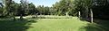
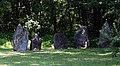
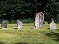
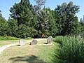
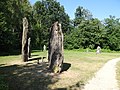
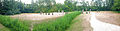
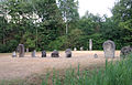
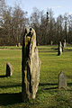
archaeological site in Yverdon-les-Bains in the canton of Vaud, Switzerland  | |||||
| Upload media | |||||
| Instance of | |||||
|---|---|---|---|---|---|
| Part of | |||||
| Location |
| ||||
| Street address |
| ||||
| Heritage designation |
| ||||
 | |||||
Media in category "Menhirs de Clendy"
The following 50 files are in this category, out of 50 total.
-
 2006-Yverdon-Menhirs.jpg 1,280 × 1,920; 3 MB
-
 Alignement Clendy.jpg 1,500 × 442; 182 KB
-
 Alignement de Clendy.jpg 14,774 × 4,971; 65.05 MB
-
 Alignement des menhirs de Clendy.jpg 2,000 × 383; 242 KB
-
 Alignement von Clendy 01.jpg 4,645 × 3,010; 4.35 MB
-
 Alignement von Clendy 02.jpg 4,848 × 2,686; 3.82 MB
-
 Alignement von Clendy 03.jpg 4,896 × 3,672; 7.58 MB
-
 Alignement von Clendy 04.jpg 4,912 × 1,080; 2.31 MB
-
 Alignement von Clendy 05.jpg 4,912 × 1,080; 2.23 MB
-
 Alignement von Clendy 06.jpg 3,672 × 4,896; 6.62 MB
-
 Alignement von Clendy 07.jpg 4,896 × 3,672; 6.7 MB
-
 Alignement von Clendy 08.jpg 4,896 × 3,672; 6.73 MB
-
 Alignement von Clendy 09.jpg 3,672 × 4,896; 6.38 MB
-
 Alignement von Clendy 10.jpg 4,896 × 3,672; 7.07 MB
-
 Alignement von Clendy 11.jpg 4,896 × 3,672; 7.68 MB
-
 Alignement von Clendy 12.jpg 4,896 × 3,672; 7.58 MB
-
 Alignement von Clendy 13.jpg 3,672 × 4,896; 6.63 MB
-
 Alignement von Clendy 14.jpg 4,896 × 3,672; 7.23 MB
-
 Alignement von Clendy 15.jpg 4,896 × 3,672; 5.87 MB
-
 Menhirs de Clendy - 0981.jpg 9,152 × 2,346; 18.06 MB
-
 Menhirs de Clendy - 0983.jpg 6,272 × 2,032; 10.23 MB
-
 Menhirs de Clendy - 0984.jpg 3,264 × 2,094; 5.06 MB
-
 Picswiss VD-47-48.jpg 300 × 450; 65 KB
-
 Picswiss VD-47-49.jpg 300 × 450; 54 KB
-
 Picswiss VD-47-50.jpg 300 × 450; 64 KB
-
 Picswiss VD-47-51.jpg 300 × 450; 61 KB
-
 Picswiss VD-47-79.jpg 300 × 450; 67 KB
-
 Soleil posée sur un menhir de clendy.jpg 2,587 × 1,931; 4.32 MB
-
 Yverdon stone rows.jpg 1,024 × 768; 315 KB
-
 Yverdon-Clendy - 1 von 17.jpg 5,184 × 3,456; 6.02 MB
-
 Yverdon-Clendy - 10 von 17.jpg 5,184 × 3,456; 4.96 MB
-
 Yverdon-Clendy - 11 von 17.jpg 5,184 × 3,456; 5.87 MB
-
 Yverdon-Clendy - 12 von 17.jpg 5,184 × 3,456; 4.96 MB
-
 Yverdon-Clendy - 13 von 17.jpg 5,184 × 3,456; 6.5 MB
-
 Yverdon-Clendy - 14 von 17.jpg 5,184 × 3,456; 7.2 MB
-
 Yverdon-Clendy - 15 von 17.jpg 3,456 × 5,184; 6.32 MB
-
 Yverdon-Clendy - 16 von 17.jpg 3,456 × 5,184; 5.29 MB
-
 Yverdon-Clendy - 17 von 17.jpg 3,152 × 5,030; 4.58 MB
-
 Yverdon-Clendy - 2 von 17.jpg 5,184 × 3,456; 6.89 MB
-
 Yverdon-Clendy - 3 von 17.jpg 5,184 × 3,456; 6.08 MB
-
 Yverdon-Clendy - 4 von 17.jpg 5,184 × 3,456; 7.65 MB
-
 Yverdon-Clendy - 5 von 17.jpg 5,184 × 3,456; 3.78 MB
-
 Yverdon-Clendy - 6 von 17.jpg 5,184 × 3,456; 4.93 MB
-
 Yverdon-Clendy - 7 von 17.jpg 5,184 × 3,456; 5.05 MB
-
 Yverdon-Clendy - 8 von 17.jpg 5,184 × 3,456; 5.87 MB
-
 Yverdon-Clendy - 9 von 17.jpg 5,184 × 3,456; 5.74 MB
-
 Yverdon-Clendy, Switzerland (p6080566-8).jpg 810 × 422; 131 KB
-
 Yverdon-Clendy-01.jpg 400 × 600; 101 KB
-
 Yverdon-Clendy-02.jpg 400 × 600; 114 KB
-
 Yverdon-Clendy-03.jpg 533 × 800; 186 KB


.jpg)

