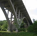
Category:Mendota Bridge
Jump to navigation
Jump to search
|
This is a category about a place or building that is listed on the National Register of Historic Places in the United States of America. Its reference number is 78001534. |
bridge in Mendota Heights and Fort Snelling, Minnesota | |||||
| Upload media | |||||
| Instance of | |||||
|---|---|---|---|---|---|
| Located in protected area | |||||
| Location |
| ||||
| Maintained by | |||||
| Crosses | |||||
| Carries |
| ||||
| Heritage designation |
| ||||
| Inception |
| ||||
| Date of official opening |
| ||||
| Length |
| ||||
 | |||||
Media in category "Mendota Bridge"
The following 29 files are in this category, out of 29 total.
-
Aerial view of Mendota Bridge and historic Fort Snelling 2019-05-26.jpg 4,329 × 1,443; 2.32 MB
-
Aerial View of the Mendota Bridge - DPLA - 2b3badb190d1163a69f0e53379c1360e.jpg 2,919 × 2,222; 796 KB
-
Fort Snelling - panoramio (16).jpg 3,728 × 2,093; 4.31 MB
-
Mendota Bridge - panoramio (1).jpg 4,128 × 2,322; 4.93 MB
-
Mendota Bridge - panoramio (10).jpg 4,128 × 2,322; 4.27 MB
-
Mendota Bridge - panoramio (2).jpg 4,128 × 2,322; 5.77 MB
-
Mendota Bridge - panoramio (3).jpg 4,128 × 2,322; 3.34 MB
-
Mendota Bridge - panoramio (4).jpg 4,128 × 2,322; 5.19 MB
-
Mendota Bridge - panoramio (5).jpg 4,128 × 2,322; 4.28 MB
-
Mendota Bridge - panoramio (6).jpg 4,128 × 2,322; 5.08 MB
-
Mendota Bridge - panoramio (7).jpg 4,128 × 2,322; 4.66 MB
-
Mendota Bridge - panoramio (8).jpg 2,322 × 4,128; 3.41 MB
-
Mendota Bridge - panoramio (9).jpg 2,834 × 1,597; 2.65 MB
-
Mendota Bridge - panoramio.jpg 4,128 × 2,322; 3.12 MB
-
Mendota Bridge from Picnic Island.jpg 2,519 × 1,354; 3.73 MB
-
Mendota Bridge golden hour.jpg 2,372 × 1,873; 791 KB
-
Mendota Bridge over old channel.jpg 2,520 × 1,436; 2.84 MB
-
Mendota Bridge plaque.jpg 2,147 × 1,635; 3.02 MB
-
Mendota Bridge underside.jpg 2,526 × 1,872; 720 KB
-
Mendota Bridge.jpg 2,536 × 1,652; 3.17 MB
-
Mendota, MN - panoramio (5).jpg 4,128 × 2,322; 5.49 MB
-
MendotaBridge-underneath.jpg 800 × 782; 127 KB
-
MendotaBridge1.jpg 915 × 400; 94 KB
-
MendotaBridge2.jpg 800 × 440; 103 KB
-
MendotaBridge8.jpg 1,000 × 583; 123 KB
-
MN-13 MN-110 and MN-13 Split.jpg 4,608 × 3,456; 3.13 MB
-
MN13nMN110n-MN55eMN13sSigns - At MN62end (29809154286).jpg 2,400 × 1,600; 1.57 MB
-
Under the Mendota Bridge (Highway 55), Fort Snelling State Park, Bridge Deck (42393120331).jpg 5,969 × 3,939; 12.36 MB
Categories:
- Fort Snelling State Park
- Mendota, Minnesota
- Bridges in Dakota County, Minnesota
- National Register of Historic Places in Dakota County, Minnesota
- Bridges on the National Register of Historic Places in Hennepin County, Minnesota
- Bridges over the Minnesota River
- Concrete deck arch bridges in Minnesota
- Road bridges in Minnesota
- Built in Minnesota in 1926
- Built in Minnesota in 1994
- 1920s bridges in Minnesota
- 1990s bridges in Minnesota
- Road bridges in the United States completed in 1926
- Road bridges in the United States completed in 1994
- Bridges over railway lines in Minnesota
- Freeway bridges in the United States
- 1.2-kilometer bridges in the United States
- Minnesota State Highway 55
- Minnesota State Highway 62
- Highway bridges in the United States
- Bridges across county lines
- Great River Road in Minnesota


