Category:Meghalaya subtropical forests ecoregion
Jump to navigation
Jump to search
Ecoregion (WWF) | |||||
| Upload media | |||||
| Instance of | |||||
|---|---|---|---|---|---|
| Location |
| ||||
| Area |
| ||||
| |||||
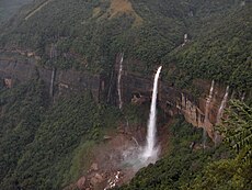
The Meghalaya Subtropical Forests Ecoregion is a designated ecoregion by WWF and One Earth. It is classified as a Tropical & Subtropical Moist Broadleaf Forests Biome. It is one of seven ecoregions in the North Indian Tropical Forests & Sundarbans Bioregion.
Subcategories
This category has the following 12 subcategories, out of 12 total.
A
B
- Balphakram National Park (10 F)
G
H
K
- Khrang Suri Falls (15 F)
L
M
- Mawphlang Sacred Groves (47 F)
N
- Narpuh Reserved Forest (1 F)
- Nohkalikai Falls (73 F)
- Nohsngithiang Falls (46 F)
- Nokrek National Park (15 F)
Media in category "Meghalaya subtropical forests ecoregion"
The following 122 files are in this category, out of 122 total.
-
1 Khashia by Shakir Ahmed.JPG 640 × 404; 326 KB
-
A shoe-lace like snake.jpg 1,932 × 2,576; 2.21 MB
-
A view from South Khasi hills looking towards Bangladesh 01.jpg 4,032 × 3,024; 2.55 MB
-
A view of lower valley, hills and upper plateau, Nongrum Meghalaya India.jpg 4,288 × 2,848; 2.01 MB
-
A white Malvales flower (India, 2017).jpg 2,576 × 1,932; 1.59 MB
-
A wild flower in Shillong.jpg 6,000 × 4,000; 6.26 MB
-
Ampelophaga khasiana, female, underside. India, Jaintia Hills.jpg 1,600 × 1,067; 147 KB
-
Ampelophaga khasiana, female, upperside. India, Jaintia Hills.jpg 1,600 × 1,067; 118 KB
-
Ancient monoliths in Mawphlang sacred grove.jpg 3,456 × 5,184; 10.17 MB
-
Blue Peacock (Papilio arcturus) (8364842473).jpg 2,950 × 2,495; 2.35 MB
-
Cherapunji 1.jpg 2,048 × 1,229; 1.88 MB
-
Cherrapunjee (7159000133).jpg 3,630 × 3,154; 3.18 MB
-
Cherrapunjee Landscape (7344206642).jpg 4,928 × 3,264; 4.41 MB
-
Cherrapunjee Rain Forests (7158995367).jpg 3,985 × 2,799; 4.95 MB
-
Cherrapunjee Rain Forests (7158995667).jpg 4,928 × 3,264; 8.9 MB
-
Cherrapunjee Rain Forests (7158996145).jpg 3,912 × 3,264; 5.42 MB
-
Cherrapunjee Rain Forests (7344204344).jpg 3,471 × 2,480; 2.15 MB
-
Cherrapunjee.jpg 2,048 × 1,536; 751 KB
-
CHERRAPUNJI ROADS ON BEAUTIFUL MOUNTAINS.jpg 3,648 × 2,736; 4.35 MB
-
Cherrapunji, Meghalaya 2.jpg 4,320 × 2,432; 4.46 MB
-
Cherrapunji, Meghalaya 3.jpg 4,320 × 2,432; 4.08 MB
-
Cherrapunji, Meghalaya.jpg 3,648 × 2,736; 4.29 MB
-
Cherrapunji, Shillong.jpg 4,048 × 3,036; 2.29 MB
-
Communication Poverty.jpg 1,024 × 768; 612 KB
-
Davidraju Garo Hills (11).jpg 3,456 × 5,184; 5.39 MB
-
Day4@Shillong.jpg 5,344 × 3,006; 4.4 MB
-
Day5@Shillong.jpg 5,344 × 3,006; 4.3 MB
-
Day7@Shillong.jpg 5,344 × 3,006; 8.43 MB
-
Dragon Plant.jpg 3,120 × 4,160; 3.19 MB
-
East Khasi Hills.jpg 4,681 × 2,508; 6.18 MB
-
Elephant Falls (7158994883).jpg 4,365 × 3,264; 3.99 MB
-
Elephant Falls (7344202396).jpg 4,928 × 3,264; 5.64 MB
-
Every realm of nature is marvellous.jpg 4,032 × 3,024; 2.44 MB
-
Flaura and Fauna in Shillong,Meghalaya.jpg 4,608 × 3,456; 3.42 MB
-
Flora of shillong.jpg 3,264 × 2,448; 1.93 MB
-
Forest in East Khashi hills district Forest in East Khashi hills district JEG7602.jpg 3,264 × 4,928; 3.97 MB
-
Forest in East Khashi hills district JEG7530.jpg 3,264 × 4,928; 6.91 MB
-
Forest in East Khashi hills district JEG7531.jpg 4,928 × 3,264; 7.54 MB
-
Forest in East Khashi hills district JEG7532.jpg 3,264 × 4,928; 7.84 MB
-
Forest in East Khashi hills district JEG7535.jpg 4,928 × 3,264; 7.4 MB
-
Forest in East Khashi hills district JEG7603.jpg 3,264 × 4,928; 5.23 MB
-
Forest in East Khashi hills district JEG7605.jpg 3,264 × 4,928; 5.48 MB
-
Gibbon Hoolock de l'ouest.JPG 1,927 × 1,343; 636 KB
-
Hill near Shillong, Meghalya, India.jpg 6,000 × 4,000; 10.37 MB
-
Hills of Cherrapunjee (7344211154) (cropped).jpg 4,154 × 594; 489 KB
-
Hills of Cherrapunjee (7344211154).jpg 4,157 × 2,652; 1.21 MB
-
Hills of Shillong.jpg 4,032 × 3,024; 5.28 MB
-
Ind-BD border at Piyain River.JPG 2,272 × 1,704; 881 KB
-
Jaflong Sylhet Bangladesh (14).JPG 2,048 × 1,536; 1.36 MB
-
Jaflong Sylhet Bangladesh (19).JPG 2,048 × 1,536; 1.33 MB
-
Jaflong sylhet.jpg 2,048 × 1,536; 1.32 MB
-
Jhum cultivation in Nokrek Biosphere Reserve Meghalaya India Northeast India 2004.jpg 2,080 × 1,368; 673 KB
-
Khasi hills bent-toed gecko.jpg 2,652 × 1,804; 2.26 MB
-
Khasi Hills, Mawphlang.jpg 4,896 × 3,672; 6.77 MB
-
Khasi hills.jpg 4,928 × 3,264; 2.68 MB
-
Krang Suri Falls 1.jpg 2,048 × 1,536; 1.28 MB
-
Krang Suri Falls 4.jpg 2,048 × 1,229; 1.37 MB
-
Kukon, Meghalaya, India 2008.jpg 4,288 × 2,848; 2.25 MB
-
Langshiang Falls Located in Sangriang, Nongstoin.jpg 6,000 × 4,000; 10.56 MB
-
Mawkdok Dympep Valley.jpg 4,160 × 3,120; 2.13 MB
-
Mawphlang Sacred Forest, Mawphlang, Meghalaya.jpg 3,264 × 1,840; 2.08 MB
-
Mawphlang village.jpg 5,184 × 3,456; 4.35 MB
-
Mawsmai Nongthymmai Eco park.jpg 3,456 × 5,184; 3.56 MB
-
Meghalaya (7158997463).jpg 4,928 × 3,264; 2.92 MB
-
Meghalaya (7344203558).jpg 4,928 × 3,264; 3.74 MB
-
Meghalaya (7344210298).jpg 3,189 × 2,762; 1.68 MB
-
Meghalaya Abode of the Clouds India Nature in Laitmawsiang Landscape.jpg 4,050 × 2,700; 2.32 MB
-
Meghalaya.jpg 1,600 × 1,200; 1.26 MB
-
MeghalayaClouds.jpg 3,864 × 1,944; 1.9 MB
-
MG 1427 Silver-eared Mesia.jpg 1,279 × 853; 562 KB
-
MG 1497 Rufous-Gorgeted Flycatcher.jpg 1,542 × 1,028; 363 KB
-
MG 1671 Streak-breasted Scimitar Babbler.jpg 2,065 × 1,377; 730 KB
-
Mini falls.jpg 4,160 × 3,120; 5.97 MB
-
Mountainview 2.jpg 1,280 × 720; 87 KB
-
Mountainview.jpg 1,280 × 720; 127 KB
-
Nature and Agriculture in Mawphlang Kukon Meghalaya India.jpg 7,987 × 3,246; 6.31 MB
-
Nature Forests Rivers Cherrapunjee Landscape Meghalaya India.jpg 4,928 × 3,264; 17.46 MB
-
Nature Scenic Landscape Meghalaya Laitmawsiang India July 2011.jpg 4,050 × 2,700; 2.91 MB
-
Near Shillong Meghalaya India.jpg 4,010 × 3,007; 8.16 MB
-
NOH KA LIKAI FALLS ( shillong).jpg 3,240 × 4,320; 4.62 MB
-
Nohkalikai Falls .jpg 5,171 × 3,433; 2.25 MB
-
Nohkalikai Falls Cherrapunji.JPG 3,648 × 2,736; 8.69 MB
-
Nohkalikai Falls.JPG 3,264 × 2,448; 2.65 MB
-
Of mountains and valleys.jpg 4,928 × 3,264; 4.26 MB
-
Pair of flower.jpg 960 × 540; 84 KB
-
Pitcher Plant of Mawlynnong, Meghalaya.jpg 3,849 × 5,773; 1 MB
-
Pitcher Plant Sanctuary at Baghmara.jpg 480 × 360; 58 KB
-
Piyain River (8).jpg 4,600 × 3,059; 9.97 MB
-
Pparis449.JPG 3,057 × 1,841; 897 KB
-
Root Bridge,Mawlynong, East Khashi Hills.jpg 5,152 × 2,896; 3.47 MB
-
Sacred forest, Mawphlang, Meghalaya.jpg 4,640 × 3,480; 6.39 MB
-
Scared groove mawphlang.jpg 3,264 × 2,448; 2.76 MB
-
Seven Sisters Water Falls (7158999983).jpg 4,928 × 3,093; 4.13 MB
-
Shillong 4.jpg 2,048 × 1,536; 1.51 MB
-
Shillong caves from inside.jpg 4,096 × 3,072; 4.57 MB
-
Shillong peak.jpg 960 × 1,280; 175 KB
-
Shillong waterfall.jpg 1,536 × 2,048; 1.73 MB
-
Shillong, India.jpg 4,640 × 3,480; 3.71 MB
-
Shillong-Jowai Road.JPG 876 × 574; 121 KB
-
Shillong5.jpg 3,096 × 4,128; 6.6 MB
-
ShillongBeauty.jpg 625 × 350; 51 KB
-
Shrouded in mist.jpg 4,640 × 3,480; 5.37 MB
-
Skymetweather1.jpg 1,280 × 720; 108 KB
-
Sohra Orchid.jpg 1,536 × 2,048; 370 KB
-
Sonerila maculata 2906x2518.jpg 2,906 × 2,518; 2.83 MB
-
State animal of arunachal pradesh hoolock gibbon.jpg 3,022 × 2,733; 2.43 MB
-
Sunset in Mawatwar.jpg 2,560 × 1,440; 975 KB
-
TAKE A PLUNGE DEEP IN !! NohKaLikai aka "The fall of Ka Likai".jpg 1,632 × 1,224; 1.83 MB
-
The double decker living root bridge.jpg 5,184 × 3,456; 17.02 MB
-
The Living Root Bridges Of Cherrapunji In Megahalya, India.jpg 4,512 × 3,000; 9.46 MB
-
Tropical Rain Forests, North Eastern India (7159000727).jpg 4,365 × 2,639; 4.78 MB
-
Tropical Rain Forests, North Eastern India (7159001507).jpg 4,928 × 3,264; 6.03 MB
-
Tropical Rain Forests, North Eastern India (7344209020).jpg 3,264 × 4,928; 6.88 MB
-
Umngot river, Dawki.jpg 5,144 × 3,430; 16.85 MB
-
Unidentified Begonia sp from east khasi hills, meghalaya JEG7592.jpg 4,928 × 3,264; 4.84 MB
-
Unidentified impatiens from forests of east khasi hills JEG7597.jpg 4,928 × 3,264; 4.48 MB
-
Valley in midst of two plateaus.jpg 5,312 × 2,988; 4.98 MB
-
Waterfall1 2.jpg 720 × 1,280; 195 KB
-
Wei Spi Falls in Sangriang Village.JPG 4,000 × 6,000; 9.42 MB
-
White Wagtail Bird.jpg 4,521 × 2,969; 5.82 MB
-
Wild flowers cherrapunji.jpg 4,608 × 3,072; 3.69 MB
-
Zero Point at Zuflong.jpg 1,024 × 768; 234 KB
Categories:
- North Indian Tropical Forests & Sundarbans Bioregion
- Tropical & Subtropical Moist Broadleaf Forests Biome (One Earth)
- Ecoregions of India (One Earth)
- Terrestrial Ecoregions of Indomalaya (One Earth)
- Montane ecoregions
- Ecoregions of India
- WWF ecoregions by name
- Indomalayan ecoregions
- Tropical and subtropical moist broadleaf forests
- Rainforests in India


