Category:Meelstraat 13, Zierikzee
Jump to navigation
Jump to search
| Object location | | View all coordinates using: OpenStreetMap |
|---|
 | |||||
| Upload media | |||||
| Instance of |
| ||||
|---|---|---|---|---|---|
| Location | Zierikzee, Schouwen-Duiveland, Zeeland, Netherlands | ||||
| Street address |
| ||||
| Located on street | |||||
| Heritage designation |
| ||||
 | |||||
|
This is a category about rijksmonument number 40731
|
| Address |
|
Media in category "Meelstraat 13, Zierikzee"
The following 4 files are in this category, out of 4 total.
-
 Exterieur VOORGEVELS, TOPGEVELS - Zierikzee - 20299066 - RCE.jpg 3,040 × 3,063; 3.77 MB
-
 Tegenover Stadhuis - Zierikzee - 20223413 - RCE.jpg 2,062 × 2,598; 1.28 MB
-
 Zierikzee Meelstraat 13.jpg 1,712 × 2,288; 786 KB
-
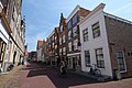 Zierikzee, Netherlands - panoramio (10).jpg 4,896 × 3,264; 2.56 MB


.jpg)