Category:Median income maps of the United States
Jump to navigation
Jump to search
Countries of the Americas: United States of America
Media in category "Median income maps of the United States"
The following 57 files are in this category, out of 57 total.
-
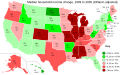
 2008 US Presidential election confounding ORWA.svg 1,047 × 577; 262 KB
-
 2010 Median Family Income and Industrial Site Locations in Houston, Texas.png 2,229 × 1,632; 3.88 MB
-
 Albuquerque Income.png 996 × 639; 228 KB
-
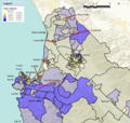
 Block Group Level Map of Median Household Income in the Contiguous United States.pdf 20,833 × 13,452; 49.03 MB
-
 Block Group Level Map of Median Household Income in the Contiguous United States.png 10,000 × 6,456; 13.14 MB
-
 Block Group Level Map of Median Household Income in the Contiguous United States.svg 13,333 × 8,609; 135.94 MB
-
 Block Group Level Map of Median Household Income in Virginia 2019.png 1,530 × 710; 750 KB
-
 California Counties by Median Household Income.png 800 × 944; 94 KB
-
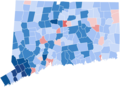 Connecticut Towns by Median Household Income.png 1,200 × 870; 192 KB
-
 Denton, Texas 1999 median income.png 573 × 421; 58 KB
-
 Geo Map of Income by Location in Cambridge, Ma (2015).svg 905 × 475; 14 KB
-
 Geo Map of Income by Location in Chicago, Il (2015).svg 905 × 474; 319 KB
-
 Geo Map of Income by Location in New York, Ny (2015).svg 905 × 475; 869 KB
-
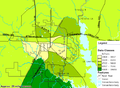
 Geo Map of Income by Location in Texas (2014).png 802 × 882; 246 KB
-
 Geo Map of Median Income by County in Indiana.png 1,008 × 882; 309 KB
-
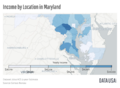 Geo Map of Median Income by Location in Maryland.png 1,208 × 882; 521 KB
-
 Geo Map of Median Income by Location in Tennessee.png 1,738 × 882; 603 KB
-
 Highmhhimap.png 300 × 221; 74 KB
-
 Income in Oregon by County.png 1,052 × 708; 139 KB
-
 Largo, Florida 2000 Census Median Household Income.gif 575 × 425; 46 KB
-
 Lowmhhimap.png 300 × 221; 74 KB
-
 Lowmhhimap.svg 986 × 624; 1.26 MB
-
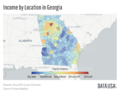 Map of Georgia Median Income by County.png 1,124 × 882; 361 KB
-
 Map of Income by Location in New Jersey.png 750 × 882; 338 KB
-
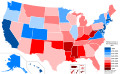
 Map of states by median family income in 2014.svg 1,000 × 630; 79 KB
-
 Map of states by median household income in 2019.svg 512 × 317; 168 KB
-
 Map of the United States by Median Personal Income.svg 600 × 400; 114 KB
-

-
 Median Household Income by Census Block Group.png 842 × 688; 281 KB
-
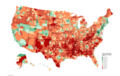
 Median Household Income in USA, by county (2013-2017).jpg 2,000 × 1,512; 1.62 MB
-

-

-

-
 Median Household Income per County as of 2021.png 6,900 × 4,326; 4.31 MB
-
 Median Household Income.svg 792 × 612; 3.9 MB
-
 Median income change US.svg 959 × 593; 113 KB
-
 Monterey County Populated Area Median Household Income 2013.png 1,126 × 1,069; 1.51 MB
-
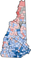 NHMedianHouseholdIncome1519.png 640 × 1,207; 247 KB
-
 OregonFinal.png 1,100 × 850; 155 KB
-
 Per Capita Income by County.png 1,714 × 1,284; 2.13 MB
-
 Philadelphia-Householdincome.jpg 572 × 422; 411 KB
-

-
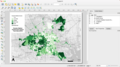 QGIS Interface Screenshot with Map of Median Income in Houston (2010).png 2,610 × 1,464; 986 KB
-
 Salinas Median Household Income 2013.png 963 × 922; 835 KB
-
 Silicon Valley Income Map 20160315.png 954 × 700; 442 KB
-
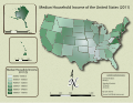
 United States Map of Median Household Income by State (2015).svg 850 × 499; 516 KB
-
 US counties by median family income.png 1,513 × 983; 197 KB
-
 US counties by median nonfamily income.png 1,513 × 983; 197 KB
-
 US county household median income 2008.png 1,829 × 1,413; 551 KB
-
 US county household median income 2009.png 2,379 × 1,800; 948 KB
-
 US county household median income 2012.png 2,483 × 1,885; 965 KB
-
 US states by median family income.png 2,000 × 1,237; 306 KB
-
 US states by median nonfamily income.png 2,000 × 1,237; 306 KB
-
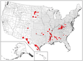
 USA highest income counties median.PNG 841 × 580; 24 KB
-
 Virginia Median Household Income 2015–2019.png 1,473 × 685; 212 KB
-
 Virginia-Median family income.svg 792 × 344; 394 KB
-
 Virginia-Median household income.svg 792 × 344; 396 KB


.svg)
.svg)
.svg)
.png)


.jpg)
.png)


.svg)
.png)


.svg)


