Category:Meall nam Maigheach
Jump to navigation
Jump to search
English: Meall nam Maigheach, 779 m (2555 ft), lies E of the minor road that connects Glen Lyon to Loch Tay.
Media in category "Meall nam Maigheach"
The following 16 files are in this category, out of 16 total.
-
 Cairn below Meall nam Maigheach - geograph.org.uk - 820970.jpg 640 × 480; 77 KB
-
 Cairn on Meall nam Maigheach - geograph.org.uk - 1261228.jpg 640 × 480; 92 KB
-
 Erosion - geograph.org.uk - 187483.jpg 640 × 480; 85 KB
-
 Forest track - geograph.org.uk - 187491.jpg 480 × 640; 119 KB
-
 Lochan below Meall nam Maigheach - geograph.org.uk - 820935.jpg 640 × 480; 107 KB
-
 Meall nam Maigheach - geograph.org.uk - 187482.jpg 640 × 480; 72 KB
-
 Meall nam Maigheach summit - geograph.org.uk - 187484.jpg 640 × 480; 81 KB
-
 Meall nam Maigheach summit - geograph.org.uk - 987838.jpg 640 × 480; 69 KB
-
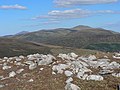
 Meall nan Eun from the NNW - geograph.org.uk - 987847.jpg 640 × 480; 80 KB
-
 On Meall nam Maigheach - geograph.org.uk - 820810.jpg 640 × 480; 77 KB
-
 On Meall nam Maigheach - geograph.org.uk - 821053.jpg 640 × 480; 83 KB
-
 Peat haggs - geograph.org.uk - 1261220.jpg 640 × 480; 99 KB
-
 Peaty land and small lochan - geograph.org.uk - 987841.jpg 640 × 480; 70 KB
-
 Peaty pool - geograph.org.uk - 1284142.jpg 640 × 480; 60 KB
-

-
 Top of Meall nam Maigheach - geograph.org.uk - 821074.jpg 640 × 480; 77 KB


