Category:Mayabeque Province
Jump to navigation
Jump to search
Cuban province | |||||
| Upload media | |||||
| Instance of | |||||
|---|---|---|---|---|---|
| Named after | |||||
| Location | Cuba | ||||
| Capital | |||||
| Inception |
| ||||
| Population |
| ||||
| Area |
| ||||
| Elevation above sea level |
| ||||
| Follows | |||||
| Replaces | |||||
 | |||||
Subcategories
This category has the following 17 subcategories, out of 17 total.
*
C
G
J
- Jaruco (6 F)
M
- Madruga (3 F)
N
- Nueva Paz (3 F)
P
Q
R
- Río Mayabeque (9 F)
S
- San Nicolás de Bari (2 F)
V
Media in category "Mayabeque Province"
The following 16 files are in this category, out of 16 total.
-
Artemisa-Mayabeque.jpg 300 × 250; 18 KB
-
Artemisa-Mayabeque.png 300 × 176; 74 KB
-
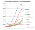
Ciudades Mayabeque.png 610 × 526; 33 KB
-
Cows roam the countryside without fences right outside Havana, Cuba LCCN2010638885.tif 6,144 × 4,096; 144.04 MB
-
Cuba and the Gulf of Batabanó (MODIS).jpg 2,223 × 1,825; 538 KB
-
Cuenca mayabeque.png 1,223 × 815; 121 KB
-
ISS006-E-37255 - View of Cuba - coast west of Havana from Cojímar to Matanzas.jpg 3,024 × 2,064; 1.17 MB
-
La Habana Province (1976–2010) Location Map.svg 1,018 × 342; 101 KB
-
Mapacarr mayabeq.png 2,339 × 1,654; 335 KB
-
Mayabeque in Cuba.svg 1,795 × 761; 1.13 MB
-
Mayabeque Locator Map.svg 1,025 × 377; 112 KB
-
Mayabeque Map - Jamaica (San José de las Lajas).png 439 × 289; 50 KB
-
Mayabeque Map - San Antonio de las Vegas (San José de las Lajas).png 439 × 289; 50 KB
-
Mayabeque Map - Sur (San José de las Lajas).png 439 × 289; 50 KB
-
Mayabeque mapa.jpg 600 × 428; 74 KB
-
Cuba 2011 Mayabeque.svg 1,795 × 761; 383 KB


