Category:May 2020 in Perth, Western Australia
Jump to navigation
Jump to search
Deutsch: Bilder, die im Mai 2020 in Perth, Western Australia aufgenommen worden sind. Bitte beachten Sie, dass dies weder das Datum des Uploads noch das Datum des Scannens eines Fotos ist.
English: Images/pictures taken in Perth, Western Australia during May 2020. Note this is not the date of the upload, nor the date a photo was scanned.
Español: Fotografías o imágenes tomadas en Perth, Western Australia durante mayo 2020. No es la fecha de subida ni escaneo, sino la fecha en que las fotografías o imágenes se crearon.
Esperanto: Bildoj faritaj en Perth, Western Australia en majo 2020. Tio ne estas la dato, kiam la bildoj estis alŝutitaj aŭ skanitaj.
Français : Photographies ou images prises en Perth, Western Australia durant mai 2020. Ce n'est pas la date du téléchargement ou du scan.
Galego: Fotografías ou imaxes tomadas en Perth, Western Australia durante maio 2020. Non é a data de subida nin escaneamento, senón a data na que se crearon as fotografías ou imaxes.
Italiano: Fotografie o immagini scattate a Perth, Western Australia nel maggio 2020. Nota bene: la data non si riferisce né a quella di upload né a quella in cui la foto è stata digitalizzata.
Norsk bokmål: Bilder tatt i Perth, Western Australia i løpet av mai 2020. Merk at dette ikke er datoen for opplasting, eller når et bilde har blitt skannet.
Norsk nynorsk: Bilete teke i Perth, Western Australia i løpet av mai 2020. Merk at dette ikkje er datoen for opplasting, eller når eit bilete har vorte skanna.
Русский: Изображения, сделанные в Perth, Western Australia в течение май 2020 (не дата загрузки изображения).
Українська: Зображення, зроблені в Perth, Western Australia протягом травень 2020. Зауважте, що це не дата завантаження чи дата сканування фотографії.
| May 2019 | ← | May 2020 | → | May 2021 | |||||||
| Jan | Feb | Mar | Apr | May | Jun | Jul | Aug | Sep | Oct | Nov | Dec |
| 16 | 27 | 17 | 74 | 181 | 65 | 11 | 13 | 58 | 20 | 66 | 34 |
|---|---|---|---|---|---|---|---|---|---|---|---|
Subcategories
This category has the following 5 subcategories, out of 5 total.
Media in category "May 2020 in Perth, Western Australia"
The following 176 files are in this category, out of 176 total.
-
1902 sign and security camera Mundaring weir wall.jpg 848 × 1,280; 461 KB
-
1984 sign for opening of version of No 1 Pumping station museum.jpg 848 × 1,280; 718 KB
-
Airport Central railway station under construction, May 2020 01.jpg 4,608 × 3,456; 6.86 MB
-
Airport Central railway station under construction, May 2020 02.jpg 4,608 × 2,592; 4.25 MB
-
Airport Central railway station under construction, May 2020 03.jpg 4,608 × 2,592; 4.79 MB
-
Airport Central railway station under construction, May 2020 04.jpg 4,608 × 2,592; 4.72 MB
-
Beelu National Park sign on Mundaring Weir Road.jpg 1,280 × 848; 1.03 MB
-
Building at lower portion of Mundaring weir wall l.jpg 1,280 × 848; 372 KB
-
Camping ground sign at Hills Discovery centre on hill above Mundaring weir.jpg 1,280 × 848; 869 KB
-
Chimney tower for No 1 Pumping station at Mundaring Weir.jpg 848 × 1,280; 880 KB
-
Chittering check point signs May 2020.jpg 3,547 × 1,799; 1.66 MB
-
Chittering checkpoint May 2020.jpg 3,257 × 1,048; 723 KB
-
Claremont railway station overpass, Perth, May 2020.jpg 4,608 × 3,456; 4.96 MB
-
Closing time at Mundaring Weir - gates locked.jpg 1,600 × 901; 174 KB
-
Cockatoos sign and ''Dam'' sign at Mundaring weir.jpg 1,280 × 848; 934 KB
-
Cyclist on Mundaring weir road near Farell Grove.jpg 1,280 × 732; 402 KB
-
Decomissioned water authority buildings.jpg 848 × 1,280; 922 KB
-
Dirt bikes on Mundaring Weir Road May 2020.jpg 1,280 × 848; 878 KB
-
Downstream from Mundaring Weir.jpg 915 × 1,280; 373 KB
-
Ducklings on Lake O'connor near weir wall.jpg 1,742 × 973; 219 KB
-
Eastern view of zig zag formation junction at Mundaring weir.jpg 1,280 × 848; 525 KB
-
Eliza (sculpture), May 2020.jpg 4,608 × 3,456; 3.42 MB
-
Entrance area to No 1 pumping station.jpg 1,280 × 796; 344 KB
-
Equipment inside southern half of No 1 Pumping station.jpg 3,232 × 2,920; 1.8 MB
-
Face of Mundaring weir and modified river bed below weir.jpg 1,280 × 848; 833 KB
-
Footbridge at Mundaring Weir.jpg 1,280 × 848; 829 KB
-
Former control tower in Forrestfield before demolition in 2021.jpg 4,928 × 3,264; 6.29 MB
-
Former entry to No 1 Pumping Station on west wall.jpg 848 × 1,280; 995 KB
-
Former quarry wall on southern shore of Lake O'Connor.jpg 1,280 × 848; 382 KB
-
Forrestfield windsock, tower and tracks.jpg 3,167 × 2,570; 1.63 MB
-
From the east upper portion No 1 Pumping station chimney.jpg 619 × 2,256; 374 KB
-
Gallop House, Dalkeith, May 2020 01.jpg 4,330 × 3,448; 3.18 MB
-
Gallop House, Dalkeith, May 2020.jpg 3,456 × 4,608; 3.84 MB
-
Garden and steps up hill.jpg 1,280 × 848; 1 MB
-
Goldfields pipeline(s) and Mundaring weir road proximity .jpg 1,280 × 848; 954 KB
-
Grooves from former structures on southern end of weir rear wall.jpg 800 × 1,280; 338 KB
-
Hills discovery centre sign amongst trees.jpg 1,280 × 848; 547 KB
-
Inside entrance to Pumping Station.jpg 1,280 × 848; 318 KB
-
Inspection point at base of Mundaring weir wall.jpg 1,280 × 848; 407 KB
-
Journey 2 110520 gnangarra-106.jpg 1,600 × 2,397; 356 KB
-
Journey 2 110520 gnangarra-107.jpg 2,397 × 1,600; 705 KB
-
Journey 2 110520 gnangarra-108.jpg 2,397 × 1,600; 602 KB
-
Journey 2 110520 gnangarra-109.jpg 2,397 × 1,600; 656 KB
-
Journey 2 110520 gnangarra-110.jpg 2,397 × 1,600; 720 KB
-
Journey 2 110520 gnangarra-111.jpg 1,600 × 2,397; 504 KB
-
Junction and round about of Mundaring Weir Road.jpg 1,280 × 848; 793 KB
-
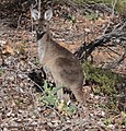
Juvenile Macropus fuliginosus at Kalamunda National Park May 2020.jpg 1,387 × 1,449; 639 KB
-
Kangaroo with itch.jpg 2,098 × 1,870; 1.26 MB
-
Ladder and surveying mark in profile on upper chimney.jpg 1,257 × 2,931; 499 KB
-
Lake O'Connor beach with surface level marks.jpg 1,280 × 942; 1.04 MB
-
Lake O'Connor north shore with stump.jpg 1,280 × 642; 845 KB
-
Lake O'Connor upper reach visible from Mundaring Weir.jpg 3,561 × 1,023; 725 KB
-
Lifting equipment above wall on Mundaring Weir.jpg 1,280 × 848; 894 KB
-
Lights, witch hats and tent at Chittering check point.jpg 2,399 × 1,649; 885 KB
-
Locking at 4 pm Mundaring Weir wall walkway closed.jpg 1,600 × 901; 201 KB
-
Looking down face of wall from spillway top.jpg 1,280 × 848; 850 KB
-
Looking from Paulls Valley Road across ridges to the north.jpg 2,352 × 1,333; 524 KB
-
Mundaring catchment warning sign.jpg 1,280 × 848; 747 KB
-
Mundaring Dam map of grounds and surrounds.jpg 1,280 × 848; 634 KB
-
Mundaring Weir building at base of wall face.jpg 1,280 × 848; 880 KB
-
Mundaring Weir crane and top of wall.jpg 1,280 × 803; 366 KB
-
Mundaring Weir discovery centre sign.jpg 1,280 × 848; 1.02 MB
-
Mundaring Weir down stream.jpg 848 × 1,280; 459 KB
-
Mundaring weir face and overflow area and base rocks.jpg 848 × 1,280; 783 KB
-
Mundaring Weir grounds footbridge from south.jpg 861 × 1,280; 545 KB
-
Mundaring weir grounds gate at Bibbulman entry area.jpg 1,280 × 603; 714 KB
-
Mundaring Weir grounds south side signage.jpg 1,280 × 848; 975 KB
-
Mundaring Weir hall.jpg 1,280 × 1,158; 814 KB
-
Mundaring weir historic and modern form of lookout on to Lake O'Connor.jpg 1,280 × 848; 997 KB
-
Mundaring Weir Hotel during Covid virus May 2020.jpg 3,605 × 1,502; 1.25 MB
-
Mundaring weir hotel entrance area and public phone.jpg 1,280 × 747; 406 KB
-
Mundaring weir lower part of rear of weir wall at water level.jpg 1,280 × 848; 957 KB
-
Mundaring weir north side steps.jpg 1,280 × 848; 1.06 MB
-
Mundaring Weir Road junction.jpg 1,280 × 848; 809 KB
-
Mundaring Weir road motorbikes and curves sign.jpg 1,280 × 622; 342 KB
-
Mundaring weir road near The Dell.jpg 1,280 × 848; 480 KB
-
Mundaring Weir Road sign for Pimelia.jpg 1,280 × 651; 508 KB
-
Mundaring weir road south side and view of telco tower.jpg 1,280 × 1,232; 503 KB
-
Mundaring Weir Road trees.jpg 1,280 × 848; 939 KB
-
Mundaring Weir road vegetation.jpg 1,280 × 848; 965 KB
-
Mundaring weir road, Weir Village road and Allen road signs.jpg 1,280 × 622; 376 KB
-
Mundaring weir spillway and walkway.jpg 1,280 × 848; 400 KB
-
Mundaring Weir wall face in May 2020.jpg 1,280 × 848; 343 KB
-
Mundaring Weir wall top and central buiding.jpg 1,280 × 1,052; 425 KB
-
New fencing around base of face of Mundaring Weir.jpg 1,048 × 1,280; 431 KB
-
No 1 Power station chimney from north east upper.jpg 660 × 1,554; 639 KB
-
No 1 Pumping station entrance in 2020.jpg 848 × 1,280; 487 KB
-
No 1 Pumping station wall with pipes.jpg 848 × 1,280; 837 KB
-
No Drone Zone area sign at Mundaring Weir north side.jpg 848 × 1,280; 858 KB
-
Northern end of top of weir.jpg 848 × 1,280; 858 KB
-
Northern most machinery in Southern half of No 1 Pumping Station.jpg 1,280 × 848; 286 KB
-
Older style Bibbulman track signage.jpg 1,280 × 848; 1.02 MB
-
Overflow barrier and equipment west of Mundaring Weir wall.jpg 848 × 1,280; 751 KB
-
Overflow barrier on display following removal.jpg 1,280 × 848; 991 KB
-
Overflow section of top of weir from the rear.jpg 1,280 × 848; 898 KB
-
Path constructed over railway formation.jpg 1,280 × 848; 736 KB
-
Pedestrian bridge sign next to Power station No 1 Mundaring Weir.jpg 1,280 × 848; 739 KB
-
Pedestrian footbridge to picnic area.jpg 1,280 × 848; 1,010 KB
-
Perth Airport Terminal 2, May 2020 01.jpg 4,608 × 2,592; 2.45 MB
-
Perth Airport Terminal 2, May 2020 02.jpg 4,608 × 3,456; 3.6 MB
-
PerthDentalSchool202008.jpg 3,024 × 4,032; 7.22 MB
-
PerthGirls2WellingtonStEastPerth.jpg 2,712 × 3,488; 1.15 MB
-
PerthOval310PierStreetEastPerth202005 (4).jpg 3,685 × 2,672; 1.2 MB
-
Picnic area on southern side.jpg 1,280 × 848; 904 KB
-
Pimelea mycumbene on Mundaring Weir Road.jpg 1,024 × 624; 347 KB
-
Pink and Grey galahs and Beelu National park hill in background.jpg 1,024 × 692; 212 KB
-
Pipeline at south western side of Lake O'Connor.jpg 1,280 × 848; 979 KB
-
Pond and channel and pumping station.jpg 945 × 1,280; 307 KB
-
Pond and channel below the Mundaring Weir.jpg 1,280 × 848; 621 KB
-
Portion of the zig zag formation of the Mundaring weir railway.jpg 1,280 × 848; 414 KB
-
PrestonFlats264StirlingStreetPerth1.jpg 2,883 × 3,969; 1.67 MB
-
Pub Open sign at The Bellevue Darling Range Hotel.jpg 1,221 × 1,280; 357 KB
-
Pumping station chimney and southern side Helena River valley.jpg 1,280 × 848; 783 KB
-
Regional Traffic sign for Perth Metro sign boards May 2020.jpg 4,496 × 1,683; 1.24 MB
-
Restricted access location on the zig zag.jpg 1,280 × 848; 918 KB
-
Road alignment on river channel next to pumping station.jpg 1,280 × 848; 1.02 MB
-
Rock cutting on northern leg of zig zag.jpg 1,280 × 848; 520 KB
-
Rock outcrop above amentities on southern side of Mundaring Weir grounds.jpg 1,280 × 848; 517 KB
-
RoyalPerthHospitalBlockA202003.jpg 3,881 × 2,364; 4.9 MB
-
Shore line on southern side of Lake O'Connor.jpg 1,817 × 1,224; 682 KB
-
Sign explaining 2005 fire.jpg 1,280 × 848; 746 KB
-
Sign for north ledge on Mundaring Weir Road.jpg 1,280 × 848; 532 KB
-
Sign on road above Mundaring Weir Hotel.jpg 1,280 × 848; 948 KB
-
Signage on Mundaring Weir Road re water catchment.jpg 1,280 × 651; 439 KB
-
Sleepers on shore of Lake O'Connor.jpg 848 × 1,280; 958 KB
-
South ledge lookout on hill.jpg 1,280 × 848; 387 KB
-
South side of Mundaring Weir Hotel.jpg 1,280 × 671; 399 KB
-
South side of Mundaring weir signage regarding dogs and drones.jpg 848 × 1,280; 847 KB
-
South side of weir carpark and edge of Lake O'Connor.jpg 1,280 × 848; 1 MB
-
South western wall of No 1 Pumping Station.jpg 1,280 × 848; 953 KB
-
Southern end boilers in No 1 Pumping station.jpg 1,280 × 829; 303 KB
-
Southern view of zig zag junction below weir.jpg 1,280 × 848; 494 KB
-
St Joseph's Chapel, Sunset Hospital, May 2020.jpg 3,456 × 4,608; 4.06 MB
-
Steps and hand rail down through garden.jpg 848 × 1,280; 824 KB
-
Steps up the zig zag.jpg 876 × 1,024; 362 KB
-
Sunken Garden, UWA, May 2020 01.jpg 4,608 × 3,456; 6.75 MB
-
Sunken Garden, UWA, May 2020 02.jpg 3,456 × 4,608; 6.59 MB
-
Sunken Garden, UWA, May 2020 03.jpg 4,608 × 3,456; 7.75 MB
-
Sunken Garden, UWA, May 2020 04.jpg 4,608 × 3,456; 7.53 MB
-
Sunken Garden, UWA, May 2020 05.jpg 4,608 × 3,456; 6.27 MB
-
Sunset Hospital, May 2020 01.jpg 4,608 × 3,456; 5.28 MB
-
Sunset Hospital, May 2020 02.jpg 4,608 × 3,456; 4.57 MB
-
Sunset Hospital, May 2020 03.jpg 4,608 × 3,456; 4.2 MB
-
Sunset Hospital, May 2020 04.jpg 4,608 × 3,456; 4.62 MB
-
Sunset Hospital, May 2020 05.jpg 4,608 × 3,456; 3.63 MB
-
Symbols of prohibited activities at Mundaring Weir.jpg 1,280 × 848; 501 KB
-
Tanker British Renown passing through the dredged channel of the Parmelia Bank, May 2020.jpg 3,648 × 2,736; 2.53 MB
-
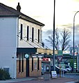
The Bellevue Darling Range Hotel formerly Darling Range Hotel late afternoon.jpg 1,280 × 644; 216 KB
-
Time limit sign for Mundaring Weir grounds.jpg 1,280 × 848; 975 KB
-
Tonkin Highway from Great Eastern Highway bridge first.jpg 1,793 × 625; 245 KB
-
Tonkin Highway from Great Eastern Highway bridge second.jpg 2,075 × 535; 252 KB
-
Top of the Mundaring Wier looking south.jpg 1,280 × 803; 366 KB
-
Top verandah of Mundaring Weir Hotel.jpg 2,730 × 1,834; 1.13 MB
-
Top walkway on Mundaring Weir.jpg 1,201 × 1,280; 431 KB
-
Track derived from railway formation.jpg 1,280 × 848; 535 KB
-
Trucks clearing the checkpoint at Chittering May 2020.jpg 1,366 × 530; 196 KB
-
Tugboat and bulk carrier at Fremantle Outer Harbour, May 2020.jpg 3,648 × 2,736; 2.78 MB
-
Unidentified lizard on rock at Mundaring Weir May 2020.jpg 1,535 × 760; 522 KB
-
Upper portion of No 1 Chimney tower with ladder to the left.jpg 1,846 × 3,340; 2.43 MB
-
Upper portion with no ladder in view.jpg 672 × 1,003; 190 KB
-
Walkway above spillway Mundaring Weir.jpg 1,280 × 848; 624 KB
-
Walkway across top.jpg 3,690 × 1,098; 467 KB
-
Walkway at northern end of top of Mundaring Weir wall.jpg 1,035 × 1,280; 512 KB
-
Warning sign on Mundaring Weir Road.jpg 1,280 × 848; 993 KB
-
Water authority building next to No 1 pumping station.jpg 1,280 × 848; 758 KB
-
Water tanks and kangaroos.jpg 1,280 × 848; 1.02 MB
-
West wall of Pumping Station number 1.jpg 848 × 1,280; 416 KB
-
Western Grey at roadside in Kalamunda National Park.jpg 1,804 × 1,501; 853 KB
-
Western Grey Kangaroo at roadside.jpg 1,686 × 1,434; 938 KB
-
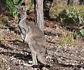
Western Grey kangaroo pulling at itch.jpg 1,670 × 1,668; 934 KB
-
Zig zag railway formation at Mundaring Weir in 2020.jpg 1,280 × 848; 558 KB
-
Zig zag railway formation on side of hill at Mundaring Weir.jpg 1,280 × 848; 1.03 MB


