Category:May 2013 in Kent
Jump to navigation
Jump to search
Deutsch: Bilder, die im Mai 2013 in Kent aufgenommen worden sind. Bitte beachten Sie, dass dies weder das Datum des Uploads noch das Datum des Scannens eines Fotos ist.
English: Images/pictures taken in Kent during May 2013. Note this is not the date of the upload, nor the date a photo was scanned.
Español: Fotografías o imágenes tomadas en Kent durante mayo 2013. No es la fecha de subida ni escaneo, sino la fecha en que las fotografías o imágenes se crearon.
Esperanto: Bildoj faritaj en Kent en majo 2013. Tio ne estas la dato, kiam la bildoj estis alŝutitaj aŭ skanitaj.
Français : Photographies ou images prises en Kent durant mai 2013. Ce n'est pas la date du téléchargement ou du scan.
Galego: Fotografías ou imaxes tomadas en Kent durante maio 2013. Non é a data de subida nin escaneamento, senón a data na que se crearon as fotografías ou imaxes.
Italiano: Fotografie o immagini scattate a Kent nel maggio 2013. Nota bene: la data non si riferisce né a quella di upload né a quella in cui la foto è stata digitalizzata.
Norsk bokmål: Bilder tatt i Kent i løpet av mai 2013. Merk at dette ikke er datoen for opplasting, eller når et bilde har blitt skannet.
Norsk nynorsk: Bilete teke i Kent i løpet av mai 2013. Merk at dette ikkje er datoen for opplasting, eller når eit bilete har vorte skanna.
Русский: Изображения, сделанные в Kent в течение май 2013 (не дата загрузки изображения).
Українська: Зображення, зроблені в Kent протягом травень 2013. Зауважте, що це не дата завантаження чи дата сканування фотографії.
| May 2012 | ← | May 2013 | → | May 2014 | |||||||
| Jan | Feb | Mar | Apr | May | Jun | Jul | Aug | Sep | Oct | Nov | Dec |
| 77 | 5 | 73 | 65 | 274 | 231 | 57 | 69 | 26 | 77 | 252 | 30 |
|---|---|---|---|---|---|---|---|---|---|---|---|
Media in category "May 2013 in Kent"
The following 200 files are in this category, out of 273 total.
(previous page) (next page)-
 101 steps, Happy Valley - geograph.org.uk - 3542065.jpg 640 × 430; 128 KB
-
 101 steps, Happy Valley - geograph.org.uk - 3542093.jpg 640 × 430; 119 KB
-

-
 20 - 22, Church Rd - geograph.org.uk - 3634149.jpg 640 × 430; 77 KB
-
 24 - 30, Mount Ephraim - geograph.org.uk - 3547233.jpg 640 × 430; 92 KB
-
 28, Church Rd - geograph.org.uk - 3634148.jpg 640 × 430; 80 KB
-
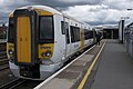 375911 at Tonbridge.jpg 4,288 × 2,848; 3.38 MB
-
 395009 Departs Ashford International 2013-05-25.jpg 4,171 × 2,770; 2.65 MB
-
 465919 at Ashford International.jpg 4,288 × 2,848; 3.59 MB
-
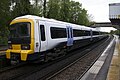 466019 at Charing.jpg 4,288 × 2,848; 4.1 MB
-
 52 - 53, Mount Ephraim - geograph.org.uk - 3547210.jpg 640 × 430; 72 KB
-
 55 - 63, Lower Green Rd - geograph.org.uk - 3690870.jpg 640 × 430; 73 KB
-
 55 - 63, Lower Green Rd - geograph.org.uk - 3690873.jpg 640 × 430; 63 KB
-
 60, Mount Ephraim - geograph.org.uk - 3547187.jpg 640 × 430; 56 KB
-
 88, Grosvenor Rd - geograph.org.uk - 3539774.jpg 640 × 430; 90 KB
-
 A good place for a cone - geograph.org.uk - 3547265.jpg 422 × 640; 70 KB
-
 A26 - A264 junction - geograph.org.uk - 3539788.jpg 640 × 430; 66 KB
-
 A264, eastbound - geograph.org.uk - 3542027.jpg 640 × 430; 99 KB
-
 A264, westbound - geograph.org.uk - 3542030.jpg 640 × 430; 115 KB
-
 Allotments - geograph.org.uk - 3684071.jpg 640 × 430; 87 KB
-
 Apartments by the railway - geograph.org.uk - 3614989.jpg 640 × 430; 60 KB
-
 Arriva bus depot - geograph.org.uk - 3539768.jpg 640 × 430; 60 KB
-
 Ashley Park Close - geograph.org.uk - 3690876.jpg 640 × 430; 58 KB
-
 Aspen Clinic - geograph.org.uk - 3547239.jpg 640 × 430; 64 KB
-
 Barns, Smockham Farm - geograph.org.uk - 3704962.jpg 640 × 430; 72 KB
-
 Bean - geograph.org.uk - 3705027.jpg 640 × 430; 69 KB
-
 Beaumont House - geograph.org.uk - 3547204.jpg 640 × 430; 82 KB
-

-

-
 Between the rock outcrops - geograph.org.uk - 3539816.jpg 640 × 430; 100 KB
-
 Beware SATNAV - geograph.org.uk - 3539823.jpg 640 × 430; 131 KB
-
 Blossom entering Rusthall - geograph.org.uk - 3539812.jpg 640 × 430; 99 KB
-
 Blossom in Rusthall - geograph.org.uk - 3539814.jpg 640 × 430; 93 KB
-
 Blossom on the common - geograph.org.uk - 3543031.jpg 640 × 430; 120 KB
-
 Blossom, Royal Chase - geograph.org.uk - 3539789.jpg 430 × 640; 100 KB
-
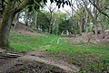
 Bluebells, Happy Valley - geograph.org.uk - 3542087.jpg 640 × 430; 146 KB
-
 Boer War Memorial, Dane John Gardens - geograph.org.uk - 3467834.jpg 640 × 480; 662 KB
-
 Boyne Park - geograph.org.uk - 3547182.jpg 640 × 430; 69 KB
-
 Bretland Rd - geograph.org.uk - 3697136.jpg 640 × 430; 74 KB
-
 BT building, St John's Rd - geograph.org.uk - 3539771.jpg 640 × 437; 58 KB
-
 Bunker, Tunbridge Wells Golf Course - geograph.org.uk - 3539806.jpg 640 × 430; 90 KB
-
 Byng Hall - geograph.org.uk - 3547288.jpg 430 × 640; 90 KB
-
 Byng Hall - geograph.org.uk - 3705031.jpg 640 × 430; 99 KB
-
 Byng Rd - geograph.org.uk - 3539797.jpg 640 × 430; 80 KB
-
 Cafe, St John's Recreation Ground - geograph.org.uk - 3704993.jpg 640 × 430; 54 KB
-
 Calverley Grounds - geograph.org.uk - 3628259.jpg 640 × 430; 101 KB
-
 Calverley Grounds - geograph.org.uk - 3628262.jpg 640 × 430; 85 KB
-
 Calverley Grounds - geograph.org.uk - 3628267.jpg 640 × 430; 79 KB
-
 Calverley House - geograph.org.uk - 3634167.jpg 430 × 640; 54 KB
-
 Calverley Park Crescent - geograph.org.uk - 3628244.jpg 640 × 430; 78 KB
-
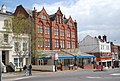
 Camden Road Retro Centre - geograph.org.uk - 3634185.jpg 640 × 430; 85 KB
-
 Charing Cross from Platform 1!.jpg 1,920 × 1,080; 653 KB
-
 Church of Christ - geograph.org.uk - 3684054.jpg 640 × 387; 48 KB
-
 Church of St Paul - geograph.org.uk - 3542040.jpg 640 × 430; 66 KB
-
 Church View - geograph.org.uk - 3615029.jpg 640 × 430; 76 KB
-
 Coniston Avenue - geograph.org.uk - 3539803.jpg 640 × 430; 102 KB
-
 Coniston Avenue - geograph.org.uk - 3539804.jpg 640 × 430; 99 KB
-
 Construction site, Queensborough..jpg 3,888 × 2,592; 6.1 MB
-
 Costa - geograph.org.uk - 3628190.jpg 640 × 454; 68 KB
-
 Coyotes Sports Bar - geograph.org.uk - 3634147.jpg 640 × 430; 84 KB
-
 Cranwell Rd - geograph.org.uk - 3690879.jpg 640 × 430; 69 KB
-
 Croquet, Calverley Grounds - geograph.org.uk - 3628255.jpg 640 × 430; 69 KB
-
 Crossway - geograph.org.uk - 3542797.jpg 640 × 430; 94 KB
-
 Crystal Palace, Tunbridge Wells - geograph.org.uk - 3510189.jpg 3,488 × 2,616; 2.16 MB
-
 Culverden Down - geograph.org.uk - 3539798.jpg 640 × 430; 89 KB
-
 Culverden Down School - geograph.org.uk - 3705026.jpg 640 × 393; 73 KB
-
 Culverden Evangelical Church - geograph.org.uk - 3539772.jpg 640 × 413; 72 KB
-
 Dairy Crest Dairy - geograph.org.uk - 3547297.jpg 640 × 430; 44 KB
-
 Depot on Reynolds Lane - geograph.org.uk - 3704978.jpg 640 × 430; 130 KB
-
 Derelict barn, Smockham Farm - geograph.org.uk - 3697321.jpg 640 × 430; 78 KB
-
 Domino's Pizza, Mount Ephraim - geograph.org.uk - 3547228.jpg 640 × 430; 85 KB
-
 Drinking Fountain - geograph.org.uk - 3697080.jpg 640 × 430; 105 KB
-
 Edwardian House - geograph.org.uk - 3697192.jpg 640 × 430; 95 KB
-
 Elephant Rock - geograph.org.uk - 3697152.jpg 640 × 430; 144 KB
-
 Ely Court - geograph.org.uk - 3634169.jpg 640 × 430; 80 KB
-
 End of Nevill Park - geograph.org.uk - 3543016.jpg 640 × 430; 89 KB
-
 Entering Hurst Wood - geograph.org.uk - 3697230.jpg 640 × 430; 114 KB
-

-
 Exiting Nevill Park - geograph.org.uk - 3543012.jpg 640 × 430; 96 KB
-
 Farmers Market - geograph.org.uk - 3628217.jpg 640 × 430; 85 KB
-
 Farmers Market - geograph.org.uk - 3628221.jpg 640 × 430; 88 KB
-
 Fenwick, Royal Victoria Place - geograph.org.uk - 3628182.jpg 640 × 430; 81 KB
-
 Filling Station, St John's Rd - geograph.org.uk - 3547257.jpg 640 × 430; 55 KB
-
 Filling Station, St John's Rd - geograph.org.uk - 3547262.jpg 640 × 430; 69 KB
-
 Flats, Grosvenor Bridge - geograph.org.uk - 3634266.jpg 640 × 430; 70 KB
-
 Footpath from Rusthall - geograph.org.uk - 3697196.jpg 640 × 430; 134 KB
-
 Footpath in Happy Valley - geograph.org.uk - 3542052.jpg 640 × 430; 147 KB
-
 Footpath in Hurst Wood - geograph.org.uk - 3697290.jpg 640 × 430; 139 KB
-
 Footpath off Lakeman Way - geograph.org.uk - 3684069.jpg 640 × 430; 95 KB
-
 Footpath off North Farm Rd - geograph.org.uk - 3615002.jpg 430 × 640; 68 KB
-
 Footpath off Sandhurst Rd - geograph.org.uk - 3684052.jpg 640 × 430; 104 KB
-
 Footpath to Cunningham Rd - geograph.org.uk - 3684073.jpg 640 × 430; 81 KB
-
 Footpath to Hurst Wood - geograph.org.uk - 3697211.jpg 640 × 430; 145 KB
-
 Footpath to Smockham Farm - geograph.org.uk - 3697315.jpg 640 × 430; 150 KB
-
 Footpath to St Michael's Rd - geograph.org.uk - 3615041.jpg 640 × 430; 99 KB
-
 Footpath, Happy Valley - geograph.org.uk - 3542084.jpg 640 × 430; 130 KB
-
 Footpath, Hurst Wood - geograph.org.uk - 3697297.jpg 640 × 430; 149 KB
-
 Footpath, Rusthall Common - geograph.org.uk - 3697097.jpg 640 × 430; 122 KB
-
 Footpath, St John's Recreation Ground - geograph.org.uk - 3704984.jpg 640 × 430; 130 KB
-
 Former Kent ^ Sussex Hospital - geograph.org.uk - 3539782.jpg 640 × 430; 43 KB
-
 Freeway Exhaust and tyre centre - geograph.org.uk - 3547291.jpg 640 × 430; 58 KB
-
 Gasholder, High Brooms - geograph.org.uk - 3684048.jpg 640 × 430; 67 KB
-
 Gibraltar Cottage - geograph.org.uk - 3547161.jpg 640 × 430; 88 KB
-
 Gibraltar Cottage - geograph.org.uk - 3547177.jpg 640 × 430; 77 KB
-
 GN59FVC TONBRIDGE ROAD MAIDSTONE (16917931212).jpg 5,184 × 3,888; 6.47 MB
-
 Great Hall Arcade - geograph.org.uk - 3628271.jpg 640 × 430; 80 KB
-
 Great Hall Arcade - geograph.org.uk - 3628283.jpg 640 × 430; 81 KB
-
 Grosvenor Bridge - geograph.org.uk - 3634267.jpg 640 × 430; 86 KB
-
 Grosvenor Medical Centre - geograph.org.uk - 3628171.jpg 640 × 430; 66 KB
-
 Happy Valley - geograph.org.uk - 3542059.jpg 640 × 430; 101 KB
-
 Happy Valley - geograph.org.uk - 3542067.jpg 640 × 430; 108 KB
-
 Happy Valley - geograph.org.uk - 3542091.jpg 640 × 430; 141 KB
-
 Happy Valley Rocks - geograph.org.uk - 3542097.jpg 640 × 430; 117 KB
-
 Harmony St - geograph.org.uk - 3697175.jpg 640 × 430; 82 KB
-
 High Brooms Gasholder - geograph.org.uk - 3614995.jpg 640 × 430; 64 KB
-
 Hoare Monument - geograph.org.uk - 3547254.jpg 640 × 406; 57 KB
-
 Holy Trinity Church Hall - geograph.org.uk - 3634150.jpg 640 × 430; 103 KB
-
 Homoeopathic Hospital - geograph.org.uk - 3634144.jpg 640 × 430; 112 KB
-
 House on Lower Green Rd - geograph.org.uk - 3690861.jpg 640 × 430; 61 KB
-
 Houses and rock outcrops - geograph.org.uk - 3539836.jpg 640 × 430; 117 KB
-
 Houses, Rusthall Rd - geograph.org.uk - 3697133.jpg 640 × 430; 77 KB
-
 Hungershall Park - geograph.org.uk - 3542799.jpg 640 × 430; 52 KB
-
 Hungershall Park - geograph.org.uk - 3542967.jpg 640 × 430; 42 KB
-
 Hungershall Park - geograph.org.uk - 3542971.jpg 640 × 430; 45 KB
-
 Hurst Wood - geograph.org.uk - 3697237.jpg 640 × 430; 139 KB
-
 Hurst Wood - geograph.org.uk - 3697251.jpg 640 × 430; 143 KB
-
 Hurst Wood - geograph.org.uk - 3697269.jpg 640 × 430; 145 KB
-
 Hurst Wood - geograph.org.uk - 3697285.jpg 640 × 430; 156 KB
-
 Hurst Wood - geograph.org.uk - 3697293.jpg 640 × 430; 149 KB
-
 Hurst Wood - geograph.org.uk - 3697302.jpg 640 × 430; 146 KB
-
 Hurst Wood - geograph.org.uk - 3697304.jpg 640 × 430; 139 KB
-
 Hurst Wood - geograph.org.uk - 3697307.jpg 640 × 430; 146 KB
-
 Hurst Wood - geograph.org.uk - 3697312.jpg 640 × 430; 139 KB
-
 Kent ^ Sussex Hospital (closed) - geograph.org.uk - 3547235.jpg 640 × 396; 44 KB
-
 Lake Rd - geograph.org.uk - 3539799.jpg 640 × 430; 115 KB
-
 Lakeman Way - geograph.org.uk - 3615035.jpg 640 × 430; 71 KB
-
 Lakeman Way - geograph.org.uk - 3684068.jpg 640 × 408; 69 KB
-
 Lamp Support, Lonsdale Gardens - geograph.org.uk - 3628286.jpg 640 × 430; 87 KB
-
 Lecture Hall, York Rd - geograph.org.uk - 3634156.jpg 640 × 430; 83 KB
-
 Linden Park Cricket Ground - geograph.org.uk - 3543032.jpg 640 × 430; 55 KB
-
 Lion Rock - geograph.org.uk - 3539818.jpg 640 × 430; 135 KB
-
 Little Bracken - geograph.org.uk - 3690887.jpg 640 × 430; 87 KB
-
 London Road at the junction of Pinewood Gardens - geograph.org.uk - 3445619.jpg 2,048 × 1,536; 1.55 MB
-
 London Road, Southborough - geograph.org.uk - 3445816.jpg 2,048 × 1,536; 1.47 MB
-
 Lonsdale Gardens - geograph.org.uk - 3634130.jpg 640 × 430; 86 KB
-
 Lorry on bridge over A21 - geograph.org.uk - 3487823.jpg 1,600 × 960; 292 KB
-
 Lower Green Rd - geograph.org.uk - 3690874.jpg 640 × 430; 101 KB
-
 Lower Green Rd - geograph.org.uk - 3690880.jpg 640 × 430; 75 KB
-
 Major York's Rd - geograph.org.uk - 3543018.jpg 640 × 430; 89 KB
-
 Mayo House - geograph.org.uk - 3547154.jpg 640 × 430; 78 KB
-
 Meadow Car Park - geograph.org.uk - 3628175.jpg 640 × 430; 65 KB
-
 Memorial to George Whitfield - geograph.org.uk - 3539780.jpg 640 × 430; 99 KB
-
 Mereworth Motor - geograph.org.uk - 3705038.jpg 640 × 430; 56 KB
-
 Merrion Close - geograph.org.uk - 3684064.jpg 640 × 430; 53 KB
-
 Molyneux Place - geograph.org.uk - 3547135.jpg 640 × 430; 71 KB
-
 Monkey Puzzle Tree - geograph.org.uk - 3704988.jpg 430 × 640; 81 KB
-
 MSC Poesia at Dover Cruise Terminal (8714433215).jpg 3,285 × 2,463; 1.13 MB
-
 Muddy footpath, Hurst Wood - geograph.org.uk - 3697274.jpg 640 × 430; 133 KB
-
 NatWest Bank - geograph.org.uk - 3547247.jpg 640 × 430; 69 KB
-
 Nevill Park - geograph.org.uk - 3542803.jpg 640 × 430; 91 KB
-
 Nevill Park - geograph.org.uk - 3542806.jpg 640 × 430; 77 KB
-
 New development, Quarry Hill - geograph.org.uk - 3634265.jpg 640 × 430; 81 KB
-
 New Life Church Centre, Speldhurst Road - geograph.org.uk - 3445502.jpg 2,048 × 1,536; 1.15 MB
-
 North Farm Road by High Brooms station - geograph.org.uk - 3445431.jpg 2,048 × 1,536; 1.43 MB
-
 Oakhurst Lodge - geograph.org.uk - 3547132.jpg 640 × 430; 92 KB
-
 Old open top bus by the Guildhall, Faversham (geograph 3465624).jpg 640 × 462; 86 KB
-
 Old St Paul's School - geograph.org.uk - 3542042.jpg 640 × 430; 61 KB
-
 Out buildings, Smockham Farm - geograph.org.uk - 3704967.jpg 640 × 430; 104 KB
-
 Outcrop in the trees - geograph.org.uk - 3539831.jpg 640 × 430; 132 KB
-
 Pavilion, Linden Park Cricket Club - geograph.org.uk - 3543034.jpg 640 × 430; 57 KB
-
 Percy Terrace - geograph.org.uk - 3705003.jpg 640 × 430; 89 KB
-
 Pride of Canterbury arriving in Dover (8714433299).jpg 3,996 × 2,997; 2.45 MB
-
 Pride of Canterbury arriving in Dover (8714433423).jpg 4,000 × 3,000; 1.55 MB
-
 Prince of Wales, Tunbridge Wells - geograph.org.uk - 3510187.jpg 3,488 × 2,616; 3.34 MB
-
 Pumping Station - geograph.org.uk - 3697202.jpg 640 × 430; 108 KB
-
 Ramsgate, Boundary Road - geograph.org.uk - 3723897.jpg 640 × 480; 279 KB
-
 Restaurant Madeira - geograph.org.uk - 3634195.jpg 640 × 430; 70 KB
-
 Rodin crossing the Channel (8715552864).jpg 3,964 × 2,973; 1.84 MB
-
 Rooftop Sunset (39762416).jpeg 2,048 × 1,365; 294 KB
-
 Rose Cottage - geograph.org.uk - 3539832.jpg 640 × 430; 88 KB
-
 Rosemont - geograph.org.uk - 3547128.jpg 640 × 430; 73 KB
-
 Royal Chase - geograph.org.uk - 3539790.jpg 640 × 430; 80 KB
-
 Royal Chase - geograph.org.uk - 3539791.jpg 640 × 430; 71 KB
-
 Royal Wells Hotel - geograph.org.uk - 3547197.jpg 640 × 430; 62 KB
-
 Rusthall Common - geograph.org.uk - 3542023.jpg 640 × 430; 127 KB
-
 Rusthall Common - geograph.org.uk - 3542054.jpg 640 × 430; 112 KB
-
 Rusthall Mews - geograph.org.uk - 3697060.jpg 640 × 430; 97 KB
-
 Rusthall Rd - geograph.org.uk - 3539837.jpg 640 × 430; 121 KB
-
 Rusthall Rd - geograph.org.uk - 3697111.jpg 640 × 430; 117 KB
-
 Rusthall Rd - geograph.org.uk - 3697142.jpg 640 × 430; 106 KB
-
 Rusthall War Memorial - geograph.org.uk - 3542036.jpg 640 × 430; 109 KB
-
 Sankey's - geograph.org.uk - 3539787.jpg 430 × 640; 62 KB
-
 Shatters Wood - geograph.org.uk - 3705045.jpg 640 × 430; 90 KB
-
 Shirley Gardens - geograph.org.uk - 3690895.jpg 640 × 430; 79 KB
-
 Silverdale Day Nursery - geograph.org.uk - 3615024.jpg 640 × 430; 102 KB
-
 Slade Chambers - geograph.org.uk - 3628276.jpg 640 × 430; 81 KB
-
 Smockham Farmhouse - geograph.org.uk - 3704958.jpg 640 × 430; 83 KB
-
 Speldhurst Road by North Lodge - geograph.org.uk - 3445652.jpg 2,048 × 1,536; 1.5 MB
-
 Speldhurst Road by Salomons House - geograph.org.uk - 3445869.jpg 2,048 × 1,536; 1.49 MB
-
 St Barnabas Primary School - geograph.org.uk - 3634264.jpg 640 × 430; 91 KB


.jpg)


_-_geograph.org.uk_-_3547235.jpg)


.jpg)


.jpg)


.jpg)
.jpg)


.jpg)
.jpeg)


