Category:Mauritiuskerk, Silvolde
Jump to navigation
Jump to search
| Object location | | View all coordinates using: OpenStreetMap |
|---|
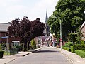
former church building in Oude IJsselstreek (Sint-Mauritiuskerk), Netherlands  | |||||
| Upload media | |||||
| Instance of | |||||
|---|---|---|---|---|---|
| Location | Silvolde, Oude IJsselstreek, Gelderland, Netherlands | ||||
| Street address |
| ||||
| Located on street |
| ||||
| Architect | |||||
| Heritage designation |
| ||||
| Inception |
| ||||
| Religion or worldview | |||||
 | |||||
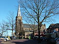
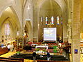
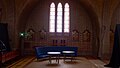
English: Mauritiuskerk, Silvolde - former Roman Catholic church in Silvolde, Netherlands. No church since 2018. Since 2024 the name is „De Tempel“.
Nederlands: Mauritiuskerk, Silvolde - voormalige roomskatholieke kerk - anno 1931. Ook Grote Mauritius genoemd. Sinds 2018 geen kerk meer. Sinds 2024 naam „De Tempel“.
|
This is a category about rijksmonument number 515474
|
| Address |
|
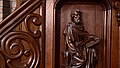
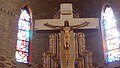
Media in category "Mauritiuskerk, Silvolde"
The following 59 files are in this category, out of 59 total.
-
 2007 silvolde st mauritius van brug.jpg 2,241 × 1,661; 2.44 MB
-
 2008 St Mauritius Silvolde Südseite.JPG 2,848 × 2,136; 1.57 MB
-
 2008 St Mauritius Silvolde.JPG 2,848 × 2,136; 1.42 MB
-
 2009 silvolde kerken.JPG 3,648 × 2,736; 2.87 MB
-
 2009 st mauritius silvolde.jpg 2,626 × 1,973; 1.3 MB
-
 2009-06-21 Silvolde Mauritius binnen.jpg 2,563 × 1,925; 1.29 MB
-
 2014-02 Silvolde Mauritius deel.JPG 5,184 × 3,456; 3.17 MB
-
 2014-02 Silvolde Mauritius nacht.JPG 5,184 × 3,456; 6.41 MB
-
 2023-06 Grote Mauritius Silvolde Gld ZvD 01.jpg 5,254 × 2,955; 1.89 MB
-
 2023-06 Grote Mauritius Silvolde Gld ZvD 02.jpg 5,820 × 3,274; 2.66 MB
-
 2023-06 Grote Mauritius Silvolde Gld ZvD 03.jpg 5,711 × 3,290; 445 KB
-
 2023-06 Grote Mauritius Silvolde Gld ZvD 04.jpg 3,340 × 5,935; 1.58 MB
-
 2023-06 Grote Mauritius Silvolde Gld ZvD 05.jpg 5,811 × 3,269; 1.2 MB
-
 2023-06 Grote Mauritius Silvolde Gld ZvD 06.jpg 5,803 × 3,264; 3.02 MB
-
 2023-06 Grote Mauritius Silvolde Gld ZvD 07.jpg 5,754 × 3,136; 385 KB
-
 2023-06 Grote Mauritius Silvolde Gld ZvD 08.jpg 3,376 × 6,000; 3.48 MB
-
 2023-06 Grote Mauritius Silvolde Gld ZvD 09.jpg 2,572 × 5,222; 412 KB
-
 2023-06 Grote Mauritius Silvolde Gld ZvD 10.jpg 5,598 × 3,149; 2.01 MB
-
 2023-06 Grote Mauritius Silvolde Gld ZvD 11.jpg 4,951 × 2,785; 2.28 MB
-
 2023-06 Grote Mauritius Silvolde Gld ZvD 12.jpg 5,629 × 3,038; 342 KB
-
 2023-06 Grote Mauritius Silvolde Gld ZvD 13.jpg 5,529 × 3,224; 580 KB
-
 2023-06 Grote Mauritius Silvolde Gld ZvD 14.jpg 5,849 × 3,291; 1.59 MB
-
 2023-06 Grote Mauritius Silvolde Gld ZvD 15.jpg 5,903 × 3,322; 2.65 MB
-
 2023-06 Grote Mauritius Silvolde Gld ZvD 16.jpg 6,000 × 3,376; 2.19 MB
-
 2023-06 Grote Mauritius Silvolde Gld ZvD 17.jpg 3,376 × 6,000; 452 KB
-
 2023-06 Grote Mauritius Silvolde Gld ZvD 18.jpg 6,000 × 3,376; 2.18 MB
-
 2023-06 Grote Mauritius Silvolde Gld ZvD 19.jpg 6,000 × 3,376; 5.01 MB
-
 2023-06 Grote Mauritius Silvolde Gld ZvD 20.jpg 3,189 × 5,759; 494 KB
-
 2023-06 Grote Mauritius Silvolde Gld ZvD 21.jpg 6,000 × 3,376; 5.67 MB
-
 2023-06 Grote Mauritius Silvolde Gld ZvD 23.jpg 3,376 × 6,000; 2.04 MB
-
 2023-06 Grote Mauritius Silvolde Gld ZvD 24.jpg 6,000 × 3,376; 4.72 MB
-
 2023-06 Grote Mauritius Silvolde Gld ZvD 27.jpg 6,000 × 3,376; 5.01 MB
-
 2023-06 Grote Mauritius Silvolde Gld ZvD 28.jpg 6,000 × 3,376; 4.97 MB
-
 2023-06 Grote Mauritius Silvolde Gld ZvD 31.jpg 6,000 × 3,376; 5.54 MB
-
 2023-06 Grote Mauritius Silvolde Gld ZvD 32.jpg 6,000 × 3,376; 6.4 MB
-
 2023-06 Grote Mauritius Silvolde Gld ZvD 33.jpg 6,000 × 3,376; 3.31 MB
-
 2023-06 Grote Mauritius Silvolde Gld ZvD 34.jpg 3,376 × 6,000; 4.95 MB
-
 2023-06 Grote Mauritius Silvolde Gld ZvD 35.jpg 6,000 × 3,376; 6.06 MB
-
 2023-06 Grote Mauritius Silvolde Gld ZvD 36.jpg 6,000 × 3,376; 3.43 MB
-
 2023-06 Grote Mauritius Silvolde Gld ZvD 37.jpg 3,376 × 6,000; 6.39 MB
-
 2023-06 Grote Mauritius Silvolde Gld ZvD 38.jpg 6,000 × 3,376; 6.1 MB
-
 2024-07-06 Silvolde in the evening 06.jpg 6,240 × 3,512; 10.4 MB
-
 2024-09-21 Mauritius Silvolde 01.jpg 6,240 × 3,512; 12.87 MB
-
 2024-09-21 Mauritius Silvolde 02.jpg 6,240 × 3,512; 12.43 MB
-
 2024-09-21 Mauritius Silvolde 03.jpg 6,240 × 3,512; 13.8 MB
-
 2024-09-21 Mauritius Silvolde 04.jpg 6,240 × 3,512; 13.15 MB
-
 2024-09-21 Mauritius Silvolde 05.jpg 6,240 × 3,512; 11.64 MB
-
 2024-09-21 Mauritius Silvolde 06.jpg 6,240 × 3,512; 13.74 MB
-
 2024-09-21 Mauritius Silvolde 07.jpg 6,240 × 3,512; 13.16 MB
-
 2024-09-21 Mauritius Silvolde 08.jpg 6,240 × 3,512; 10.88 MB
-
 2024-09-21 Mauritius Silvolde 09.jpg 3,446 × 6,125; 2.65 MB
-
 Marianum - Silvolde - 20199649 - RCE.jpg 959 × 1,200; 231 KB
-
 Silvolde, de Sint Mauritiuskerk RM515474 foto2 2015-05-14 12.50.jpg 4,290 × 3,234; 8.65 MB
-
 Silvolde09441.JPG 4,608 × 3,456; 5.21 MB
-
 Silvolde09443.JPG 4,608 × 3,456; 5.3 MB
-
 Silvolde09444.JPG 4,608 × 3,456; 4.57 MB
-
 Silvolde09452.JPG 3,456 × 4,608; 4.38 MB
-
 Silvolde09458.JPG 3,456 × 4,608; 5.27 MB
-
 Silvolde09464.JPG 4,608 × 3,456; 4.28 MB


