Category:Markagunt Plateau
Jump to navigation
Jump to search
plateau in Iron and Kane counties in Utah, United States | |||||
| Upload media | |||||
| Instance of | |||||
|---|---|---|---|---|---|
| Location |
| ||||
| Elevation above sea level |
| ||||
 | |||||
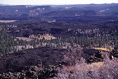
English: Media related to the Markagunt Plateau, a plateau in Iron and Kane counties in Utah, United States.
- In the physiographic High Plateaus Section of the Colorado Plateau Province.
Subcategories
This category has the following 8 subcategories, out of 8 total.
Media in category "Markagunt Plateau"
The following 12 files are in this category, out of 12 total.
-
Grand Staircase-big.jpg 1,700 × 483; 204 KB
-
Markagunt Plateau (8400302623).jpg 4,000 × 3,000; 2.43 MB
-
Markagunt Plateau (8400303529).jpg 4,000 × 3,000; 2.59 MB
-
Markagunt Plateau.jpg 640 × 431; 96 KB
-
S.R. 14 Lava Flow, Near Duck Creek, Utah (3942656769).jpg 4,272 × 2,848; 6.5 MB
-
S.R. 14 Lava Flow, Near Duck Creek, Utah (3942664939).jpg 4,272 × 2,848; 6.45 MB
-
S.R. 14 Lava Flow, Near Duck Creek, Utah (3943429928).jpg 4,272 × 2,848; 4.62 MB
-
S.R. 14 Lava Flow, Near Duck Creek, Utah (3943437970).jpg 4,272 × 2,848; 7.33 MB
-
S.R. 14 Lava Flow, Near Duck Creek, Utah (3943445562).jpg 4,272 × 2,848; 6.72 MB
-
S.R. 14 Lava Flow, Near Duck Creek, Utah (3943449256).jpg 4,272 × 2,848; 6.28 MB
-
S.R. 14 Lava Flow, Near Duck Creek, Utah (3943452184).jpg 4,272 × 2,848; 4.87 MB
-
S.R. 14 Lava Flow, Near Duck Creek, Utah (3943455254).jpg 4,272 × 2,848; 5.05 MB
Categories:
- Plateaus of Utah
- High Plateaus section of Utah
- Landforms of Iron County, Utah
- Landforms of Kane County, Utah
- Volcanic fields in Utah
- Quaternary volcanism of Utah
- Neogene volcanism of Utah
- Locations along Utah State Route 14 in Iron County, Utah
- Locations along Utah State Route 14 in Kane County, Utah
- Locations along Utah State Route 143 in Iron County, Utah


