Category:Marine geology
Jump to navigation
Jump to search
study of the history and structure of the ocean floor   | |||||
| Upload media | |||||
| Instance of | |||||
|---|---|---|---|---|---|
| Subclass of |
| ||||
| Part of | |||||
| Facet of | |||||
| |||||
Subcategories
This category has the following 32 subcategories, out of 32 total.
Media in category "Marine geology"
The following 52 files are in this category, out of 52 total.
-
 2020-11 Marion Dufresne 52.jpg 5,568 × 3,712; 12.28 MB
-
 Atlantic Summary.png 5,600 × 7,200; 15.31 MB
-
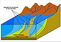
 BAB formation.jpg 2,852 × 1,582; 532 KB
-
-
-
-
-
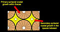
 Bloc diagramme Lias Haut Atlas.jpg 678 × 562; 102 KB
-
 Brockhaus and Efron Encyclopedic Dictionary b16 900-0.jpg 1,493 × 2,541; 747 KB
-
 Calcretes et birdseyes.jpg 1,941 × 1,151; 1.4 MB
-
 Calcretes remaniés dolomie.jpg 2,468 × 1,642; 2.65 MB
-
 Champ de nodules dans le Pacifique équatorial nord.jpg 674 × 443; 232 KB
-
 Charliegibbsschema-en.svg 1,052 × 744; 18 KB
-
 Ciment stalactite vadose.jpg 932 × 624; 122 KB
-
 Cormorant N-83 2978.20m Argo Fm.jpg 1,803 × 3,113; 3.33 MB
-
 Cycle virtuel émersif.jpg 1,002 × 1,467; 424 KB
-
 Cycles régressifs de comblement.jpg 768 × 862; 105 KB
-
 Cystoid External Cement.jpg 709 × 376; 101 KB
-
Discovery-of-New-Hydrothermal-Activity-and-Chemosynthetic-Fauna-on-the-Central-Indian-Ridge-at-pone.0032965.s001.ogv 3 min 26 s, 640 × 480; 96.11 MB
-
 DSDP 368.png 996 × 560; 46 KB
-
 East Gulf of Mexico Summary.png 7,200 × 6,000; 7.59 MB
-
 EncrustedBivalveMold.jpg 720 × 540; 90 KB
-
 Expl2256 - Flickr - NOAA Photo Library.jpg 1,920 × 1,080; 482 KB
-
 Expl2286 - Flickr - NOAA Photo Library.jpg 1,920 × 1,080; 604 KB
-
 Formation at Lost City Field.jpg 1,920 × 1,080; 1.43 MB
-
 Fracturezone-nl.svg 723 × 898; 10 KB
-
 Fracturezone.svg 744 × 1,052; 10 KB
-
Impacts-on-the-Deep-Sea-Ecosystem-by-a-Severe-Coastal-Storm-pone.0030395.s003.ogv 22 s, 1,440 × 1,080; 8.34 MB
-
 IODP Kernlager Bremen.jpg 2,560 × 1,703; 3.56 MB
-
 KC Macdonald ALVIN RISE exped.png 713 × 619; 955 KB
-
 Keystone vugs meniscus.jpg 2,464 × 1,646; 3.32 MB
-
 Mariana Islands Summary.png 7,200 × 7,200; 16.24 MB
-
 Marine geology of the continental margin off southern Oregon. (IA marinegeologyofc00spig).pdf 1,193 × 1,627, 466 pages; 10.31 MB
-
 Mgongo kati wa bahari.jpg 1,600 × 837; 184 KB
-
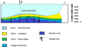
 Mid-ocean ridge cut away view.png 1,405 × 480; 77 KB
-
 North Alaskan Summary 01.png 7,200 × 7,200; 18.38 MB
-
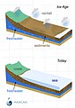 OFG cartoon marcan.jpg 1,228 × 1,752; 189 KB
-
 Ophiolite suite scheme.jpg 826 × 634; 150 KB
-
 OSCed.svg 792 × 612; 1.57 MB
-
 Pacific Summary.png 7,200 × 4,800; 9.93 MB
-
 Pisolithes vadoses.jpg 1,909 × 1,646; 1.91 MB
-
 Propagating Rift - Morphological Signature.png 1,616 × 544; 1.77 MB
-
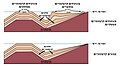
 Propagating Rift.png 840 × 696; 60 KB
-
 Research vessel in Greenland.jpg 4,608 × 2,184; 2.04 MB
-
-
 South Alaskan Summary.png 7,200 × 5,566; 8.81 MB
-
 Teepee supratidal flat.jpg 2,464 × 1,655; 4.41 MB
-
 Turbidite formation.jpg 3,003 × 2,093; 783 KB
-
 Types of Carbonate platform He.jpg 1,200 × 658; 125 KB
-
 Unbekannt gakkel-ruecken-arktis.jpg 4,861 × 4,272; 3.1 MB
-
 VonDamm OlivineandSediment.jpg 4,608 × 2,112; 889 KB
-
 West Gulf of Mexico Summary.png 7,200 × 6,000; 6.44 MB


