Category:Maps with azimuthal equidistant projection
Jump to navigation
Jump to search
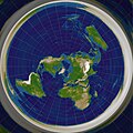
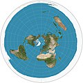
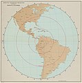
- Longitudes: concentric circles
- Latitudes: strait, equal spaced
- Global outer curve: circle
English: This map-projection-related category exists in the following hierarchy:
- Category:Map projections
- Category:Maps by projection
- Category:Azimuthal equidistant projection – media related to the Azimuthal equidistant projection other than maps
- Category:Maps with azimuthal equidistant projection (“Category:azimuthal equidistant projections”) – maps made using the Azimuthal equidistant projection
Subcategories
This category has only the following subcategory.
E
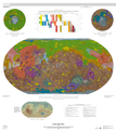
Media in category "Maps with azimuthal equidistant projection"
The following 77 files are in this category, out of 77 total.
-
 Azimuthal Equidistant Berlin.jpg 1,024 × 1,024; 296 KB
-
 Azimuthal Equidistant Canberra.jpg 4,096 × 4,096; 3.23 MB
-
 Azimuthal Equidistant N0E0.jpg 4,096 × 4,096; 3.23 MB
-
 Azimuthal Equidistant N90.jpg 4,096 × 4,096; 2.9 MB
-
 Azimuthal equidistant projection SW.jpg 2,058 × 2,058; 975 KB
-
 Azimuthal Equidistant S90.jpg 4,096 × 4,096; 3.16 MB
-

-

-
 1941 Northern hemisphere.jpg 3,040 × 2,962; 2.01 MB
-
 1966 Bogota (30253021294).jpg 6,889 × 6,971; 29.53 MB
-
 Air age map of the world centered in London, 1945.jpg 8,049 × 8,999; 7.05 MB
-
 Air age map of the world, 1946.jpg 3,242 × 4,450; 4.21 MB
-
 Air map of the World, 1943.jpg 2,810 × 1,890; 2.59 MB
-
 Atlas Ortelius KB PPN369376781-083av-083br.jpg 3,000 × 2,194; 4.39 MB
-
 Atlas Ortelius KB PPN369376781-085av-085br.jpg 3,000 × 2,194; 4.6 MB
-
 Azimuthal Equidistant 90.jpg 1,024 × 1,024; 280 KB
-

-
 Azimuthal equidistant projection south SW.jpg 2,058 × 2,058; 1.17 MB
-
 Azimuthal equidistant projection with Tissot's indicatrix centering 0°N 0°E.svg 3,600 × 3,600; 2.53 MB
-
 Azimuthal Equidistant with Tissot's Indicatrices of Distortion.svg 1,600 × 1,600; 596 KB
-
 Azimuthal Warsaw.png 1,807 × 1,800; 69 KB
-
 Azimuthal Zurich.png 2,032 × 2,016; 70 KB
-
 Azimuthal-equidistant.jpg 2,048 × 1,992; 984 KB
-
 Blue Marble 2002 Azimuthal Highres.png 10,800 × 10,800; 74.54 MB
-
 Conhecimento Cartográfico - 1 (1), Acervo do Museu Paulista da USP.jpg 7,216 × 5,412; 19.37 MB
-
 España en el centro del mundo.jpg 933 × 933; 290 KB
-
 España en el mundo, 1993.jpg 3,207 × 2,187; 1.87 MB
-
 Estrella de banderas.png 1,635 × 1,636; 469 KB
-
 Flag of the United Nations (1-2).svg 1,200 × 600; 33 KB
-
 Flag of the United Nations.svg 1,200 × 800; 33 KB
-
 Flag of UNIDO.svg 512 × 341; 11 KB
-
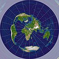
 Flat earth map found in a Japanese temple.png 1,414 × 1,236; 1.41 MB
-
 Flat earth.png 543 × 543; 396 KB
-
 Flat Earth.png 1,550 × 1,550; 263 KB
-
 Fútbol mundial - World football-soccer.png 867 × 863; 71 KB
-
 Gcmsyd.jpg 700 × 700; 140 KB
-
 Gott-Goldberg-Vanderbei Projection.png 2,058 × 1,037; 2.73 MB
-
 Great circle Switzerland.jpg 900 × 900; 150 KB
-
 Imagines syderum coelestium RMG L6847-001.tiff 3,322 × 4,800; 45.62 MB
-
 Insigniae Mundi 2.png 395 × 1,039; 59 KB
-
 Insigniae Mundi.png 375 × 1,033; 53 KB
-
 International crew.png 1,109 × 1,131; 144 KB
-
 Los Angeles centered azimuthal equidistant projection.gif 4,000 × 4,000; 2.3 MB
-
 Luke Foxe voyage account (North-West Fox, 1635) - 2 foldout map -1 full view.png 5,742 × 4,226; 39.96 MB
-
 Luke Foxe voyage account (North-West Fox, 1635) - 3 foldout map - 2 Hudson Bay.png 1,539 × 1,360; 4.46 MB
-
 Map of the world centered at Anchorage, Alaska.svg 1,000 × 1,000; 140 KB
-
 Map of the world, polar projection (1999).jpg 1,582 × 2,030; 1.32 MB
-
 Mapa cenital argentino, 1975.jpg 2,119 × 2,078; 960 KB
-

-
 Mapa mundial visto desde el espacio con centro en El Cairo.gif 497 × 400; 88 KB
-
 Mecca azimuthal equidistant.png 1,024 × 1,024; 887 KB
-
 Mecca Direction Equidistant (-90 rotation).jpg 4,096 × 4,096; 2.59 MB
-
 Mecca Direction Equidistant.jpg 4,096 × 4,096; 2.48 MB
-
 Miami, Azimuthal equidistant projection (1945).jpg 8,508 × 9,000; 7.38 MB
-
 Mundo al vuelo - World on flight.png 1,023 × 400; 51 KB
-
 NatGeo northern hemisphere 1946.jpg 3,508 × 3,839; 5.15 MB
-
 NatGeo world hemispheres 1943.jpg 4,917 × 2,583; 5.46 MB
-
 National Atlas 1970 - World around the United States.jpg 1,448 × 1,739; 832 KB
-
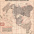 North polar Azimuthal equidistant map, 1950.jpg 2,117 × 2,102; 852 KB
-
 Oceanus.png 407 × 407; 45 KB
-
 Polar map of the world, 1943.jpg 1,674 × 2,225; 1.09 MB
-
 Polar World map 1945.jpg 1,401 × 1,673; 1.19 MB
-
 Posição do Estado, Acervo do Museu Paulista da USP.jpg 7,216 × 5,412; 19.31 MB
-
 Qibla observation by shadows map.svg 512 × 512; 87 KB
-
 Qiblih direction.jpg 4,096 × 4,096; 1.93 MB
-
 Shemya Island, Azimuthal equidistant projection (1945).jpg 8,721 × 9,000; 7.25 MB
-
 The clays of the round carpet.png 1,246 × 1,196; 111 KB
-
 The joint problem, 1940.jpg 1,652 × 2,065; 611 KB
-
 The World around Brazil, 1948.jpg 4,120 × 3,624; 3.63 MB
-
 Urbano Monti — World Map as of 1587.jpg 3,000 × 3,004; 3.57 MB
-
 USGS-MarsMap-sim3292-20140714-crop.png 3,773 × 4,249; 8.88 MB
-
 World around Poland.png 2,836 × 2,832; 258 KB
-
 World borders eqaz.png 1,944 × 1,944; 740 KB
-
 World ocean map.gif 500 × 500; 68 KB
-
 World outline blue.png 868 × 877; 29 KB
-
 Águila y globo terráqueo.png 679 × 663; 140 KB
-
 わが国周辺海空域における最近の中国軍の主な活動.gif 679 × 503; 178 KB


.jpg)
.jpg)

.jpg)


,_Acervo_do_Museu_Paulista_da_USP.jpg)


.svg)


_-_2_foldout_map_-1_full_view.png)
_-_3_foldout_map_-_2_Hudson_Bay.png)

.jpg)


.jpg)

.jpg)


.jpg)


