Category:Maps with Goode-Homolosine projection
Jump to navigation
Jump to search
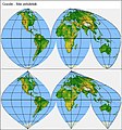
English: The Goode–Homolosine projection is a combination of the sinusoidal and Mollweide projections with interruptions in the oceans.
English: This map-projection-related category exists in the following hierarchy:
- Category:Map projections
- Category:Maps by projection
- Category:Goode-Homolosine projection – media related to the Goode-Homolosine projection other than maps
- Category:Maps with Goode-Homolosine projection (“Category:Goode-Homolosine projections”) – maps made using the Goode-Homolosine projection
Media in category "Maps with Goode-Homolosine projection"
The following 12 files are in this category, out of 12 total.
-
22d Space Operations Squadron.png 1,638 × 1,875; 634 KB
-
Earth 2017 02 16 (32802878532).jpg 4,169 × 1,760; 1.48 MB
-
Goode Homolosine demonstration.gif 1,024 × 768; 58 KB
-
Goode homolosine projection SW.jpg 2,058 × 900; 519 KB
-
Goode homolosine projection with Tissot's indicatrix.svg 3,600 × 1,568; 2.52 MB
-
Goode-homolosine-projection.jpg 2,048 × 888; 663 KB
-
Goode-homolosine.jpg 2,048 × 1,024; 425 KB
-
Map-Goode.jpg 554 × 592; 70 KB
-
The Earth beneath the sea - History (1963) (20936619040).jpg 3,008 × 2,048; 1.55 MB
-
World borders goode.png 4,000 × 2,000; 827 KB


