Category:Maps with Gall-Peters projection
Jump to navigation
Jump to search
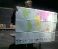
Maps with Gall-Peters projection:
- Longitudes: strait
- Latitudes: strait
- Global outer curve: rectangle
English: This map-projection-related category exists in the following hierarchy:
- Category:Map projections
- Category:Maps by projection
- Category:Gall-Peters projection – media related to the Gall-Peters projection other than maps
- Category:Maps with Gall-Peters projection (“Category:Gall-Peters projections”) – maps made using the Gall-Peters projection
Subcategories
This category has the following 2 subcategories, out of 2 total.
M
Media in category "Maps with Gall-Peters projection"
The following 2 files are in this category, out of 2 total.
-
Gall–Peters projection SW (cropped-n-22.25N-33.75W-78.75E).jpg 643 × 404; 132 KB
-
Jeffries BLST101.jpg 1,428 × 1,202; 438 KB

